Yesterday, played hooky from the rest of my life and went for a
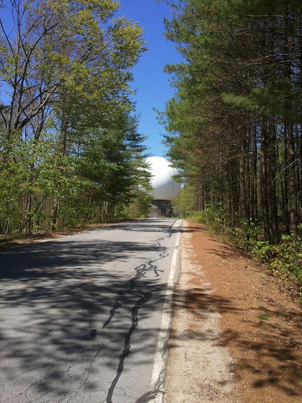
66-mile ride through Carlisle, Westford, Groton, and Tyngsboro. This was partly revisiting old haunts, partly a purposeful exploration of some interesting-looking lines on the map, and partly an exercise in Murphy's Law. The plan was to ride out the Minuteman and Rt 225 to MIT Haystack Observatory, in Groton, have lunch there, then do some exploring based on some previous route planning. It almost worked that way.
The ride out to Haystack was pleasant. It was a beautiful day, of course, so the Minuteman was full, with the usual cast of characters, showing its usual civic vigor. Overheard conversational snippet: (Teenager 1) "You were high that night, Skip." (Teenager 2) "We were all high that night." It looks like the Lexington DPW has concluded their months' long drainage improvement project, and things are back to slightly better than normal on the Lexington stretch. The hills on Rt 225 are still there, varying from rolling to imposing, with some runs of asphalt in better shape than others. Lots of riders out, many in genial moods, including the one who passed me on a beautiful road bike with a musical bearing chirping loudly. This turned out to be an omen. I missed my customary turn on Town Farm Road in Forge Village, and ended up climbing E. Prescott Street instead. This was the first of four wrong turns, and the one with the most pleasant consequences: it's a nice hill, and still early enough in the ride that an unexpected climb was welcome.
Haystack was wonderful as usual. Primarily used for radio astronomy and radar research in space and the high atmosphere, it also extends its hospitality to amateur astronomers.
When my kids were young I would bring them here to see meteor showers or comets. It's far enough out in the country so that seeing is superior, although recent residential development is encroaching with its light pollution, and the days of good seeing may be numbered.
I've always thought of Haystack as a sort of XXth Century Stonehenge; the various telescopes and radars are monumental and solemn. And there are enough hills to make for entertaining riding.
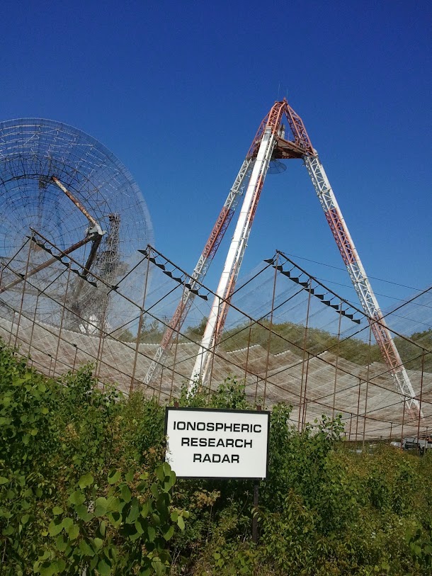
I had a peanut butter sandwich there, listening to to the fabric cover of a large radome moan in a basso register in the wind.

Then it was time to move on. I missed my turn at Millstone Hill Road, a short country road where I had once seen a pileated woodpecker. This was the second wrong turn of the four.
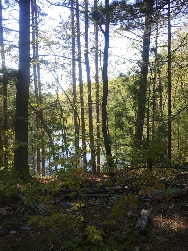
The planned exploration part of the ride began then. Rode out Rt 40 East--noting a road-kill fisher--to Gould Road, Westford, and took that North, connecting with Keyes Road and Davis Road. These are lovely country roads, with a bit of the residential development previously mentioned, but not too much, and plenty of forests, bogs, and hills, along with a working farm; prime cycling territory.

At some point, I crossed the town line into a western excursion of Tyngsboro I hadn't known existed. Picked up Groton Road and rode that West to the water course between Cow Pond Brook Reservoir and Upper Massapoag Pond. This is a lovely spot, with a waterfall and swimming hole much used in warmer weather.

So far, so good. Continued West on Island Pond Road (Groton), then South on Old Dunstable Road to Rocky Hill Road (West), a well-graded dirt/gravel road, good for riding, at least with my 38mm touring tires.
This quickly brought me to the beginning of what Google maps variously listed as "Dan Parker Road" and a bike route to Raddin Road (and, therefore, a sneaky way to approach Groton Center from the N.E.).

This seemed too useful not to investigate, so I did. The surface wasn't too bad...

... and neither was the scenery...
Unfortunately, I forked right when I should have forked left (or forked up when I should have forked down, the third wrong turn on the ride), and ended up on an increasingly stoney, hilly, muddy, single-track.
How'd that happen? I got to a point where the visible landmarks, the map, and the GPS didn't agree, and made the wrong call; it could be that I was fooled by OUR FRIENDS, THE BEAVERS, who put a pond where one didn't show on the map. In any case, the FOOL portion of the ride had started.
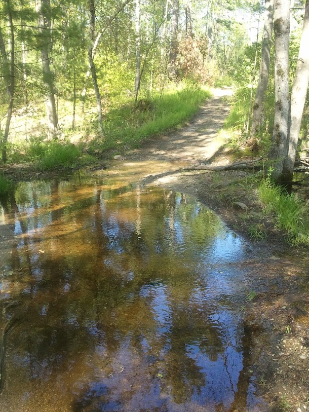
I forded two streams--BAD idea. The second, deeper one left me with a fouled rear brake and a wet right shoe.
This was followed by a series of very steep, very rocky climbs, that were frankly somewhat more than I'd bargained for that day. But I could see on the map that I was approaching an access road to a Groton conservation area, and sure enough, there it was.
This put me back on Old Dunstable Road, and I declared an end to exploration and pedaled along a known trajectory (Hoyt's Wharf Road, Cow Pond Brook Road, West Street, N. Main Street, Town Farm Road), that SHOULD have put me on 225 for a longish but uncomplicated ride home. Except that I made the last wrong turn of the day, mistaking Forge Village Road for 225, and getting another scenic hill climb for my trouble. Realized my error when I was almost to Westford Center, and bailed on Flagg to Hildreth and finally back to 225. That was the last accidental exploration of the day, the rest of the ride being made particularly special by the fact that my rear brake was rubbing the rim now, and I wasn't able to fix that after several tries (my MacGyver Quotient being a little low just then); this cost about four gear ratios, just kept pedaling. Ran out of water at the Westford-Carlisle line, and stopped at Fern's for some water and a little fuel. Made it home later than I expected, tired but pleased, and more than a little amused. Beautiful day, interesting ride. 5650 ft. elevation gain, if the MyTracks app is to be believed.
rod