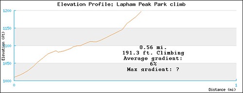
Okay, I didn't make a specific Routeslip to get from point A to point B (Lapham Peak), but I did make a Routeslip of Lapham Peak's climb as motivation. You can look up Lapham Peak on Google maps and find it easy enough. As motivation, here's what it has to offer:
Lapham Peak Park climb:
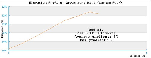
The next road south of the park entrance (about a mile?) is Government Hill Rd. It's the old summit road before the park was built (used to be private property).
Government Hill: (it should read 0.66mi)
For comparison, the biggest climb I can find in Milwaukee County is in Grant Park, riding from the beach on Lake Mich. to the top of the bluff (there are some that are steeper, but this one has the most gain in height):
Grant Park:
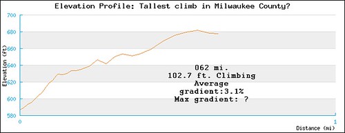
Half as steep, half the height, half the fun.
Hope you can make it up to Lapham Peak !
