


Have Garmin, will Travel
 09-03-11, 03:06 PM
#1
I need speed
Thread Starter

Join Date: Sep 2009
Location: Phoenix, AZ
Posts: 5,550
Bikes: Giant Propel, Cervelo P2
Mentioned: 1 Post(s)
Tagged: 0 Thread(s)
Quoted: 0 Post(s)
Likes: 0
Liked 1 Time
in
1 Post
Have Garmin, will Travel
This is a long ride report, focused on travelling while using ridewithgps.com and a Garmin Edge 500 computer to both select and navigate unfamiliar routes.
Last summer, my dog and I took what I called our "California Dreaming" tour. I grew up in San Diego, and had siblings both there and in San Jose, so we drove from Phoenix to Santa Barbara, then up to San Jose, then back down the coast to San Diego, and back home to Phoenix. I wasn't as cycling addicted last year, so I didn't take my bike. This year, however, for "California Dreaming II", I took both my dog and my bike. For some strange reason, my wife found the idea of me, my dog, and my bike all being gone for 6 days very appealing. My sister recently moved from San Jose to San Salvador (as in El Salvador), and so the trip included only Santa Barbara and San Diego. I have no relatives in Santa Barbara, I just love the place, and it's a great place to take a dog, and a great place for cycling.
In my preparation for the trip, I searched ridewithgps.com for routes I might want to ride. I came up with two candidates:
1. A 75 mile loop around Lake Casitas, and
2. A 40 mile route called by its creator simply "Ridge"
The links will take you to the route profiles. Here is what I did to be able to ride these routes, in unfamiliar territory, without getting hopelessly lost.
A. I reentered the Lake Casitas route in ridewithgps.com, so that it originated where I was staying, and to get rid of extraneous metrics that had been uploaded by the person who created the route. I should have done this for The Ridge as well, but ran out of time.
B. I downloaded .TCX (Garmin Training Center) files from ridewithgps.com to my desktop.
C. I copied the .TCX files into the "Courses" folder of my Garmin Edge 500
D. I packed up and drove to Santa Barbara, watching the outside temperature drop 45 degrees over the course of the drive.
After taking my dog for a romp on the Santa Barbara beach Wednesday (8/24) morning, I got my bike ready and began the Lake Casitas ride. I navigated to the Courses function of my Garmin, selected the Lake Casitas course, and told it to "Do Course". This made the course specific screens available, and here is a sample of them:

Essentially, even though the Edge 500 does not have mapping, it does have the ability to both keep you on course, and give you an idea of what lies ahead. It gives you a warning when you deviate from the course, and it provides a squiggly line of the road ahead, which is of extreme value when going downhill at speed on an unfamiliar road. It wasn't perfect, but it was close. I was twice told I was off course, because the computer route wanted me to go on non-existent roads. Once I converged with its intended path, it told me I was back on course. That "crying wolf" later caused me to ignore a warning I shouldn't have.
The Lake Casitas ride was fantastic. It had everything from riding with an Osprey off my right shoulder while paralleling the shore on Interstate 101, to seaside towns, to tree covered forest paths, to winding mountain roads. Oh, and a lake:

I had one of those conversations that highlight the huge gap in understanding between cyclists and those poor souls who don't ride, when I was stopped at some construction where they were doing lane control. As I waited for my turn to go through, I chatted with the construction flagman:
Him: "Where did you come from?"
Me: "I came around the lake.
Him: "From where? Ojai?"
Me: "No, I came down from Santa Barbara, rode around the lake, and now I'm headed back."
Him: "When did you leave?"
Me: "I think it was about 7:00."
Him: "7:00? What? You mean last night?"
Me: "Err... no."
The guy thought I was insane.
As I said, a totally gorgeous ride of about 75 miles with 3K+ of climbing. It would have been really really difficult (and slow) to navigate this route without the GPS "Course function". There were a lot of turns that weren't obvious, as well as entrances to bike paths you would have had to know were there. The GPS took me right to them.
I'll do a separate post for the report of the Ridge ride the next day.
Last summer, my dog and I took what I called our "California Dreaming" tour. I grew up in San Diego, and had siblings both there and in San Jose, so we drove from Phoenix to Santa Barbara, then up to San Jose, then back down the coast to San Diego, and back home to Phoenix. I wasn't as cycling addicted last year, so I didn't take my bike. This year, however, for "California Dreaming II", I took both my dog and my bike. For some strange reason, my wife found the idea of me, my dog, and my bike all being gone for 6 days very appealing. My sister recently moved from San Jose to San Salvador (as in El Salvador), and so the trip included only Santa Barbara and San Diego. I have no relatives in Santa Barbara, I just love the place, and it's a great place to take a dog, and a great place for cycling.
In my preparation for the trip, I searched ridewithgps.com for routes I might want to ride. I came up with two candidates:
1. A 75 mile loop around Lake Casitas, and
2. A 40 mile route called by its creator simply "Ridge"
The links will take you to the route profiles. Here is what I did to be able to ride these routes, in unfamiliar territory, without getting hopelessly lost.
A. I reentered the Lake Casitas route in ridewithgps.com, so that it originated where I was staying, and to get rid of extraneous metrics that had been uploaded by the person who created the route. I should have done this for The Ridge as well, but ran out of time.
B. I downloaded .TCX (Garmin Training Center) files from ridewithgps.com to my desktop.
C. I copied the .TCX files into the "Courses" folder of my Garmin Edge 500
D. I packed up and drove to Santa Barbara, watching the outside temperature drop 45 degrees over the course of the drive.
After taking my dog for a romp on the Santa Barbara beach Wednesday (8/24) morning, I got my bike ready and began the Lake Casitas ride. I navigated to the Courses function of my Garmin, selected the Lake Casitas course, and told it to "Do Course". This made the course specific screens available, and here is a sample of them:
Essentially, even though the Edge 500 does not have mapping, it does have the ability to both keep you on course, and give you an idea of what lies ahead. It gives you a warning when you deviate from the course, and it provides a squiggly line of the road ahead, which is of extreme value when going downhill at speed on an unfamiliar road. It wasn't perfect, but it was close. I was twice told I was off course, because the computer route wanted me to go on non-existent roads. Once I converged with its intended path, it told me I was back on course. That "crying wolf" later caused me to ignore a warning I shouldn't have.
The Lake Casitas ride was fantastic. It had everything from riding with an Osprey off my right shoulder while paralleling the shore on Interstate 101, to seaside towns, to tree covered forest paths, to winding mountain roads. Oh, and a lake:
I had one of those conversations that highlight the huge gap in understanding between cyclists and those poor souls who don't ride, when I was stopped at some construction where they were doing lane control. As I waited for my turn to go through, I chatted with the construction flagman:
Him: "Where did you come from?"
Me: "I came around the lake.
Him: "From where? Ojai?"
Me: "No, I came down from Santa Barbara, rode around the lake, and now I'm headed back."
Him: "When did you leave?"
Me: "I think it was about 7:00."
Him: "7:00? What? You mean last night?"
Me: "Err... no."
The guy thought I was insane.
As I said, a totally gorgeous ride of about 75 miles with 3K+ of climbing. It would have been really really difficult (and slow) to navigate this route without the GPS "Course function". There were a lot of turns that weren't obvious, as well as entrances to bike paths you would have had to know were there. The GPS took me right to them.
I'll do a separate post for the report of the Ridge ride the next day.
 09-03-11, 03:35 PM
#2

Senior Member
I wish my Garmin was as good as yours. It was really nice when it worked. I had the 305 forerunner though.
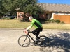
It really looks nice out there where you ride. Very nice looking bike as well. What model is it?
It really looks nice out there where you ride. Very nice looking bike as well. What model is it?
__________________
George
George
09-03-11, 03:54 PM
#4
I need speed
Thread Starter
Join Date: Sep 2009
Location: Phoenix, AZ
Posts: 5,550
Bikes: Giant Propel, Cervelo P2
Mentioned: 1 Post(s)
Tagged: 0 Thread(s)
Quoted: 0 Post(s)
Likes: 0
Liked 1 Time
in
1 Post
The Ridge
Thursday morning, after another great romp with my dog, I headed out to do "The Ridge". Wow. The Santa Barbara coastline is South facing, and it is ringed by mountains. You know, the ones you see on TV as the million dollar homes built on them are turned to cinder by the frequent brush fires. The Ridge, a route name I shall forever capitalize, goes through neighborhoods heading to the East, and then, over the course of about 10 miles, and over 4K of climbing, reaches the top of The Ridge. You then follow The Ridge West, going up and down over the peaks, and finally wear out your brake pads descending back into town. That is, if you don't miss the turn and end up heading into the back country around Lake Cachuma. If you do that, you end up doing some extra climbing going back up the backside of the mountains to find your way back. Not that I speak from personal experience or anything, but I did somehow end up with over 5K of climbing. 
This route climbs, and climbs, and then climbs some more. You go through neighborhoods with fantastic ocean views:

And then get up where there are only communications towers and fire control stations:

Eventually, you get to this view from along The Ridge:

I think that was from near the top, anyway. From there I went up and down along the top of The Ridge before really starting to (mostly very carefully) descend.
I mentioned in the Lake Casitas report that the Garmin 500 had told me I was off course twice when I wasn't. The first time it was because ridewithgps.com was set to use bike paths, and it tried to send me down what looked like a single track mountain path. The second time, it tried to send me on a shortcut through a trailer park. Both times I simply rejoined the route when I got past the 'detour'. As I was blasting down the back of The Ridge, it told me I was off course again. I said to myself "Self, there was no turn back there at all. You can't be off course. Just keep enjoying the downhill, and we'll get back in sync with the computer lickity split." Fortunately, there was another, slighly smarter self hiding in the back of my brain that started to say "But but but, we are going really fast down. Shouldn't we stop and make sure, before we, like, have to reclimb the whole fricken mountain?!?"
Fortunately, the smarter brain took temporary control, and I slowed to a stop, and checked Google Maps. Suprisingly, reception up there was stellar. I guess people need to be able to call for help when the fires reach their doorsteps? Anyway, it turns out there WAS a turn back there, but so narrow, and at such an acute angle (back), that it was impossible to see at 30+mph! So it was back up the hill, then down a narrow street of broken pavement before reaching the main road back to town.
I have never spent so much time in my granny gear as I did on this ride. I was in 39/28 for a good potion of it, s l o w l y cranking along. My computer kept pausing because I was under 5mph, so I turned off auto pause. I now know that flies can keep up with you, flying backwards while buzzing in your face to get at the profuse quantities of perspiration pooling in your sunglasses frames, at up 7.8mph. Faster than that, and you can lose them.
So this was a great, and very difficult, ride. The inland temps were over 100, and the climbing just never stopped during that 10 mile stretch that took me up to the top of The Ridge.
From now on, whenever I will be on an unfamiliar route, I'll be downloading .TCX files into my Garmin, and using those to both keep on track, and to let me know when that hairpin turn is approaching. If there is a cue sheet for the route (in these examples yes for Lake Casitas, no for The Ridge) it lets you know about the turns, gives you both time and distance to those waypoints, and shows the direction of the waypoint with a dotted line, along with an ever present North arrow. It is excellent functionality that I hadn't tried before, and I was surprised at how well it worked.
The computer also pits you against a "Virtual Partner" that is riding the course. You can adjust the speed of your partner. The default virtual partner 'crushed my soul', but I'm sure it's only because He/She/It never stopped to take a picture. Yeah. That's it!
I did two rides in San Diego as well, but relied on local knowledge. My coach sent an email to one of the local clubs to see who might be riding Friday, and I met up with a guy to do the classic "Elfin Forest Loop". That guy crushed my soul also. I did a group ride the next day that took me from Carlsbad, through Camp Pendleton Marine base, to San Clemente and back. I had an "Epic Blowout" at high speed that took took one bead of my tire off the rim going through Pendleton, and had to stop with metal on pavement, and my tube wound around my axle. Whew. All in all I did ~240 miles in the 4 days of riding, and climbed 12-14K (depending on which technology you believe).
In summary, I benefited from both the modern techie approach to find rides I did solo, as well as old school methods of joining locals on their rides.
I can't wait for "California Dreamin' III"!
This route climbs, and climbs, and then climbs some more. You go through neighborhoods with fantastic ocean views:
And then get up where there are only communications towers and fire control stations:
Eventually, you get to this view from along The Ridge:
I think that was from near the top, anyway. From there I went up and down along the top of The Ridge before really starting to (mostly very carefully) descend.
I mentioned in the Lake Casitas report that the Garmin 500 had told me I was off course twice when I wasn't. The first time it was because ridewithgps.com was set to use bike paths, and it tried to send me down what looked like a single track mountain path. The second time, it tried to send me on a shortcut through a trailer park. Both times I simply rejoined the route when I got past the 'detour'. As I was blasting down the back of The Ridge, it told me I was off course again. I said to myself "Self, there was no turn back there at all. You can't be off course. Just keep enjoying the downhill, and we'll get back in sync with the computer lickity split." Fortunately, there was another, slighly smarter self hiding in the back of my brain that started to say "But but but, we are going really fast down. Shouldn't we stop and make sure, before we, like, have to reclimb the whole fricken mountain?!?"
Fortunately, the smarter brain took temporary control, and I slowed to a stop, and checked Google Maps. Suprisingly, reception up there was stellar. I guess people need to be able to call for help when the fires reach their doorsteps? Anyway, it turns out there WAS a turn back there, but so narrow, and at such an acute angle (back), that it was impossible to see at 30+mph! So it was back up the hill, then down a narrow street of broken pavement before reaching the main road back to town.
I have never spent so much time in my granny gear as I did on this ride. I was in 39/28 for a good potion of it, s l o w l y cranking along. My computer kept pausing because I was under 5mph, so I turned off auto pause. I now know that flies can keep up with you, flying backwards while buzzing in your face to get at the profuse quantities of perspiration pooling in your sunglasses frames, at up 7.8mph. Faster than that, and you can lose them.
So this was a great, and very difficult, ride. The inland temps were over 100, and the climbing just never stopped during that 10 mile stretch that took me up to the top of The Ridge.
From now on, whenever I will be on an unfamiliar route, I'll be downloading .TCX files into my Garmin, and using those to both keep on track, and to let me know when that hairpin turn is approaching. If there is a cue sheet for the route (in these examples yes for Lake Casitas, no for The Ridge) it lets you know about the turns, gives you both time and distance to those waypoints, and shows the direction of the waypoint with a dotted line, along with an ever present North arrow. It is excellent functionality that I hadn't tried before, and I was surprised at how well it worked.
The computer also pits you against a "Virtual Partner" that is riding the course. You can adjust the speed of your partner. The default virtual partner 'crushed my soul', but I'm sure it's only because He/She/It never stopped to take a picture. Yeah. That's it!
I did two rides in San Diego as well, but relied on local knowledge. My coach sent an email to one of the local clubs to see who might be riding Friday, and I met up with a guy to do the classic "Elfin Forest Loop". That guy crushed my soul also. I did a group ride the next day that took me from Carlsbad, through Camp Pendleton Marine base, to San Clemente and back. I had an "Epic Blowout" at high speed that took took one bead of my tire off the rim going through Pendleton, and had to stop with metal on pavement, and my tube wound around my axle. Whew. All in all I did ~240 miles in the 4 days of riding, and climbed 12-14K (depending on which technology you believe).
In summary, I benefited from both the modern techie approach to find rides I did solo, as well as old school methods of joining locals on their rides.
I can't wait for "California Dreamin' III"!
09-03-11, 03:59 PM
#5
I need speed
Thread Starter
Join Date: Sep 2009
Location: Phoenix, AZ
Posts: 5,550
Bikes: Giant Propel, Cervelo P2
Mentioned: 1 Post(s)
Tagged: 0 Thread(s)
Quoted: 0 Post(s)
Likes: 0
Liked 1 Time
in
1 Post
The bike is a 2011 Madone 5.2, with the compact crank that came on it replaced by a SRAM Red standard (53/39) crankset, with an integrated Quarq Cinqo power meter. I've had it a few months now and am really enjoying it. I also swapped out the bars, the saddle, and have another set of (tubular) wheels I use when racing.
09-03-11, 04:50 PM
#6
Climbing Above It All

Join Date: Oct 2004
Location: Basking in the Sun.
Posts: 4,146
Mentioned: 0 Post(s)
Tagged: 0 Thread(s)
Quoted: 0 Post(s)
Likes: 0
Liked 0 Times
in
0 Posts
I've had my 800 for almost 10 months and I still know nothing about using the mapping or GPS features. I expect it will continue that way. I have all this tech stuff and can't use any of it. So the 800 for me is just a fancy cyclometer. But I can barely use a computer, forget about my iPhone and so it all makes sense.
09-03-11, 08:30 PM
#7
Grandpa with spunk

Join Date: Feb 2009
Location: The Calumet Region
Posts: 293
Bikes: (See sig block)
Mentioned: 0 Post(s)
Tagged: 0 Thread(s)
Quoted: 0 Post(s)
Likes: 0
Liked 0 Times
in
0 Posts
Thanks AzTall for the great reports and inspiration. I've also been prodded by your report of success to re-explore the use of .tcx files on my Garmin 705. (With thanks to DnvrFox, questioned the popularity of these kind of threads, I will remember to reply to ride reports that I read and share some appreciation.)
09-03-11, 08:58 PM
#8
Banned.

Join Date: Aug 2001
Posts: 20,917
Mentioned: 0 Post(s)
Tagged: 0 Thread(s)
Quoted: 0 Post(s)
Likes: 0
Liked 12 Times
in
10 Posts
Great post and thanks. I grew up in San Diego, also, and spent a lot of time living in the mountains near Julian and Palomar. I would challenge you in California III to do the Palomar Mountain/Lake Henshaw/Pala Loop. That will be your REAL challenge!!
Excellent reporting and writing.
Excellent reporting and writing.
Last edited by DnvrFox; 09-03-11 at 09:04 PM.


 09-04-11, 07:55 AM
#13
I need speed
Thread Starter
Join Date: Sep 2009
Location: Phoenix, AZ
Posts: 5,550
Bikes: Giant Propel, Cervelo P2
Mentioned: 1 Post(s)
Tagged: 0 Thread(s)
Quoted: 0 Post(s)
Likes: 0
Liked 1 Time
in
1 Post
Great post and thanks. I grew up in San Diego, also, and spent a lot of time living in the mountains near Julian and Palomar. I would challenge you in California III to do the Palomar Mountain/Lake Henshaw/Pala Loop. That will be your REAL challenge!!
Excellent reporting and writing.
Excellent reporting and writing.
09-04-11, 08:02 AM
#14
Idiot Emeritus

Loved it, AzT - thank you for the report and photos! I wish my Edge 305 would do courses, but it's good enough the way it is for me. Speaking of photos - we're still waiting!!! ;~)
__________________
"Can you add a signature line please? The lack of words makes me think you are being held hostage and being told to be quiet"
"Can you add a signature line please? The lack of words makes me think you are being held hostage and being told to be quiet"
09-04-11, 08:04 AM
#15
just keep riding
Join Date: Feb 2005
Location: Milledgeville, Georgia
Posts: 13,560
Bikes: 2018 Black Mountain Cycles MCD,2017 Advocate Cycles Seldom Seen Drop Bar, 2017 Niner Jet 9 Alloy, 2015 Zukas custom road, 2003 KHS Milano Tandem, 1986 Nishiki Cadence rigid MTB, 1980ish Fuji S-12S
Mentioned: 15 Post(s)
Tagged: 0 Thread(s)
Quoted: 173 Post(s)
Liked 33 Times
in
22 Posts
Thanks for the well-written (although the dog was a bit of a red herring) and well-timed report. I have been strongly considering an upgrade to my Garmin 305 Foreunner. It does most of what I need, but the lack of a barometric altimeter severely limits it. Ridewithgps.com is my favorite of all the ride mapping and uploading sites, but it does a terrible job of correcting the useless elevation data from my 305. Some of the other sites do better at that, but it would be better to have useful data directly from the gps unit.
The 500 has been the leading candidate for my next gps, but the mapping features of the 800 would be nice. Your review tells me that much of what I would want from mapping is possible with the 500. Hard to justify the extra $200+ for the 800 with accessories.
The 500 has been the leading candidate for my next gps, but the mapping features of the 800 would be nice. Your review tells me that much of what I would want from mapping is possible with the 500. Hard to justify the extra $200+ for the 800 with accessories.
09-04-11, 08:08 AM
#16
I need speed
Thread Starter
Join Date: Sep 2009
Location: Phoenix, AZ
Posts: 5,550
Bikes: Giant Propel, Cervelo P2
Mentioned: 1 Post(s)
Tagged: 0 Thread(s)
Quoted: 0 Post(s)
Likes: 0
Liked 1 Time
in
1 Post
 09-04-11, 08:23 AM
#18
I need speed
Thread Starter
Join Date: Sep 2009
Location: Phoenix, AZ
Posts: 5,550
Bikes: Giant Propel, Cervelo P2
Mentioned: 1 Post(s)
Tagged: 0 Thread(s)
Quoted: 0 Post(s)
Likes: 0
Liked 1 Time
in
1 Post
Wise dogs know that, if you sleep in front of the door, your human can't sneak out without you.

And to keep it on topic, Cannon ignores both cyclists and pedestrians, unless they show an interest in him, in which case he gives a polite hello sniff then moves on. I showed off a bit loading and unloading between the car and the motel rooms, by leaving the door open, with him waiting in the doorway, the whole time. I used Motel 6, which is dog-friendly. The Santa Barbara Motel 6 is less than a block from the beach, new and clean, and while more expensive than other Motel 6's, really cheap compared to the neighboring resort style hotels.
And to keep it on topic, Cannon ignores both cyclists and pedestrians, unless they show an interest in him, in which case he gives a polite hello sniff then moves on. I showed off a bit loading and unloading between the car and the motel rooms, by leaving the door open, with him waiting in the doorway, the whole time. I used Motel 6, which is dog-friendly. The Santa Barbara Motel 6 is less than a block from the beach, new and clean, and while more expensive than other Motel 6's, really cheap compared to the neighboring resort style hotels.
09-04-11, 08:40 AM
#19
I need speed
Thread Starter
Join Date: Sep 2009
Location: Phoenix, AZ
Posts: 5,550
Bikes: Giant Propel, Cervelo P2
Mentioned: 1 Post(s)
Tagged: 0 Thread(s)
Quoted: 0 Post(s)
Likes: 0
Liked 1 Time
in
1 Post
Ridewithgps.com is my favorite of all the ride mapping and uploading sites, but it does a terrible job of correcting the useless elevation data from my 305. Some of the other sites do better at that, but it would be better to have useful data directly from the gps unit.
Computer: ~5,100 (from memory)
trainingpeaks 4,937
garminconnect: 5,115
ridewithgps upload 5,109
The difference isn't material, but it's interesting nonetheless, and I've seen large differences between what ridewithgps said the ascent would be, and what the computer said it was when I rode it. As in thousands of feet of difference for the San Diego Century I rode earlier this year, with ridewithgps grossly overstated. But this uploaded route seems to be very accurate.
09-04-11, 11:49 AM
#20
Junior Member

Join Date: Aug 2011
Posts: 5
Mentioned: 0 Post(s)
Tagged: 0 Thread(s)
Quoted: 0 Post(s)
Likes: 0
Liked 0 Times
in
0 Posts
Great read. Thanks. I've got a forerunner 305 I use when I run, and I love it. Never tried the mapping features except once when I was on a beach at night and couldn't find the boardwalk back to the condo. I'm not sure if mine will do what yours does but it's something I can investigate. That looks like a beautiful spot. Good pics.
09-04-11, 04:16 PM
#21
Banned.
Join Date: Aug 2001
Posts: 20,917
Mentioned: 0 Post(s)
Tagged: 0 Thread(s)
Quoted: 0 Post(s)
Likes: 0
Liked 12 Times
in
10 Posts
I was hoping to do either Palomar or Laguna, but didn't fit them in. I have a 50 mile Laguna route worked out, and next time I'll give that one a go: https://ridewithgps.com/routes/185005
If you ever went to 6th grade "school camp" - outdoor education - at Palomar, Cuyamaca or Marston, I might have been your counselor!! I was also a part-time fire lookout on Cuyamaca, Los Pinos and Lyons peaks - when they used to have fire lookouts, and was a fire fighter for a couple of years near Morena Lake.
09-04-11, 05:28 PM
#22
Roadkill
Join Date: Sep 2004
Location: East Tennessee
Posts: 858
Bikes: 2002 Lightspeed Classic; 2010 Pedalforce RS
Mentioned: 0 Post(s)
Tagged: 0 Thread(s)
Quoted: 0 Post(s)
Likes: 0
Liked 0 Times
in
0 Posts
The 305 will do courses and much of what the 500 does. I used to use my 305 to navigate courses when visiting my wife, while she was working in Alabama.
I think the procedure is mostly the same, even though I haven't gotten around to doing a course in the 500. Maybe this will inspire me to try it.
09-05-11, 02:14 PM
#23
On the road again
Join Date: Aug 2005
Location: Columbus, Ohio
Posts: 127
Bikes: Specialized Roubaix, Cannondale R6000
Mentioned: 0 Post(s)
Tagged: 0 Thread(s)
Quoted: 0 Post(s)
Likes: 0
Liked 0 Times
in
0 Posts
Great post, thanks for sharing. I too have a Garmin Edge 500 and have yet to use the GPS feature, you have me very interested in testing it out, back to the manual. had fun customizing the screens I use for riding so this should be a lot of fun.
__________________
"We're high with expectation on the edge of the unknown."
"We're high with expectation on the edge of the unknown."
09-05-11, 03:20 PM
#24
Getting older and slower!

Thanks for posting.
I love my Garmin Edge 800! Vacationed in Florida this spring and while we vacation annually in the area I generally knew the area. However being able to download rides the locals did, I was able to explore some new routes and ride some safer roads in areas I had ridden before.
Again, I love my Garmin.
09-05-11, 05:58 PM
#25
I need speed
Thread Starter
Join Date: Sep 2009
Location: Phoenix, AZ
Posts: 5,550
Bikes: Giant Propel, Cervelo P2
Mentioned: 1 Post(s)
Tagged: 0 Thread(s)
Quoted: 0 Post(s)
Likes: 0
Liked 1 Time
in
1 Post
If you ever went to 6th grade "school camp" - outdoor education - at Palomar, Cuyamaca or Marston, I might have been your counselor!! I was also a part-time fire lookout on Cuyamaca, Los Pinos and Lyons peaks - when they used to have fire lookouts, and was a fire fighter for a couple of years near Morena Lake.