


weekend ride reports - where'd ya ride?

 05-26-09, 04:10 PM
#1752
Senior Member
Join Date: Jan 2007
Posts: 787
Mentioned: 0 Post(s)
Tagged: 0 Thread(s)
Quoted: 0 Post(s)
Likes: 0
Liked 0 Times
in
0 Posts
Eh, I use the Garmin elevations, so everything I post is probably 10% high as well. Regardless, as long as you use the same measurements each time you will know how what you've done compares to your other rides.
(to be honest, the Garmin elevations at the tops/bottoms of climbs seem to be about right. I don't know if it's oversensitive on rollers, or adding cumulative ascent wackily)
(to be honest, the Garmin elevations at the tops/bottoms of climbs seem to be about right. I don't know if it's oversensitive on rollers, or adding cumulative ascent wackily)
05-26-09, 06:02 PM
#1754
Full Member
MTB Saturday: Corte Madera, all over the place.
Road Monday: Homestead -> Mt Eden -> HWY 9 -> 35 ->Alpine -> Pescadero -> San Gregorio -> Tunitas ->KM -> Foothill -> Homestead
86 miles. Averaged around 14mph
Road Monday: Homestead -> Mt Eden -> HWY 9 -> 35 ->Alpine -> Pescadero -> San Gregorio -> Tunitas ->KM -> Foothill -> Homestead
86 miles. Averaged around 14mph
05-26-09, 08:10 PM
#1755
moth -----> flame

Join Date: Dec 2007
Location: SF Bay Area
Posts: 5,916
Bikes: 11 CAAD 10-4, 07 Specialized Roubaix Comp, 98 Peugeot Horizon
Mentioned: 0 Post(s)
Tagged: 0 Thread(s)
Quoted: 1 Post(s)
Likes: 0
Liked 2 Times
in
2 Posts
Eh, I use the Garmin elevations, so everything I post is probably 10% high as well. Regardless, as long as you use the same measurements each time you will know how what you've done compares to your other rides.
(to be honest, the Garmin elevations at the tops/bottoms of climbs seem to be about right. I don't know if it's oversensitive on rollers, or adding cumulative ascent wackily)
(to be honest, the Garmin elevations at the tops/bottoms of climbs seem to be about right. I don't know if it's oversensitive on rollers, or adding cumulative ascent wackily)
In my limited experience, the errors seem to come from when GPS coverage gets sketchy, and the Edge appears to suggest that you're riding off road - check out this from my Saturday climb up Tunitas. I think that the online programs then use topo maps to calculate elevation for these erroneous routes, leading to discrepancies:

__________________
BF, in a nutshell
BF, in a nutshell
05-26-09, 09:34 PM
#1756
None

Join Date: May 2008
Posts: 192
Mentioned: 1 Post(s)
Tagged: 0 Thread(s)
Quoted: 0 Post(s)
Likes: 0
Liked 0 Times
in
0 Posts
relying on gps for elevation is problematic. there are devices that supplement this data will barometric readings. but relying on google maps to dictate where the road actually is is also problematic. for instance, that last turn before star hill is wider on google maps than it is in reality and at least in that section your gps is more acurate. to illustrate, just zoom in on google maps using the satelite view + "show labels" ~ you'll see the label is off a bit, and the turn is tighter than the overlay indicates.
so neither are perfect, but we probably don't need such resolution.
so neither are perfect, but we probably don't need such resolution.
05-26-09, 09:57 PM
#1757
Erect member since 1953

Join Date: Dec 2006
Location: Antioch, CA (SF Bay Area)
Posts: 7,000
Bikes: Trek 520 Grando, Roubaix Expert, Motobecane Ti Century Elite turned commuter, Some old French thing gone fixie
Mentioned: 8 Post(s)
Tagged: 0 Thread(s)
Quoted: 121 Post(s)
Likes: 0
Liked 38 Times
in
21 Posts
Ascent (Mac software for garmin GPS) has a smoothing feature that takes out tiny bumps and makes the elevation gains much more realistic.
relying on gps for elevation is problematic. there are devices that supplement this data will barometric readings. but relying on google maps to dictate where the road actually is is also problematic. for instance, that last turn before star hill is wider on google maps than it is in reality and at least in that section your gps is more acurate. to illustrate, just zoom in on google maps using the satelite view + "show labels" ~ you'll see the label is off a bit, and the turn is tighter than the overlay indicates.
so neither are perfect, but we probably don't need such resolution.
so neither are perfect, but we probably don't need such resolution.
05-26-09, 10:11 PM
#1758
moth -----> flame
Join Date: Dec 2007
Location: SF Bay Area
Posts: 5,916
Bikes: 11 CAAD 10-4, 07 Specialized Roubaix Comp, 98 Peugeot Horizon
Mentioned: 0 Post(s)
Tagged: 0 Thread(s)
Quoted: 1 Post(s)
Likes: 0
Liked 2 Times
in
2 Posts
relying on gps for elevation is problematic. there are devices that supplement this data will barometric readings. but relying on google maps to dictate where the road actually is is also problematic. for instance, that last turn before star hill is wider on google maps than it is in reality and at least in that section your gps is more acurate. to illustrate, just zoom in on google maps using the satelite view + "show labels" ~ you'll see the label is off a bit, and the turn is tighter than the overlay indicates.
so neither are perfect, but we probably don't need such resolution.
so neither are perfect, but we probably don't need such resolution.
__________________
BF, in a nutshell
BF, in a nutshell
05-26-09, 10:43 PM
#1759
None
Join Date: May 2008
Posts: 192
Mentioned: 1 Post(s)
Tagged: 0 Thread(s)
Quoted: 0 Post(s)
Likes: 0
Liked 0 Times
in
0 Posts
but even with whatever smoothing algorithm it employs the data collection with regards to elevation will be off (trilateration vs. calibrated air pressure ~ i know of no personal radar based system). and personally, i'm totally ok with that. it's more than good enough for my uses. mostly want to track where i've gone and what kind of progress i'm making.
i'm not sure what motion based does, but it's quirky to say the least. after importing my data from garmin connect into motion based, and motion based subsequently reimporting the data back into garmin connect (jeez way to go guys) i noticed they not only did some sort of smoothing of elevation, but also altered heart rate readings.. i don't really get how the latter works, but whatever..
 05-27-09, 12:06 PM
#1760
Junior Member
Join Date: Apr 2009
Posts: 12
Mentioned: 0 Post(s)
Tagged: 0 Thread(s)
Quoted: 0 Post(s)
Likes: 0
Liked 0 Times
in
0 Posts
After a week off the bike (work travel etc) I got in a nice long ride today. Took Haskins Hill and Alpine up to 35 where I met up with Jammen (he had ridden up Page Mill from Palo Alto).
We took 35 south to 9, then descended 9 all the way to Felton. Climbed Felton Empire Rd, took Ice Cream Grade across to the descent on Pine Flat and Bonny Doon down to 1 (I got up to 39.5 mph despite headwinds from the coast). We took the side route on Swanton, back to 1, then turned off on Gazos Creek to Cloverdale to Pescadero. Total of 84 miles, 7900'.
We took 35 south to 9, then descended 9 all the way to Felton. Climbed Felton Empire Rd, took Ice Cream Grade across to the descent on Pine Flat and Bonny Doon down to 1 (I got up to 39.5 mph despite headwinds from the coast). We took the side route on Swanton, back to 1, then turned off on Gazos Creek to Cloverdale to Pescadero. Total of 84 miles, 7900'.
 05-31-09, 11:14 PM
#1761
Carbon compliance tester
Join Date: Apr 2008
Location: Santa Clara, CA
Posts: 615
Mentioned: 0 Post(s)
Tagged: 0 Thread(s)
Quoted: 10 Post(s)
Likes: 0
Liked 0 Times
in
0 Posts
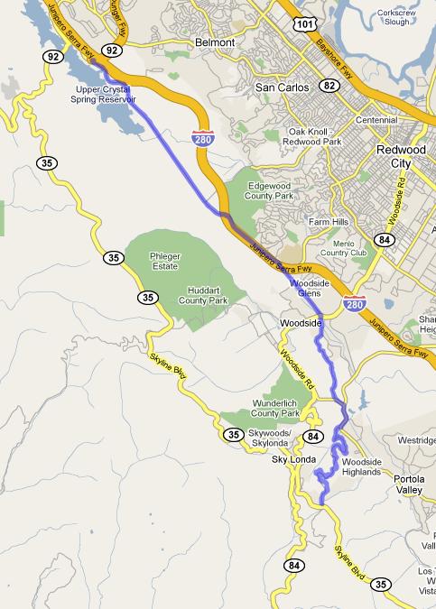
The girl lives in Menlo, so Saturday we rode Sand Hill -> OLH (E) (31:45, ugh) -> OLH (W) -> 84 -> San Gregorio -> Stage -> 1 -> Tunitas -> Kings -> Whiskey Hill -> Sand Hill.
I had originally planned on adding a Haskins Hill to Pescadero to Stage to San Gregorio section. I had expected the whole ride to be 50mi. So imagine my surprise that the whole thing was 48.85 miles without even making it over Haskins Hill to Pescadero! That would easily have made it 70.
Great weather-- a bit cold and misty on the OLH West decent, but not even too windy going down 84.
Tunitas was wet partway up, just from fog earlier in the day I think.
The Kings descent is actually pretty effing awesome. I'm not sure why everyone rags on it. I passed a Toyota Sequoia at the park near the bottom. I took a break at the intersection with 84 in Woodside (so, second stop sign) and it took the Sequoia 3 minutes to catch up.
06-01-09, 12:17 AM
#1762

Dolce far niente

Join Date: Dec 2004
Location: Northern CA
Posts: 10,704
Mentioned: 15 Post(s)
Tagged: 0 Thread(s)
Quoted: 20 Post(s)
Likes: 0
Liked 17 Times
in
14 Posts
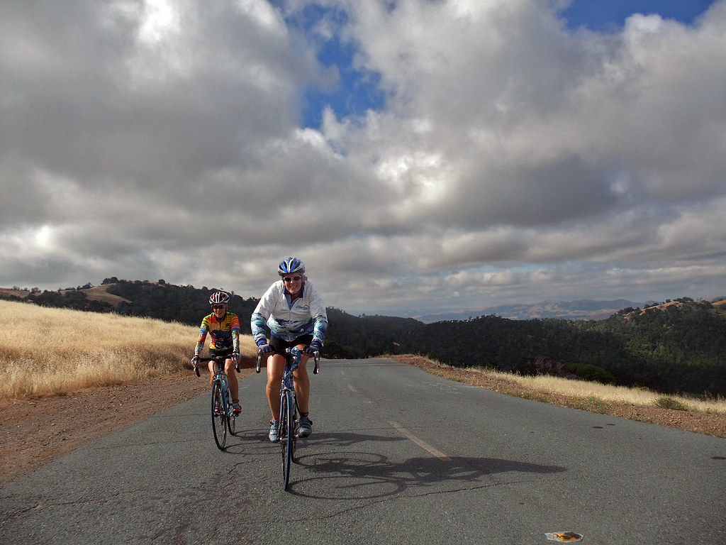
Yesterday, Rich and I saddled up for a ride, with no particular place to go. So, we set off with a vague idea about doing some sort of 40-ish mile loop. It was pretty breezy out when we started, and we sort of paid attention to it as we headed of east to the Livermore Valley. Going out, it was all rainbows, cotton candy, and unicorns. We were flying down the road having a grand old time. At about mile 25 or so, we stopped at a taco wagon and enjoyed some scratch-made tamales - Mmmmmm.
While leaning up against the fence, we took note of the ever-freshening breeze. I speculated that we might be in for a challenge on the way back, but we brushed it off and pressed on. At about mile 30 or so, we hit the far end of the loop and turn back west, into the wind.
Damn.... it was pretty strong, and we were out in the open grassland getting all of it as it swept along. We made a bee-line to a LBS whose owner Rich was friends with, and ducked inside for refills and a bit of rest. Eventually we had to get going, so we said goodbye and took off.
Now we were on Stanley Blvd heading right into the teeth of a full-blown wind, and we were getting brutalized. For 6 miles, we did a two-man rotation and managed to move along quite well until we hit a McDonald's. Taking refuge for a bit, we had a small snack and enjoyed sitting still for a little while - the last 6 miles had taken it's toll and we were feeling a bit spent.
Moving along, we made our turn north to close the loop and get home. The cross wind wasn't' nearly as bad as the headwind, but still problematic. Nevertheless, we made good time and I got home in plenty of time to clean up and get over to the middle school to see my daughter star as Dorothy in her school production of The Wiz.
About 55 miles and a couple thousand feet of climbing is all, but we worked for it. It was a great day to be out despite the wind, and I enjoyed (almost) every minute of it.
Diablo in the distance:

Diablo a little closer up:

Chasing down Rich:

Looking at my front wheel, ducking the headwind:

Big Train, hustling down the highway:

While leaning up against the fence, we took note of the ever-freshening breeze. I speculated that we might be in for a challenge on the way back, but we brushed it off and pressed on. At about mile 30 or so, we hit the far end of the loop and turn back west, into the wind.
Damn.... it was pretty strong, and we were out in the open grassland getting all of it as it swept along. We made a bee-line to a LBS whose owner Rich was friends with, and ducked inside for refills and a bit of rest. Eventually we had to get going, so we said goodbye and took off.
Now we were on Stanley Blvd heading right into the teeth of a full-blown wind, and we were getting brutalized. For 6 miles, we did a two-man rotation and managed to move along quite well until we hit a McDonald's. Taking refuge for a bit, we had a small snack and enjoyed sitting still for a little while - the last 6 miles had taken it's toll and we were feeling a bit spent.
Moving along, we made our turn north to close the loop and get home. The cross wind wasn't' nearly as bad as the headwind, but still problematic. Nevertheless, we made good time and I got home in plenty of time to clean up and get over to the middle school to see my daughter star as Dorothy in her school production of The Wiz.
About 55 miles and a couple thousand feet of climbing is all, but we worked for it. It was a great day to be out despite the wind, and I enjoyed (almost) every minute of it.
Diablo in the distance:
Diablo a little closer up:
Chasing down Rich:
Looking at my front wheel, ducking the headwind:
Big Train, hustling down the highway:
__________________
"Love is not the dying moan of a distant violin, it�s the triumphant twang of a bedspring."
S. J. Perelman
"Love is not the dying moan of a distant violin, it�s the triumphant twang of a bedspring."
S. J. Perelman
Last edited by bigbossman; 06-01-09 at 12:20 AM.
06-01-09, 12:43 AM
#1763
Senior Member
Join Date: Nov 2008
Location: Bay Area, Calif.
Posts: 7,239
Mentioned: 13 Post(s)
Tagged: 0 Thread(s)
Quoted: 659 Post(s)
Likes: 0
Liked 7 Times
in
6 Posts
A 55 mile loop today; first heading north to the Diablo Junction, then into Clayton and south over Morgan Territory.
Route and pictures at:
https://www.everytrail.com/view_trip.php?trip_id=227011
Route and pictures at:
https://www.everytrail.com/view_trip.php?trip_id=227011
06-01-09, 08:07 AM
#1764
moth -----> flame
Join Date: Dec 2007
Location: SF Bay Area
Posts: 5,916
Bikes: 11 CAAD 10-4, 07 Specialized Roubaix Comp, 98 Peugeot Horizon
Mentioned: 0 Post(s)
Tagged: 0 Thread(s)
Quoted: 1 Post(s)
Likes: 0
Liked 2 Times
in
2 Posts
Great pictures and prose, as always. I really like this one
I think it should be rewritten to say "Bicyclists - steep grade! Control yourselves"
I think it should be rewritten to say "Bicyclists - steep grade! Control yourselves"
__________________
BF, in a nutshell
BF, in a nutshell
 06-01-09, 10:06 AM
#1766

Spinning like a gerbel

Join Date: Jul 2005
Location: Silicon Valley
Posts: 7,960
Bikes: Seven
Mentioned: 1 Post(s)
Tagged: 0 Thread(s)
Quoted: 2 Post(s)
Likes: 0
Liked 4 Times
in
2 Posts
30 min up OLH is not bad. I made it in 32 min ... so maybe I'm the one out of shape ... and I'm the one doing a double century this weekend!
06-01-09, 10:43 AM
#1767
�\_(ツ)_/�

Join Date: Jun 2008
Location: Redwood City, CA
Posts: 10,978
Bikes: aggressive agreement is what I ride.
Mentioned: 109 Post(s)
Tagged: 0 Thread(s)
Quoted: 967 Post(s)
Likes: 0
Liked 4 Times
in
4 Posts
Hey, I'm definitely using the double next weekend as the reason for my slow 85 minutes up Diablo. That's my double century pace, clearly.
06-01-09, 11:44 AM
#1768
Senior Member
Join Date: Jan 2007
Posts: 787
Mentioned: 0 Post(s)
Tagged: 0 Thread(s)
Quoted: 0 Post(s)
Likes: 0
Liked 0 Times
in
0 Posts
I hookied from work on Friday hoping to do some repeats, but got pulled back into work after the first climb (up Page Mill), so aborted the training after 23 miles and 2,200 ft climb.
Went back out on Sunday, had a late start (10:45), and climbed Page Mill, descended W. Alpine (I think I saw misincredible on her folder then, with a few guys on big wheels chasing after her ), climbed back up Alpine, descended Page Mill, and climbed Page Mill again. At this point, legs were not as cooperative by that time, despite my coaxing with Clif Bar and imagined glory if I do the W. Alpine again. Instead, we reached compromise and went north on Skyline to Kings, with the intention of 2x Kings. Ambition was doused beyond belief at the first climb on Kings: I attributed it to bonking as I was shivering even under full sunshine. At the intersection of Kings and Skyline, I begged to buy extra food from 3 other cyclists, but none carried any for sale.
  I started to berate myself for bonking, and it just went down hills from this point. The descend on Kings was shaky, I took some risky chances and found myself having cold sweats a couple of times. "Live to ride another day, you fool!", I keep hearing that refrain. Called it a day then after I rode to Robert's Market, and mentally ticked off what I could have done better:
1. Start earlier: I found my motivation waning when I saw the sun first setting. I need to buy some of that HTFU's people's been raving about.
2. Bring more food, stupid.
3. Save the iPod for later in the ride, not from the beginning. Otherwise, boredom and wandering mind become part of training.
So it was 66 miles and 7,700 climb. I'm going to be in so much trouble at the Sequoia Century.
Went back out on Sunday, had a late start (10:45), and climbed Page Mill, descended W. Alpine (I think I saw misincredible on her folder then, with a few guys on big wheels chasing after her
), climbed back up Alpine, descended Page Mill, and climbed Page Mill again. At this point, legs were not as cooperative by that time, despite my coaxing with Clif Bar and imagined glory if I do the W. Alpine again. Instead, we reached compromise and went north on Skyline to Kings, with the intention of 2x Kings. Ambition was doused beyond belief at the first climb on Kings: I attributed it to bonking as I was shivering even under full sunshine. At the intersection of Kings and Skyline, I begged to buy extra food from 3 other cyclists, but none carried any for sale. I started to berate myself for bonking, and it just went down hills from this point. The descend on Kings was shaky, I took some risky chances and found myself having cold sweats a couple of times. "Live to ride another day, you fool!", I keep hearing that refrain. Called it a day then after I rode to Robert's Market, and mentally ticked off what I could have done better:1. Start earlier: I found my motivation waning when I saw the sun first setting. I need to buy some of that HTFU's people's been raving about.
2. Bring more food, stupid.
3. Save the iPod for later in the ride, not from the beginning. Otherwise, boredom and wandering mind become part of training.
So it was 66 miles and 7,700 climb. I'm going to be in so much trouble at the Sequoia Century.
06-01-09, 12:14 PM
#1769
�\_(ツ)_/�
Join Date: Jun 2008
Location: Redwood City, CA
Posts: 10,978
Bikes: aggressive agreement is what I ride.
Mentioned: 109 Post(s)
Tagged: 0 Thread(s)
Quoted: 967 Post(s)
Likes: 0
Liked 4 Times
in
4 Posts
You use that 15min chime to remember to drink, you could try to use it to remember to eat 1/3 of a bar and wash it down with some water.
You will so be fine.
06-07-09, 01:51 PM
#1772
Erect member since 1953
Join Date: Dec 2006
Location: Antioch, CA (SF Bay Area)
Posts: 7,000
Bikes: Trek 520 Grando, Roubaix Expert, Motobecane Ti Century Elite turned commuter, Some old French thing gone fixie
Mentioned: 8 Post(s)
Tagged: 0 Thread(s)
Quoted: 121 Post(s)
Likes: 0
Liked 38 Times
in
21 Posts
Just a beautiful day with MyLilPony and OrbeaJ riding Diablo, Blackhawk, Walnut Creek and Pleasant Hill.
MyLilPony and I followed up by riding to the Art and Wine Fest in walnut Creek, then she went bike shopping (no purchase yet.)
MyLilPony and I followed up by riding to the Art and Wine Fest in walnut Creek, then she went bike shopping (no purchase yet.)
06-07-09, 05:52 PM
#1773
moth -----> flame
Join Date: Dec 2007
Location: SF Bay Area
Posts: 5,916
Bikes: 11 CAAD 10-4, 07 Specialized Roubaix Comp, 98 Peugeot Horizon
Mentioned: 0 Post(s)
Tagged: 0 Thread(s)
Quoted: 1 Post(s)
Likes: 0
Liked 2 Times
in
2 Posts
Climby little 35miler with Brentley on Saturday - Rheem, Reliez, Pig Farm, Mama Bear, Happy Valley and Acalanes. Got my quads working for 3400ft elevation.
__________________
BF, in a nutshell
BF, in a nutshell
06-07-09, 07:11 PM
#1774
Senior Member
Join Date: Mar 2005
Location: Moraga, CA
Posts: 1,701
Bikes: 2008 Cervelo RS, 2011 Scott CR1 Elite, 2014 Volagi Liscio
Mentioned: 0 Post(s)
Tagged: 0 Thread(s)
Quoted: 0 Post(s)
Likes: 0
Liked 1 Time
in
1 Post
I did the Sequoia Metric Century. I nearly died going up Redwood Gulch, but the descent down Alpine was great. It was rather serene riding through the forest along Tunitas Creek. Very pretty. You folks on the peninsula have some great rides; I think they're better than the ones we have in the East Bay. You can't beat our views off of Grizzly, however.
06-07-09, 08:10 PM
#1775
Don't mince words
Saturday: Up the 505 to Winters, then an abbreviated return through the orchards, for 24 miles and change. Just keeping the legs loose for today's effort.
Sunday: Dunlap Memorial Time Trial. 18 miles in 50:50, against 20 mph sustained/29 mph gusts. Not our best effort but we put it all out there. Also gained on the district champions in the tandem category by about 2 minutes.
Sunday: Dunlap Memorial Time Trial. 18 miles in 50:50, against 20 mph sustained/29 mph gusts. Not our best effort but we put it all out there. Also gained on the district champions in the tandem category by about 2 minutes.