


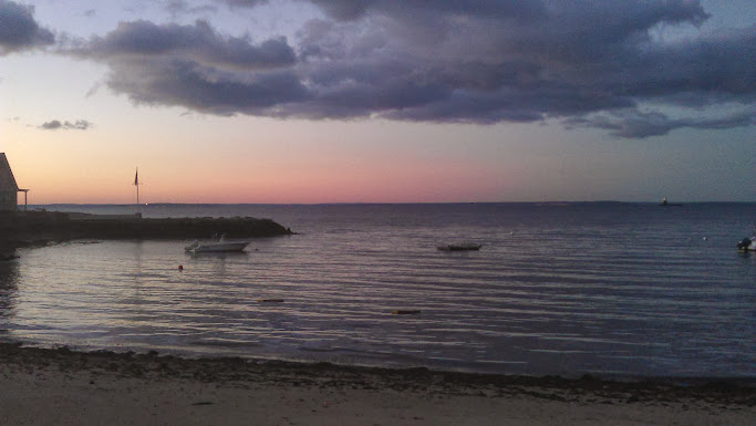
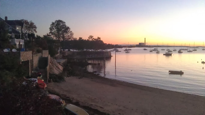
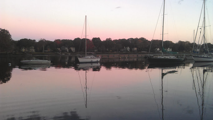
Pictures of your commute itself, not necessarily the bike.
 10-15-13, 11:29 AM
#76
Senior Member

Join Date: Apr 2012
Location: Memphis TN area
Posts: 7,391
Bikes: 2011 Felt Z85 (road/commuter), 2006 Marin Pine Mountain (utility/commuter E-bike), 1995 KHS Alite 1000 (gravel grinder)
Mentioned: 25 Post(s)
Tagged: 0 Thread(s)
Quoted: 676 Post(s)
Likes: 0
Liked 13 Times
in
13 Posts
So what's it been like going from riding on the right side of the road to riding on the left side? Weird stuff?
 10-15-13, 12:37 PM
#77
Senior Member

I don't ride much in the winter. Once the snow sticks, I pretty much switch to transit, and cycle only a few times between December and March. The city is pretty good about plowing most trails, though, and within a couple days of a snowfall, trails and roads are either plowed or hard-packed snow. Just takes longer.
10-15-13, 01:45 PM
#78
Banned
it's more natural than one would think especially when following traffic, that's very easy, but at weird intersections, it's quite hard (and England loves their double roundabouts).
the first day in the german countryside I was crossing the street to get some pretzels and leberk�se for breakfast and i didn't look the right way and was almost hit

interesting lifestyle ... bike commuting is different as well as the traffic comes from different directions.
10-15-13, 02:01 PM
#79
Senior Member
Join Date: Apr 2012
Location: Memphis TN area
Posts: 7,391
Bikes: 2011 Felt Z85 (road/commuter), 2006 Marin Pine Mountain (utility/commuter E-bike), 1995 KHS Alite 1000 (gravel grinder)
Mentioned: 25 Post(s)
Tagged: 0 Thread(s)
Quoted: 676 Post(s)
Likes: 0
Liked 13 Times
in
13 Posts
Doesn't Great Britain have signs on sidewalks saying "LOOK RIGHT" or something like that, for people who are not used to having cars approach them from the right side in the curb (kerb?  ) lane?
) lane?
10-15-13, 02:08 PM
#80
Banned
the cars were coming from the incorrect (i had adjusted after driving in UK that morning) direction and there are no warning signs, as it is germany
 10-17-13, 05:41 PM
#81
Senior Member
Join Date: Jun 2011
Location: Lexington, KY
Posts: 91
Bikes: 2014 Giant Avail 2, 1999? Giant Sedona
Mentioned: 0 Post(s)
Tagged: 0 Thread(s)
Quoted: 0 Post(s)
Likes: 0
Liked 0 Times
in
0 Posts
I sometimes ride through the Kentucky Horse Park on my way in, though it's the long way around. The two on the MUP are no longer on my commute but I still ride there for fun.


 10-17-13, 08:41 PM
#84
Senior Member

Join Date: Apr 2011
Location: Vancouver,Washington
Posts: 2,280
Bikes: Old steel GT's, for touring and commuting
Mentioned: 0 Post(s)
Tagged: 0 Thread(s)
Quoted: 39 Post(s)
Likes: 0
Liked 1 Time
in
1 Post
.
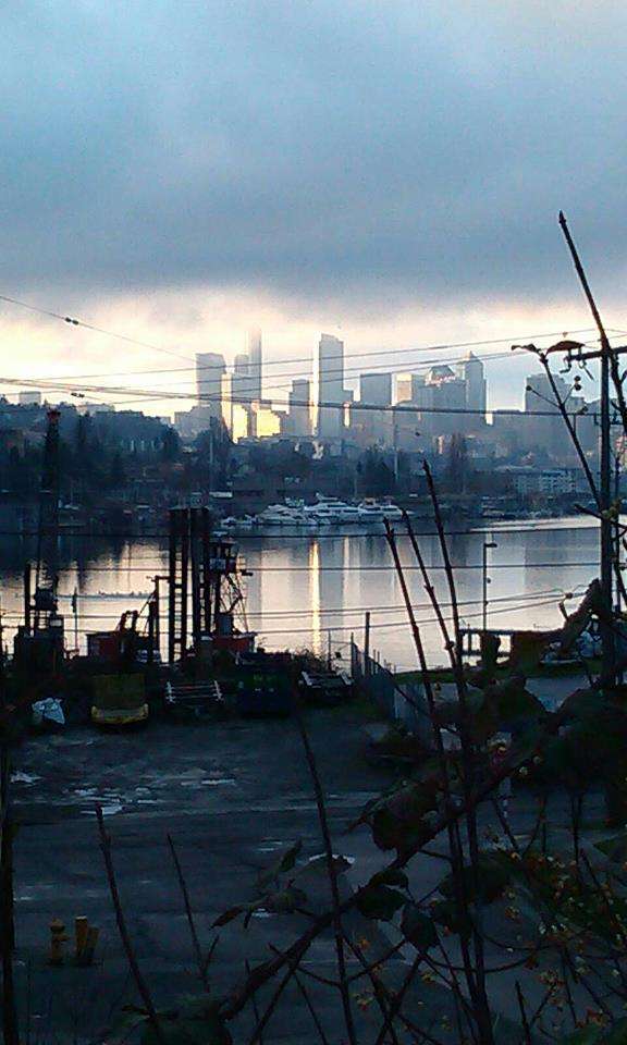
Okay, I'll play! I feel very lucky with my commute. Although it is dark for half of the year, and often at least misty or very lightly raining, and the roadways are frequently wet, I often have beautiful views. Although it is very hilly and the terrain is further broken up by water, it makes for some options as far as routes go, and makes things interesting. In addition to the four regular routes I take in to work three nights a week, and school five days a week, I also have three regular routes I take home. In addition to these, on my way home I have an additional option, but due to time constraints I can only take it one or two days a week. This route leads along the waterfront, past piers where warships and cruise ships are tied up, then through the Ballmer railyard where there are sometimes interesting railcars, cargos, or grafitti. After that the trail goes over an old drawbridge and sometimes I'll hit the half mile of singletrack behind the zoo or I can cross the Ship Canal via the locks instead of the drawbridge and probably see some interesting wildlife.
On the ride in to work:
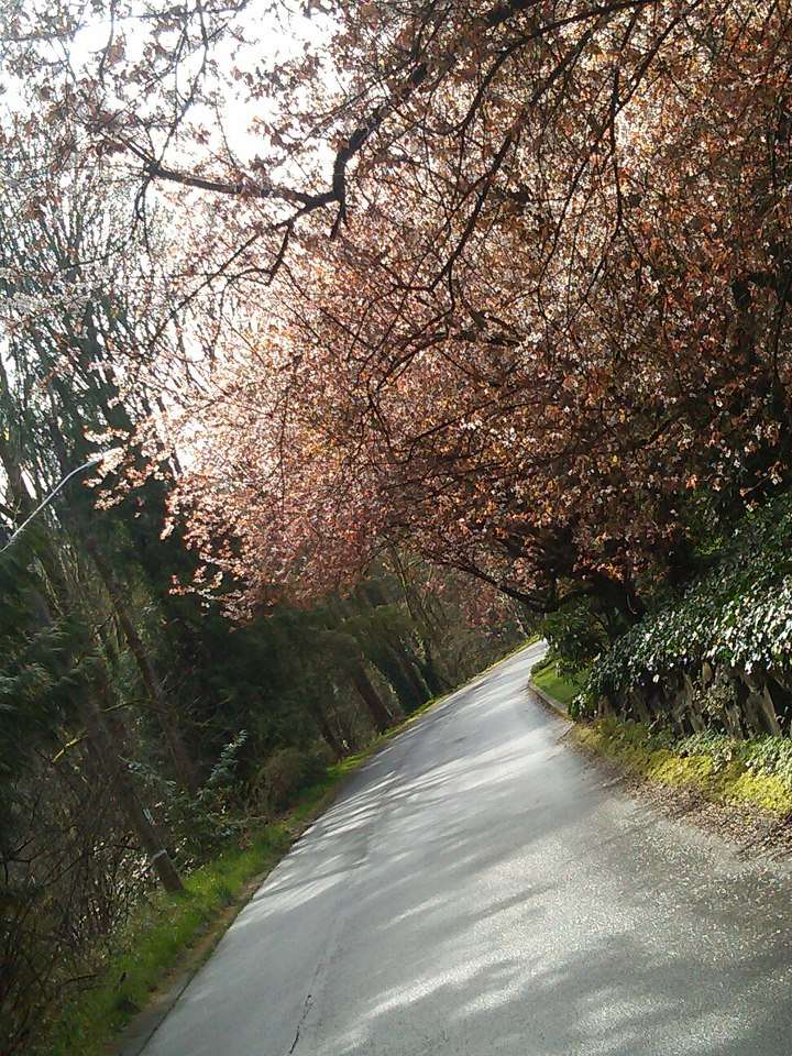
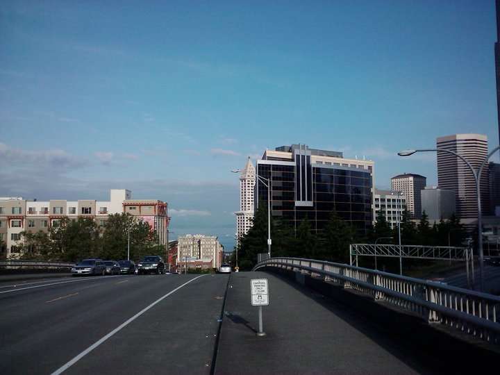
I like to leave about 5 minutes early for work so I can take a slight (half mile) detour around and up the backside of Capitol Hill through the quiet drive that winds through Interlaken Park. This shot was during cherry blossom season. The hill is pretty steep here!
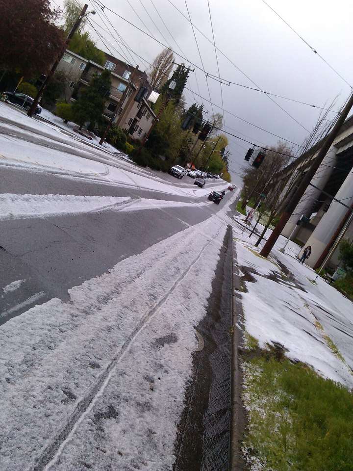
This is actually a rare day of hail. Luckily I wasn't out when the hail came down, I left for work at my regular time few minutes after it pounded my neighborhood. This was nearly a half an hour later as I began my climb up the north side of Capitol Hill. The hail was actually more than an inch thick where the cars hadn't cleared it away (where I had to ride most of the time).

I don't often take the route through downtown anymore, and when I do, usually don't go through this block any more, but I like this shot.
More in a minute.
Okay, I'll play! I feel very lucky with my commute. Although it is dark for half of the year, and often at least misty or very lightly raining, and the roadways are frequently wet, I often have beautiful views. Although it is very hilly and the terrain is further broken up by water, it makes for some options as far as routes go, and makes things interesting. In addition to the four regular routes I take in to work three nights a week, and school five days a week, I also have three regular routes I take home. In addition to these, on my way home I have an additional option, but due to time constraints I can only take it one or two days a week. This route leads along the waterfront, past piers where warships and cruise ships are tied up, then through the Ballmer railyard where there are sometimes interesting railcars, cargos, or grafitti. After that the trail goes over an old drawbridge and sometimes I'll hit the half mile of singletrack behind the zoo or I can cross the Ship Canal via the locks instead of the drawbridge and probably see some interesting wildlife.
On the ride in to work:
I like to leave about 5 minutes early for work so I can take a slight (half mile) detour around and up the backside of Capitol Hill through the quiet drive that winds through Interlaken Park. This shot was during cherry blossom season. The hill is pretty steep here!
This is actually a rare day of hail. Luckily I wasn't out when the hail came down, I left for work at my regular time few minutes after it pounded my neighborhood. This was nearly a half an hour later as I began my climb up the north side of Capitol Hill. The hail was actually more than an inch thick where the cars hadn't cleared it away (where I had to ride most of the time).
I don't often take the route through downtown anymore, and when I do, usually don't go through this block any more, but I like this shot.
More in a minute.
Last edited by Medic Zero; 10-17-13 at 10:10 PM.
10-17-13, 09:04 PM
#85
Senior Member
Join Date: Apr 2011
Location: Vancouver,Washington
Posts: 2,280
Bikes: Old steel GT's, for touring and commuting
Mentioned: 0 Post(s)
Tagged: 0 Thread(s)
Quoted: 39 Post(s)
Likes: 0
Liked 1 Time
in
1 Post
.
The rides home from work offer much more picture taking opportunities!
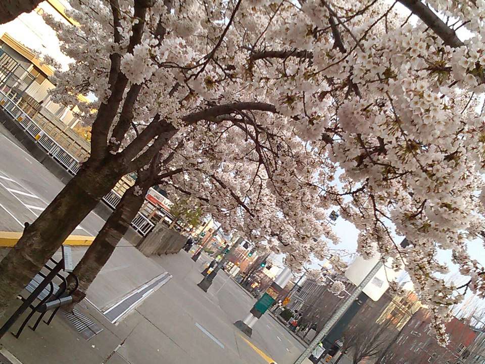
Along Alaskan Way just before getting onto the trail along the waterfront, during cherry blossom season.
Just before where the above picture was taken there is a conference center with a skybridge and an observation deck a few levels above the waterfront. I can roll my bike right into the elevator at street level (I don't even dismount) and take the lift up to the observation deck. I've done this after midnight and early on holidays and Sunday mornings. The only time I've been blocked, the elevator was still running but they locked the gate right outside it, closing off access while a cruise ship was loading. It was kind of surprising to me, because the sign said it was for security reasons, but I've taken pictures from here right down onto the decks of visiting Canadian warships, so I found it a little odd.
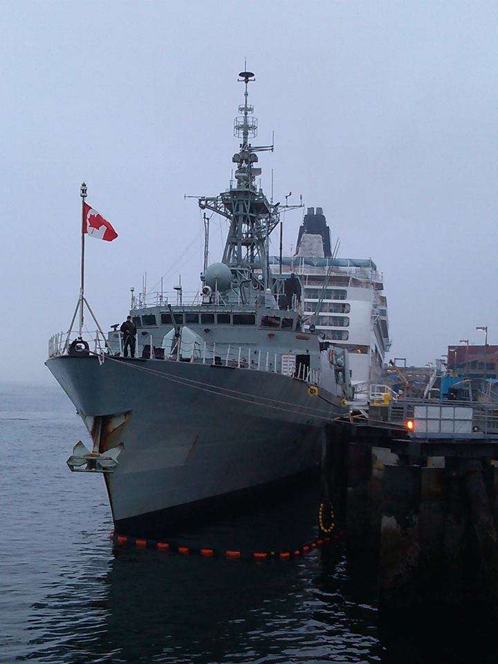
This one is from the day I found the observation deck locked, but I still took a few pics of another visiting Canadian warship (with the cruise ship behind it) from the next pier over.
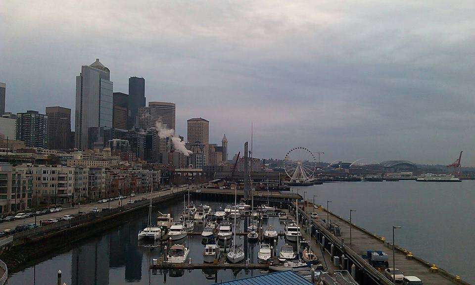
Another from the same pier, this time on a day when although it was 37 degrees out the outer end of the pier was iced over. Made for some delicate riding! The arches in the background are the stadiums, and the last skyscraper on the end there is Smith Tower, the tallest building on the west coast for some time.
The rides home from work offer much more picture taking opportunities!
Along Alaskan Way just before getting onto the trail along the waterfront, during cherry blossom season.
Just before where the above picture was taken there is a conference center with a skybridge and an observation deck a few levels above the waterfront. I can roll my bike right into the elevator at street level (I don't even dismount) and take the lift up to the observation deck. I've done this after midnight and early on holidays and Sunday mornings. The only time I've been blocked, the elevator was still running but they locked the gate right outside it, closing off access while a cruise ship was loading. It was kind of surprising to me, because the sign said it was for security reasons, but I've taken pictures from here right down onto the decks of visiting Canadian warships, so I found it a little odd.
This one is from the day I found the observation deck locked, but I still took a few pics of another visiting Canadian warship (with the cruise ship behind it) from the next pier over.
Another from the same pier, this time on a day when although it was 37 degrees out the outer end of the pier was iced over. Made for some delicate riding! The arches in the background are the stadiums, and the last skyscraper on the end there is Smith Tower, the tallest building on the west coast for some time.
10-17-13, 09:27 PM
#86
Senior Member
Join Date: Apr 2011
Location: Vancouver,Washington
Posts: 2,280
Bikes: Old steel GT's, for touring and commuting
Mentioned: 0 Post(s)
Tagged: 0 Thread(s)
Quoted: 39 Post(s)
Likes: 0
Liked 1 Time
in
1 Post
.

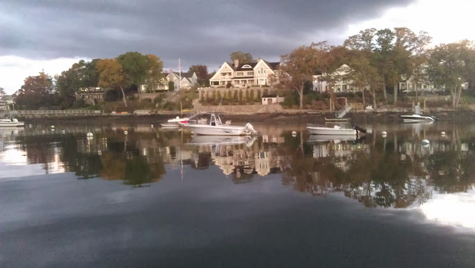
One more shot from along Alaskan Way. That's the Edgewater Hotel on the right, where the Beatles stayed. Quoting a friend of mine when I posted this photo elsewhere: "Frank Zappa also stayed there, among many other famous types. He wrote the song "Mud Shark Boogie" about fishing out the window there." That's the Olympic Mountains in the distance, my phone's camera doesn't do them justice.
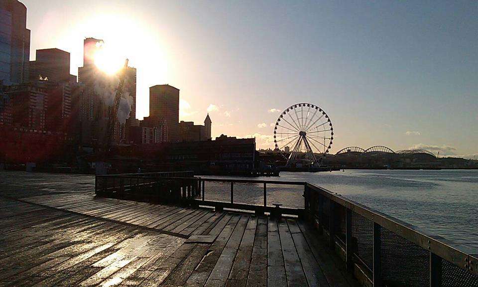
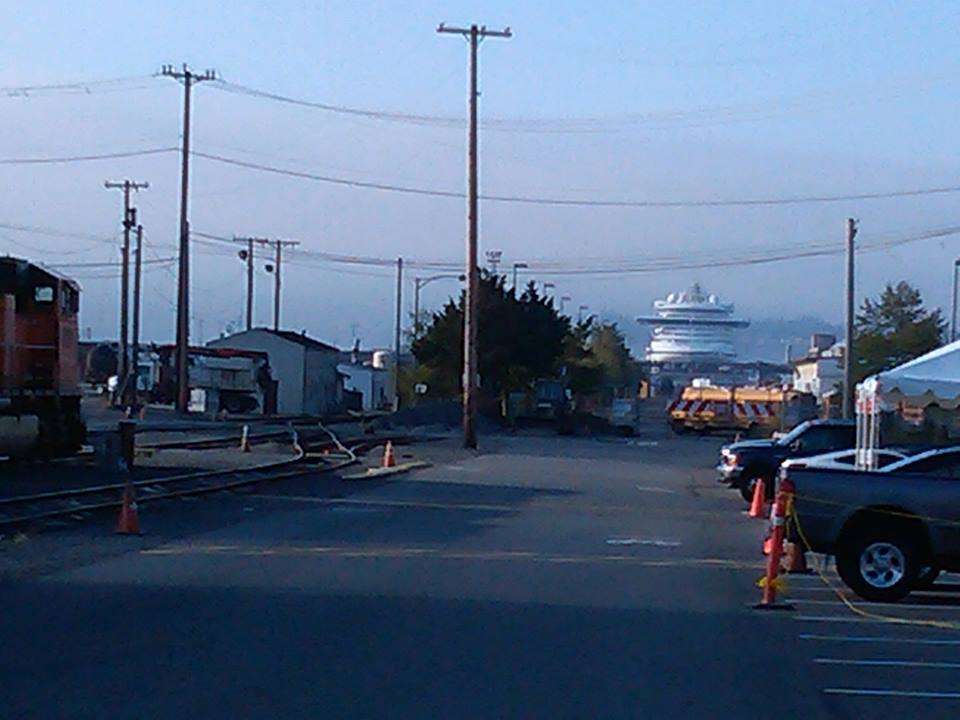
From here the trail goes through a nice park along the waterfront which has separate paths for pedestrians/joggers and cyclists, that most of the time the peds respect. After passing the grain terminal where tanker ships are filled with wheat from eastern Washington, the trail runs past another pier that sometimes has cruise ships docked at it and then through the Ballmer Rail Yard.
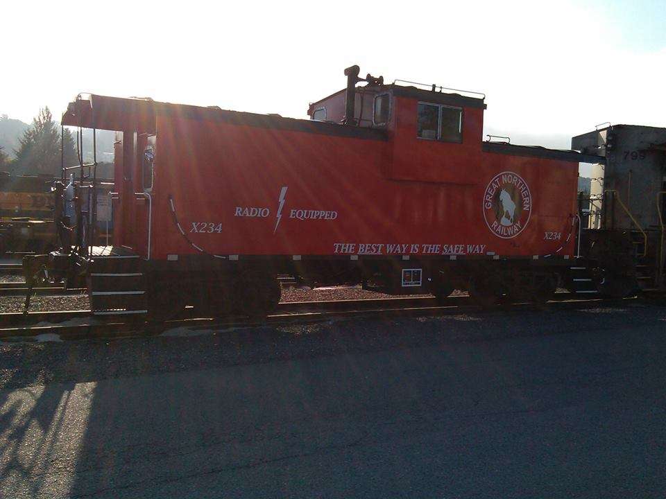
The rail yard often has interesting cargos, grafitti, or railcars. Recently it looked like they were setting up for some sort of family open house type day as I rode past early on a Sunday morning after working one of my overnight shifts. I've never seen a caboose out there before, they had this staged right across from where they were setting up some pavillions.
Much more common views of the rail yard.
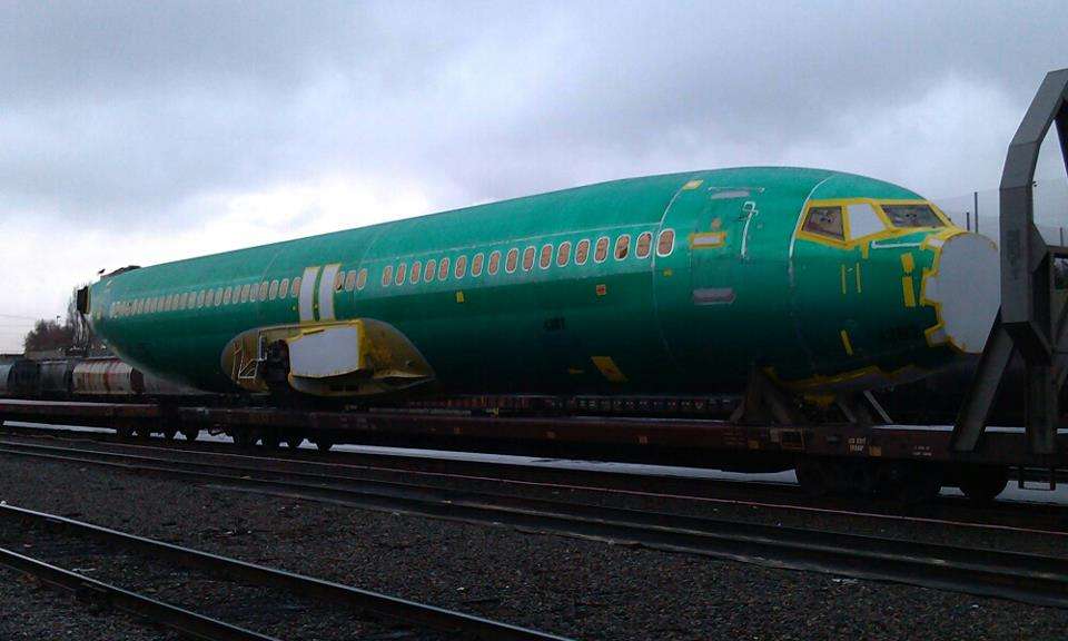
This picture was actually taken from right next to the caboose above. Kind of shows how huge cruise ships are, as that vessel is a full mile and a quarter away!
One more shot from along Alaskan Way. That's the Edgewater Hotel on the right, where the Beatles stayed. Quoting a friend of mine when I posted this photo elsewhere: "Frank Zappa also stayed there, among many other famous types. He wrote the song "Mud Shark Boogie" about fishing out the window there." That's the Olympic Mountains in the distance, my phone's camera doesn't do them justice.
From here the trail goes through a nice park along the waterfront which has separate paths for pedestrians/joggers and cyclists, that most of the time the peds respect. After passing the grain terminal where tanker ships are filled with wheat from eastern Washington, the trail runs past another pier that sometimes has cruise ships docked at it and then through the Ballmer Rail Yard.
The rail yard often has interesting cargos, grafitti, or railcars. Recently it looked like they were setting up for some sort of family open house type day as I rode past early on a Sunday morning after working one of my overnight shifts. I've never seen a caboose out there before, they had this staged right across from where they were setting up some pavillions.
Much more common views of the rail yard.
This picture was actually taken from right next to the caboose above. Kind of shows how huge cruise ships are, as that vessel is a full mile and a quarter away!
10-17-13, 09:40 PM
#87
Senior Member
Join Date: Apr 2011
Location: Vancouver,Washington
Posts: 2,280
Bikes: Old steel GT's, for touring and commuting
Mentioned: 0 Post(s)
Tagged: 0 Thread(s)
Quoted: 39 Post(s)
Likes: 0
Liked 1 Time
in
1 Post
.
From there I have a few choices of how to cross the Ship Canal. The 15th Avenue bridge has very narrow walkways on it with very low walls between you and the traffic on one side and the long drop on the other. Passing another cyclist or pedestrian going the other direction is nearly impossible and riding on it even without any others on the bridge feels like tempting fate, so I never take it. I wonder if any cyclist has tired it more than once. Google suggests another route through the Interbay neighborhood and along the northwestern edge of Queen Anne hill, but I've never taken that route. The roads don't appear great for cycling and it looks uninteresting.
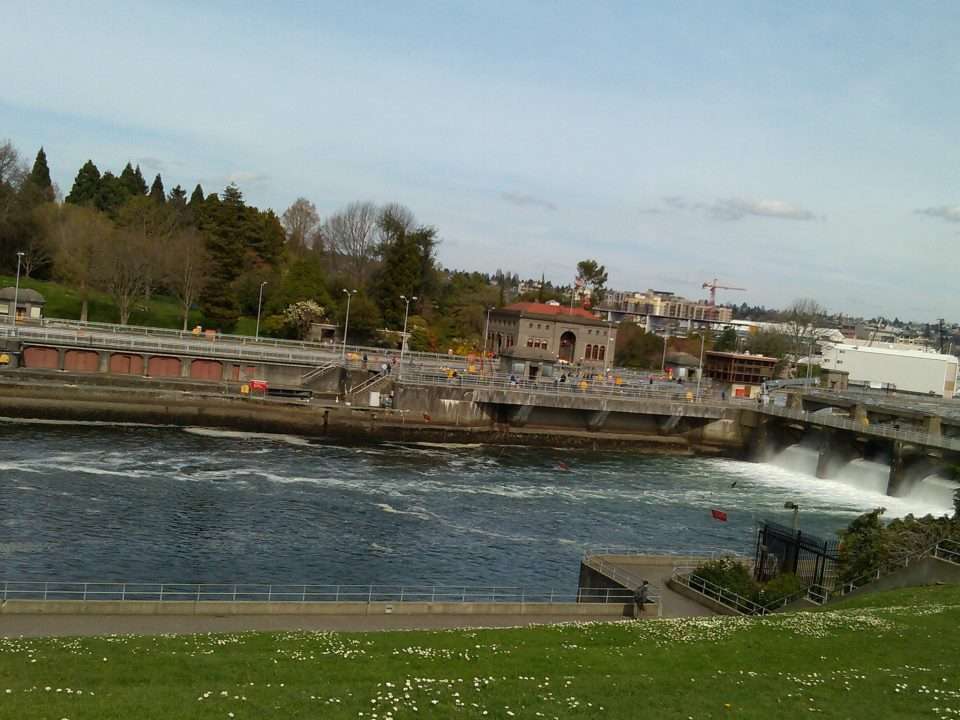
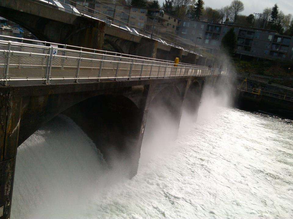
On the other hand, the trail through the rail yard leads to another trail alongside the Ship Canal. Or you can choose to cross at the Ballard (Hiram M. Chittenden, properly) Locks. I sometimes go this way, even though you have to dismount to traverse the park and the bridge-like passage over the tops of the locks themselves. Sometimes it is mobbed with tourists and difficult to get through the narrow passages with your bike, but most of the time I'm passing through there about 8:30 in the morning so that isn't a problem. On the upside, not only do I have an excuse to get out of the saddle for a few minutes, which is sometimes nice, I often sea Blue Herons, harbor seals, and a variety of other wildlife. If you want, the fish ladder has a huge clear viewing wall and you can see big salmon returning upstream through the locks.
A very rare shot without anyone else on the walkway!
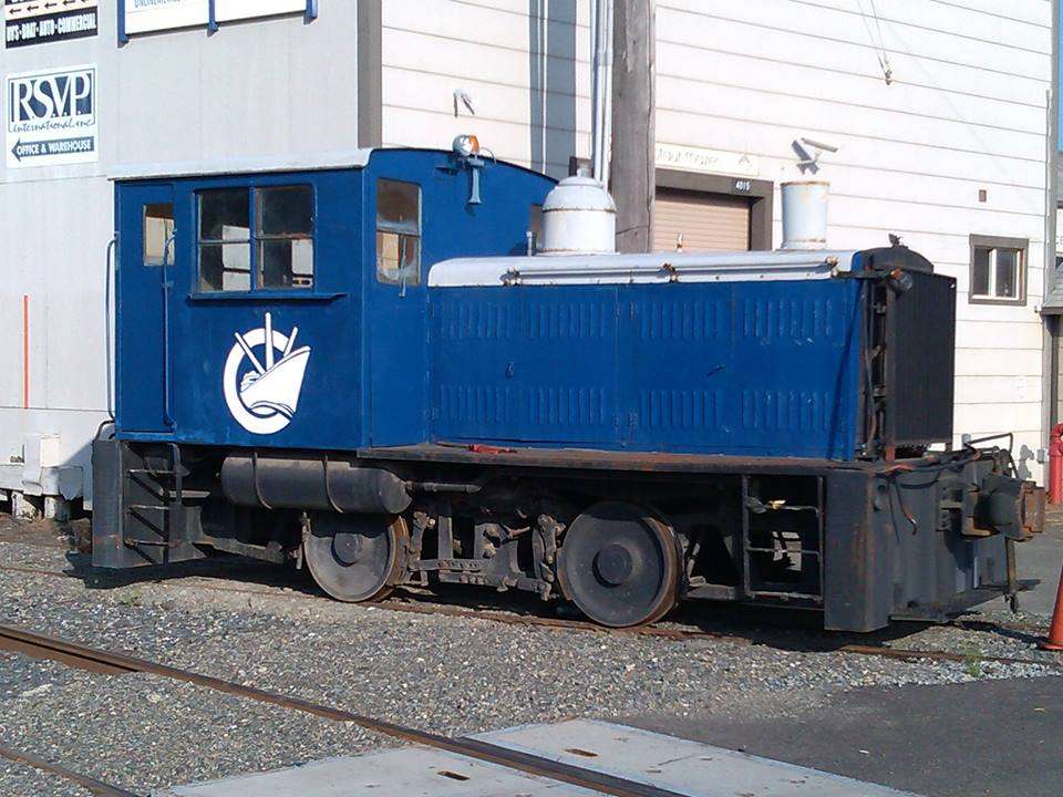
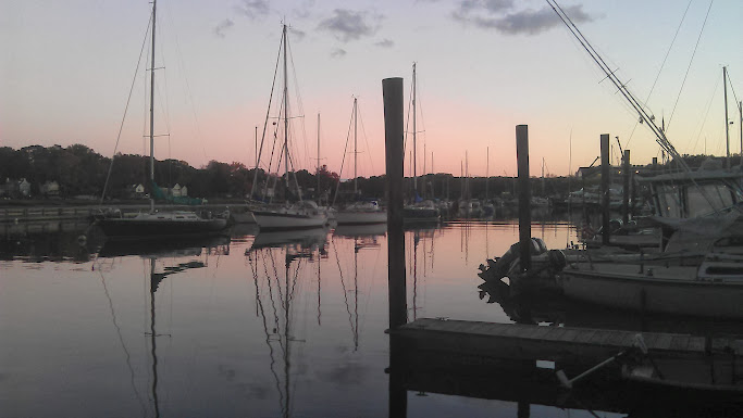
Although the locks are really nice, I usually I choose to follow the trail from the railyard to the trail alongside the Ship Canal. Part of the time this is park-like and part of the time it is alongside ship yards. The dominate local tugboat company has its main drydocks and shops here, and even has its own small rail tug for the spur:
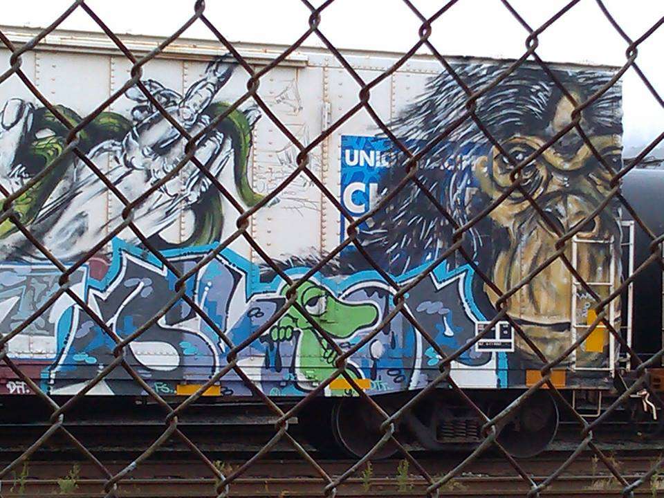
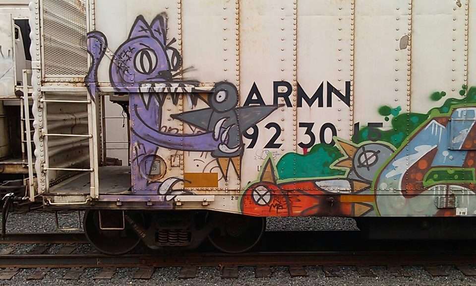
Some of the railcars on the sidings here serve either serve as canvasses for local talent, or end up delivering works from far away.
From there I have a few choices of how to cross the Ship Canal. The 15th Avenue bridge has very narrow walkways on it with very low walls between you and the traffic on one side and the long drop on the other. Passing another cyclist or pedestrian going the other direction is nearly impossible and riding on it even without any others on the bridge feels like tempting fate, so I never take it. I wonder if any cyclist has tired it more than once. Google suggests another route through the Interbay neighborhood and along the northwestern edge of Queen Anne hill, but I've never taken that route. The roads don't appear great for cycling and it looks uninteresting.
On the other hand, the trail through the rail yard leads to another trail alongside the Ship Canal. Or you can choose to cross at the Ballard (Hiram M. Chittenden, properly) Locks. I sometimes go this way, even though you have to dismount to traverse the park and the bridge-like passage over the tops of the locks themselves. Sometimes it is mobbed with tourists and difficult to get through the narrow passages with your bike, but most of the time I'm passing through there about 8:30 in the morning so that isn't a problem. On the upside, not only do I have an excuse to get out of the saddle for a few minutes, which is sometimes nice, I often sea Blue Herons, harbor seals, and a variety of other wildlife. If you want, the fish ladder has a huge clear viewing wall and you can see big salmon returning upstream through the locks.
A very rare shot without anyone else on the walkway!
Although the locks are really nice, I usually I choose to follow the trail from the railyard to the trail alongside the Ship Canal. Part of the time this is park-like and part of the time it is alongside ship yards. The dominate local tugboat company has its main drydocks and shops here, and even has its own small rail tug for the spur:
Some of the railcars on the sidings here serve either serve as canvasses for local talent, or end up delivering works from far away.
Last edited by Medic Zero; 10-21-13 at 02:26 PM.
10-17-13, 09:52 PM
#88
Senior Member
Join Date: Apr 2011
Location: Vancouver,Washington
Posts: 2,280
Bikes: Old steel GT's, for touring and commuting
Mentioned: 0 Post(s)
Tagged: 0 Thread(s)
Quoted: 39 Post(s)
Likes: 0
Liked 1 Time
in
1 Post
.
From there I cross over the Fremont Bridge, completed in 1917 along with much along the Ship Canal. Of course, being a drawbridge, it is ocassionally open for taller vessels to pass.
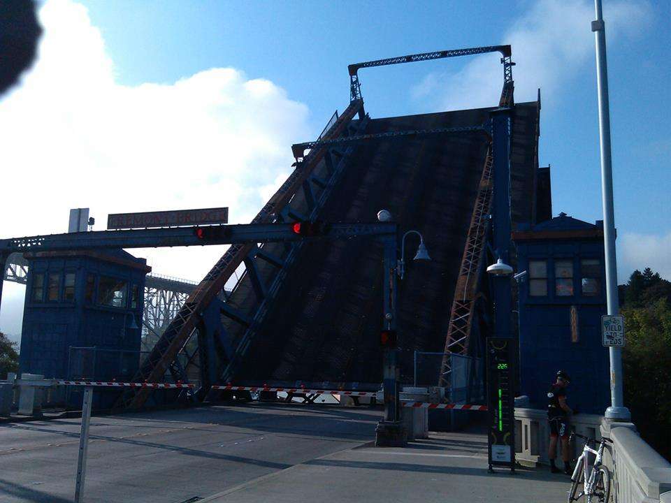
That green "225" on the right there is a bicycle counter the city installed. Nearly a million bicycles passed over this bridge in the past year. Usually when I see it in the late afternoon the counter reads around 2,000.
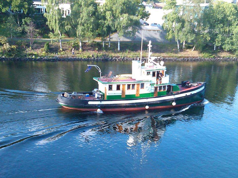
Sometimes what forced the bridge to open is interesting, like this nicely restored tugboat that is no longer a working boat.
A couple of shots from routes I don't normally take:
This one is from the northern shore of Lake Union last December.
And this last is from dropping down Yesler Street from First Hill towards downtown.
From there I cross over the Fremont Bridge, completed in 1917 along with much along the Ship Canal. Of course, being a drawbridge, it is ocassionally open for taller vessels to pass.
That green "225" on the right there is a bicycle counter the city installed. Nearly a million bicycles passed over this bridge in the past year. Usually when I see it in the late afternoon the counter reads around 2,000.
Sometimes what forced the bridge to open is interesting, like this nicely restored tugboat that is no longer a working boat.
A couple of shots from routes I don't normally take:
This one is from the northern shore of Lake Union last December.
And this last is from dropping down Yesler Street from First Hill towards downtown.
Last edited by Medic Zero; 10-21-13 at 02:25 PM.
10-18-13, 12:21 AM
#89
Member

Join Date: Oct 2013
Location: Ormoc City, Philippines
Posts: 25
Bikes: 2012 Giant ATX Pro Hybrid Mountain Bike; 2012 Jamis Xenith T Time Trial Bike
Mentioned: 0 Post(s)
Tagged: 0 Thread(s)
Quoted: 0 Post(s)
Likes: 0
Liked 0 Times
in
0 Posts
My home is just four kilometers from my office so its to ride to and from work. But having started biking less than two months ago, it takes me about 20 minutes navigate the downhill and uphill routes to my office. Here's the satellite image of my daily commute. My home is the house near "1". My office is in the building near "9".

Here's my bike in front of my home. My home, "1" in the map, is located 1228 feet above sea level:

Almost immediately after leaving home, the road starts to ascend. Here's the pic towards the guardhouse at "2" which is 1362 feet ASL.

From the guardhouse at "2", the road starts to descend. Here's the pic at the bend at "3" which is 1355 feet ASL.

And further downhill at another bend at "4" which is 1106 feet ASL

Until it reaches the lowest portion of the route at "5" which is a spillway located 1029 feet ASL

After the spillway, the road starts to ascend. Here's the pic at a bend at "6" which is 1196 feet ASL

And another bend farther uphill at "7" which is 1259 feet ASL

And another bend towards the complex where I work at "8" which is 1341 feet ASL

Until I reach the entry gate at "9" which is 1361 feet ASL.

This route may be easy to the experienced bikers here but being a noob to this hobby, its 20 minutes exercise.
Here's my bike in front of my home. My home, "1" in the map, is located 1228 feet above sea level:
Almost immediately after leaving home, the road starts to ascend. Here's the pic towards the guardhouse at "2" which is 1362 feet ASL.
From the guardhouse at "2", the road starts to descend. Here's the pic at the bend at "3" which is 1355 feet ASL.
And further downhill at another bend at "4" which is 1106 feet ASL
Until it reaches the lowest portion of the route at "5" which is a spillway located 1029 feet ASL
After the spillway, the road starts to ascend. Here's the pic at a bend at "6" which is 1196 feet ASL
And another bend farther uphill at "7" which is 1259 feet ASL
And another bend towards the complex where I work at "8" which is 1341 feet ASL
Until I reach the entry gate at "9" which is 1361 feet ASL.
This route may be easy to the experienced bikers here but being a noob to this hobby, its 20 minutes exercise.
10-18-13, 09:04 AM
#90
Senior Member
Join Date: Apr 2012
Location: Memphis TN area
Posts: 7,391
Bikes: 2011 Felt Z85 (road/commuter), 2006 Marin Pine Mountain (utility/commuter E-bike), 1995 KHS Alite 1000 (gravel grinder)
Mentioned: 25 Post(s)
Tagged: 0 Thread(s)
Quoted: 676 Post(s)
Likes: 0
Liked 13 Times
in
13 Posts
Looks steamy there.
Awesome pics of Seattle. Visited there myself in late 2006, looks like it has changed a bit along the waterfront.
Awesome pics of Seattle. Visited there myself in late 2006, looks like it has changed a bit along the waterfront.
10-18-13, 09:13 AM
#91
The Recumbent Quant

My GPS is broken, so I no longer know how fast I'm going or what time it is. So I decided to stop and take lots of pictures this morning:


Original album (including video) here.
Original album (including video) here.
10-21-13, 10:20 AM
#92
Senior Member
OK, well my photo is going to be pretty pitiful against the other beauties here but nevertheless.
This photo was taken from the SW Bypass to the south of Sudbury looking approximately north from about here. The INCO Superstack in the distance is 380m (1250ft) in height and 7.7km (4.8mi) away.

This photo was taken from the SW Bypass to the south of Sudbury looking approximately north from about here. The INCO Superstack in the distance is 380m (1250ft) in height and 7.7km (4.8mi) away.
10-21-13, 10:26 AM
#93
Senior Member
Join Date: Apr 2012
Location: Memphis TN area
Posts: 7,391
Bikes: 2011 Felt Z85 (road/commuter), 2006 Marin Pine Mountain (utility/commuter E-bike), 1995 KHS Alite 1000 (gravel grinder)
Mentioned: 25 Post(s)
Tagged: 0 Thread(s)
Quoted: 676 Post(s)
Likes: 0
Liked 13 Times
in
13 Posts
^^^ Wow, I could only wish for shoulders like that on the 2-lane roads I ride to and from work.
10-21-13, 03:33 PM
#94
Senior Member
 10-22-13, 03:57 AM
#95
Senior Member
Join Date: Apr 2011
Location: Vancouver,Washington
Posts: 2,280
Bikes: Old steel GT's, for touring and commuting
Mentioned: 0 Post(s)
Tagged: 0 Thread(s)
Quoted: 39 Post(s)
Likes: 0
Liked 1 Time
in
1 Post
Yes, a new stadium, the ferris wheel, the Olympic Sculpture Park are all fairly new. If everything goes well, a tunnel will be replacing the waterfront freeway (Viaduct/highway 99) soon as well, leading to a bunch more changes along the waterfront.
10-22-13, 05:47 AM
#96
Senior Member

Well, I guess the most important, my 20 minute car drive to work, I could take public transportation to. I guess that is if I wanted to drive 45 minutes to public transportation and then travel by that back the way I came to get to work....
10-22-13, 09:31 AM
#97
Senior Member
Join Date: Apr 2012
Location: Memphis TN area
Posts: 7,391
Bikes: 2011 Felt Z85 (road/commuter), 2006 Marin Pine Mountain (utility/commuter E-bike), 1995 KHS Alite 1000 (gravel grinder)
Mentioned: 25 Post(s)
Tagged: 0 Thread(s)
Quoted: 676 Post(s)
Likes: 0
Liked 13 Times
in
13 Posts
Thanks! My phone's camera isn't half-bad and like I said, I feel lucky to live in such a beautiful and interesting place.
Yes, a new stadium, the ferris wheel, the Olympic Sculpture Park are all fairly new. If everything goes well, a tunnel will be replacing the waterfront freeway (Viaduct/highway 99) soon as well, leading to a bunch more changes along the waterfront.
Yes, a new stadium, the ferris wheel, the Olympic Sculpture Park are all fairly new. If everything goes well, a tunnel will be replacing the waterfront freeway (Viaduct/highway 99) soon as well, leading to a bunch more changes along the waterfront.
Also I've heard that a lot of folks don't like it, but I personally LOVE the main library building there downtown.
10-22-13, 10:33 AM
#98
Senior Member
Join Date: Oct 2013
Location: Highlands Ranch, CO
Posts: 1,221
Bikes: '13 Diamondback Hybrid Commuter, '17 Spec Roubaix Di2, '17 Spec Camber 29'er, '19 CDale Topstone Gravel
Mentioned: 5 Post(s)
Tagged: 0 Thread(s)
Quoted: 590 Post(s)
Liked 445 Times
in
260 Posts
BTW: I have a great 10 mile rural/wooded commute, but it's kind of devoid of anything interesting. It would be great to soak in the landmarks you get to see daily.
 10-22-13, 12:09 PM
#100
Senior Member

Join Date: Jan 2009
Location: Colorado Springs, CO
Posts: 5,974
Bikes: 2015 Charge Plug, 2007 Dahon Boardwalk, 1997 Nishiki Blazer, 1984 Nishiki International, 2006 Felt F65, 1989 Dahon Getaway V
Mentioned: 54 Post(s)
Tagged: 0 Thread(s)
Quoted: 1364 Post(s)
Liked 1,677 Times
in
827 Posts
I recognize it as vandalism!
So you wouldn't mind if other "professional urban artists" defaced your home, vehicle, bicycle or place of business without your permission? And what about bicycle theft? "professional urban vehicle procurement specialists?"
My son is a freshman at a top art school in the US and is an aspiring "Professional Urban Artist", so thank you for recognizing graffiti of that sort as talent.
BTW: I have a great 10 mile rural/wooded commute, but it's kind of devoid of anything interesting. It would be great to soak in the landmarks you get to see daily.
BTW: I have a great 10 mile rural/wooded commute, but it's kind of devoid of anything interesting. It would be great to soak in the landmarks you get to see daily.