


Bike route from Newport Beach to Corna Del Mar
 07-08-09, 02:28 PM
#1
Junior Member
Thread Starter
Join Date: May 2009
Location: Southern California
Posts: 23
Mentioned: 0 Post(s)
Tagged: 0 Thread(s)
Quoted: 0 Post(s)
Likes: 0
Liked 0 Times
in
0 Posts
Bike route from Newport Beach to Corna Del Mar
I live in the Inland Empire. We like to bike from Green River to Huntington Beach by way of the river trail and then up the beach front side of PCH to the pier at Huntington Beach. This past weekend we went south down to Corona Del Mar. PCH was pretty busy with the traffic moving relitively fast. The road has Bike lane signage but in many places no striping on the road. I was wondering if there was another less vehicular traffic route that might be available from Newport Beach to Corna Del Mar.
 07-08-09, 02:41 PM
#2
Senior Member
Join Date: Dec 2005
Location: Oceanside, CA
Posts: 298
Bikes: 2006 Specialized Roubaix, Windsor Clockwork Orange
Mentioned: 0 Post(s)
Tagged: 0 Thread(s)
Quoted: 0 Post(s)
Likes: 0
Liked 0 Times
in
0 Posts
I live in HB and do this all the time.
From the River Trail, get on to PCH and go south.
You can stay on PCH through Newport. It's a little tight for a mile or so past the 55 Freeway but it's not too bad.
Once you cross over Back Bay you can turn right onto a street called BaySide Dr. Stay on Bayside Dr. until Margureite. From there you can either go left and back on to PCH or right down to Ocean Blvd and enjoy the views from the bluff above the ocean.
If you are up for a hill climb, back before you get to Marguerite on Bayside, turn right on a street called Fernleaf. It is a very short but very steep climb. Just stay on it and you will get onto Ocean Blvd.
Hope that helps.
07-08-09, 05:16 PM
#3
Despite all my rage, I am
Join Date: Jan 2007
Location: Los Angeles, CA
Posts: 2,613
Bikes: LeMond Zurich, Colnago C-50
Mentioned: 0 Post(s)
Tagged: 0 Thread(s)
Quoted: 0 Post(s)
Likes: 0
Liked 0 Times
in
0 Posts
I live in HB and do this all the time.
From the River Trail, get on to PCH and go south.
You can stay on PCH through Newport. It's a little tight for a mile or so past the 55 Freeway but it's not too bad.
Once you cross over Back Bay you can turn right onto a street called BaySide Dr. Stay on Bayside Dr. until Margureite. From there you can either go left and back on to PCH or right down to Ocean Blvd and enjoy the views from the bluff above the ocean.
If you are up for a hill climb, back before you get to Marguerite on Bayside, turn right on a street called Fernleaf. It is a very short but very steep climb. Just stay on it and you will get onto Ocean Blvd.
Hope that helps.
By the time the 55 fwy gets to PCH, it's called "Newport Blvd."
PCH South to Bayside - turn right.
After a bend in the road, Fernleaf will be the short, steep hill on your right. Take that.
At the stop sign, go straight. This road ends at Ocean. Turn Left.
*enjoy the views*
Turn left at the end of the road (Marguerite). Turn right at PCH. (At Five Crowns)
07-08-09, 09:11 PM
#4
Senior Member
Join Date: Aug 2007
Location: Belmont Shore (Long Beach), CA
Posts: 508
Bikes: Scattante R-560 w/ Velocity Deep V rims
Mentioned: 0 Post(s)
Tagged: 0 Thread(s)
Quoted: 0 Post(s)
Likes: 0
Liked 0 Times
in
0 Posts
i'm not bothered by the traffic on pch, but take this route through cdm (corona del mar) all the time because it's much more enjoyable. The full directions are-
by the time the 55 fwy gets to pch, it's called "newport blvd."
pch south to bayside - turn right.
After a bend in the road, fernleaf will be the short, steep hill on your right. Take that.
At the stop sign, go straight. This road ends at ocean. Turn left.
*enjoy the views*
turn left at the end of the road (marguerite). Turn right at pch. (at five crowns)
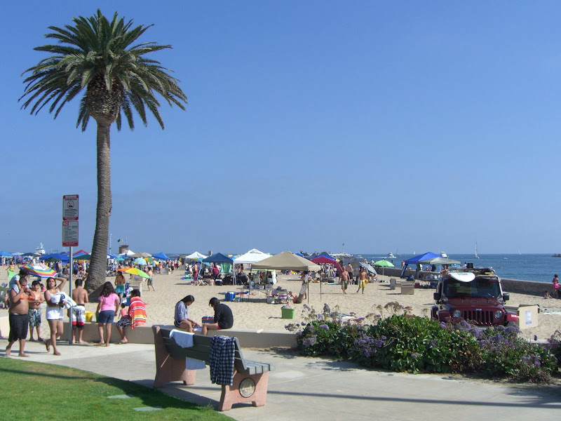
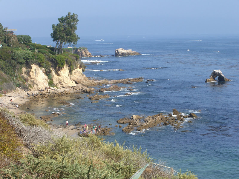
Edit: Pics of said scenery:
Last edited by rallison; 07-08-09 at 09:14 PM.
07-16-09, 08:55 AM
#6
Senior Member

Join Date: Oct 2004
Location: Huntington Beach, CA
Posts: 7,085
Bikes: Cervelo Prodigy
Mentioned: 4 Post(s)
Tagged: 0 Thread(s)
Quoted: 478 Post(s)
Likes: 0
Liked 87 Times
in
67 Posts
After you arrive at Corona del Mar, you might want to venture further south to Dana Point. The particular tight areas are going to be Laguna Beach. It's as tight or even tighter than Corona del Mar. Go real early in the summer mornings, trying to return to SARTand PCH by 10 am.
