


Steepest Mile of Climbing SoCal
 01-29-11, 05:22 PM
#1
Climbing...
Thread Starter
Join Date: Nov 2006
Location: Santa Monica
Posts: 547
Bikes: SuperSix Evo, R3, F29
Mentioned: 0 Post(s)
Tagged: 0 Thread(s)
Quoted: 0 Post(s)
Likes: 0
Liked 0 Times
in
0 Posts
Steepest Mile of Climbing SoCal
I think I stumbled upon the steepest mile of climbing in Southern California. I was riding up Yerba Buena when a little after two miles I saw a very steep road on the right called "Yellowhill Road". I decided to give it a try. Wow, what a surprise! Immediately hit a 15-17% grade which just kept on going and going! I kept wondering when the road would stop, but it didn't! My garmin read 20-22% on a few occasions. Grade didn't let up until the top. The road ended up being 1.06 miles with 830' of gain, for an average gradient of 14.8%. I don't think I know of any mile sections in SoCal that gain this much elevation.
Proof - look at split #9:
https://connect.garmin.com/splits/65716325
Yellowhill on Google Maps:
https://maps.google.com/maps?q=yellow...N&hl=en&tab=wl
EDIT:
According to "The Complete Guide to Climbing (By Bike) in California", the steepest mile of climbing in the state is Mix Canyon miles 2.8-3.8(15.8%). The second steepest is Old Priest Grade miles 0.3-1.3 (15.0%). This qualifies as the third steepest mile of climbing in the state of California.
Last edited by Ben FR; 01-29-11 at 05:42 PM.
 01-29-11, 06:57 PM
#2
Senior Member
Join Date: Aug 2007
Location: Belmont Shore (Long Beach), CA
Posts: 508
Bikes: Scattante R-560 w/ Velocity Deep V rims
Mentioned: 0 Post(s)
Tagged: 0 Thread(s)
Quoted: 0 Post(s)
Likes: 0
Liked 0 Times
in
0 Posts
Seeing that title and Mr. Ben FR as the author, I knew this was going to be good. Is this one of those technically private Malibu roads? This road is on my to-do list.
01-29-11, 07:07 PM
#3
Climbing...
Thread Starter
Join Date: Nov 2006
Location: Santa Monica
Posts: 547
Bikes: SuperSix Evo, R3, F29
Mentioned: 0 Post(s)
Tagged: 0 Thread(s)
Quoted: 0 Post(s)
Likes: 0
Liked 0 Times
in
0 Posts
There is a sign that says private road, but it's not really private. There are ranches open to the public at the top of the climb that accept visitors. Furthermore, saw several residents on my way up who couldn't care less that I was there. The road was very well maintained.
01-29-11, 07:16 PM
#4
Senior Member
Join Date: Aug 2007
Location: Belmont Shore (Long Beach), CA
Posts: 508
Bikes: Scattante R-560 w/ Velocity Deep V rims
Mentioned: 0 Post(s)
Tagged: 0 Thread(s)
Quoted: 0 Post(s)
Likes: 0
Liked 0 Times
in
0 Posts
Nice. I figured it was one of those "private" roads that is effectively not private. Good to hear.
01-29-11, 07:18 PM
#5
Climbing...
Thread Starter
Join Date: Nov 2006
Location: Santa Monica
Posts: 547
Bikes: SuperSix Evo, R3, F29
Mentioned: 0 Post(s)
Tagged: 0 Thread(s)
Quoted: 0 Post(s)
Likes: 0
Liked 0 Times
in
0 Posts
I'm looking forward to seeing YOUR write-up of this road and Noranda Lane on your blog!
01-29-11, 09:30 PM
#7
Senior Member
Join Date: Aug 2007
Location: Belmont Shore (Long Beach), CA
Posts: 508
Bikes: Scattante R-560 w/ Velocity Deep V rims
Mentioned: 0 Post(s)
Tagged: 0 Thread(s)
Quoted: 0 Post(s)
Likes: 0
Liked 0 Times
in
0 Posts
Alright, when I do make it out to Malibu again for some riding, I promise a blog entry in advance. Up Deer Creek, down Yerba Buena, up Yellow Hill, up Decker, up Decker Edison, down Encinal and up Noranda would make for a pretty epic day of steep climbing.
01-30-11, 12:29 AM
#8
aka Jerome

Join Date: Dec 2007
Location: Colorado Again
Posts: 1,080
Bikes: Yes
Mentioned: 0 Post(s)
Tagged: 0 Thread(s)
Quoted: 1 Post(s)
Likes: 0
Liked 0 Times
in
0 Posts
 01-30-11, 09:49 AM
#9
Climbing...
Thread Starter
Join Date: Nov 2006
Location: Santa Monica
Posts: 547
Bikes: SuperSix Evo, R3, F29
Mentioned: 0 Post(s)
Tagged: 0 Thread(s)
Quoted: 0 Post(s)
Likes: 0
Liked 0 Times
in
0 Posts
Noranda is a complete ball buster. It averages almost 20% for 0.38 of a mile. You are going to be suffering especially hard if you do it last.
06-03-12, 09:41 PM
#10
Senior Member
Join Date: Aug 2007
Location: Belmont Shore (Long Beach), CA
Posts: 508
Bikes: Scattante R-560 w/ Velocity Deep V rims
Mentioned: 0 Post(s)
Tagged: 0 Thread(s)
Quoted: 0 Post(s)
Likes: 0
Liked 0 Times
in
0 Posts
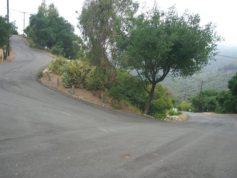
Well, I finally tried out Yellow Hill. Until today, the last time I seriously doubted my ability to climb a road was when climbing Mix Canyon up in Vacaville (still probably the toughest medium length climb I've ever done). Yellow Hill is, quite simply, brutal. If anything approaches Mix, Yellow Hill may very well be it.
Basically, it starts out very steep, then gets steeper, then gives you approximately 5 seconds of simply steep (looking at Strava, that brief respite looks to still be 7-8%, so yeah..), before kicking back up to ridiculous once again. Aside from those 5 seconds of respite after the first hard switchback, there is no break whatsoever until the top, 800 ft higher.
Also, Strava's segment from Ben's climb of this fun road pegs it at 15.1% for 1.0 miles which, if correct, would actually put it at second place for steepest paved mile in California. Regardless, if you want to suffer, Yellow Hill calls.
A few enticing photos:
06-03-12, 10:18 PM
#11
Senior Member
Join Date: Apr 2006
Location: Escondido, CA
Posts: 2,240
Mentioned: 0 Post(s)
Tagged: 0 Thread(s)
Quoted: 1 Post(s)
Likes: 0
Liked 0 Times
in
0 Posts
In San Diego County, Mt Woodson Road comes very close, though it does not quite get there. The steepest mile is 14.7%. Another fun-filled climb nearby is Camino Del Aguila, which averages 15.2% over the steep section, 0.8 miles long.
06-03-12, 10:34 PM
#13
Senior Member
Join Date: Aug 2011
Location: Fullerton
Posts: 370
Bikes: Baum Corretto - Felt F1
Mentioned: 0 Post(s)
Tagged: 0 Thread(s)
Quoted: 3 Post(s)
Likes: 0
Liked 0 Times
in
0 Posts
If I read that Garmin report right, you hit that monster pretty far into the ride (!) - that was a pretty epic ride overall. Are there any place to pick up water through those canyons?
06-04-12, 09:46 AM
#14
Junior Member
Join Date: Feb 2012
Posts: 8
Mentioned: 0 Post(s)
Tagged: 0 Thread(s)
Quoted: 0 Post(s)
Likes: 0
Liked 0 Times
in
0 Posts
Anyone know how Park Drive in Laguna Beach stacks up? I've never ridden it but drove up it a couple of times to attend softball games at that school near the top.
06-04-12, 10:34 AM
#15
Senior Member
Join Date: Aug 2007
Location: Belmont Shore (Long Beach), CA
Posts: 508
Bikes: Scattante R-560 w/ Velocity Deep V rims
Mentioned: 0 Post(s)
Tagged: 0 Thread(s)
Quoted: 0 Post(s)
Likes: 0
Liked 0 Times
in
0 Posts
06-04-12, 01:08 PM
#16
Senior Member
Join Date: Apr 2006
Location: Escondido, CA
Posts: 2,240
Mentioned: 0 Post(s)
Tagged: 0 Thread(s)
Quoted: 1 Post(s)
Likes: 0
Liked 0 Times
in
0 Posts
I spent some time exploring San Diego County in ridewithgps.com, and it looks like "The Complete Guide to Climbing (By Bike) in California" is correct. There are no paved roads in the county, public or otherwise, that average more than 15% for a mile.
Found an old post on BF by a guy who claimed that he lived in North County near an obscure, partly gated paved road that was "20% sustained with kicks up to about 25% for a mile". Must be an exaggeration, but it's still interesting to know what road he was talking about. The username has been inactive since 2006.
"Its a pretty obscure road without much traffic. The coolest part is that after the initial super steep part it continues to the top of the tallest (maybe 2nd tallest?) peak in N. County San Diego (excluding the inland Temecula valleys') The views are absolutely amazing, you can see from Mexico, the downtown skyline, etc all the way to Catalina on some days... Part of it is fenced off by a small gate (gotta do your best cyclo-impression haha), so its best to keep it very obscure, otherwise the small gate might turn into a big one when all of SoCal starts climbing it."
Could be Mt Woodson, but it does not quite fit.
Last edited by hamster; 06-04-12 at 02:27 PM.
06-04-12, 03:14 PM
#17
Senior Member
Join Date: Apr 2006
Location: Escondido, CA
Posts: 2,240
Mentioned: 0 Post(s)
Tagged: 0 Thread(s)
Quoted: 1 Post(s)
Likes: 0
Liked 0 Times
in
0 Posts
Top peaks in North County (west of Ramona and south of 76) are Mt Woodson (2896), Iron Mountain (2698), Starvation Mountain (2142), and a bunch of unnamed peaks in Valley Center area. With the exception of Mt Woodson, none of them have paved roads all the way to the top. The highest point west of the 15 seems to be "Mount Whitney" in San Marcos (1738) with a road to the top, and views should be quite good, but the road is not quite 20% sustained (the steepest part averages 13-14%).
06-04-12, 03:40 PM
#18
Climbing...
Thread Starter
Join Date: Nov 2006
Location: Santa Monica
Posts: 547
Bikes: SuperSix Evo, R3, F29
Mentioned: 0 Post(s)
Tagged: 0 Thread(s)
Quoted: 0 Post(s)
Likes: 0
Liked 0 Times
in
0 Posts
Ryan, I'm glad to see you finally hit Yellowhill! I think we may be the only two people that have ever climbed it. Looks like you got lucky-- they only recently repaved the road. When I climbed it, it was similar in (bad) quality to Yerba Buena and descending back to Yerba Buena was brutal. I swore I'd never climb it again based solely on the crappy descent. But now I'm kind of reinvigorated to try it again. Did you do try Noranda?
P.s. I've been checking out your blog on and off for the past year and have been very disappointed not to see an update. You should post this one!
P.s. I've been checking out your blog on and off for the past year and have been very disappointed not to see an update. You should post this one!
06-04-12, 04:42 PM
#20
Senior Member
I spent some time exploring San Diego County in ridewithgps.com, and it looks like "The Complete Guide to Climbing (By Bike) in California" is correct. There are no paved roads in the county, public or otherwise, that average more than 15% for a mile.
Found an old post on BF by a guy who claimed that he lived in North County near an obscure, partly gated paved road that was "20% sustained with kicks up to about 25% for a mile". Must be an exaggeration, but it's still interesting to know what road he was talking about. The username has been inactive since 2006.
"Its a pretty obscure road without much traffic. The coolest part is that after the initial super steep part it continues to the top of the tallest (maybe 2nd tallest?) peak in N. County San Diego (excluding the inland Temecula valleys') The views are absolutely amazing, you can see from Mexico, the downtown skyline, etc all the way to Catalina on some days... Part of it is fenced off by a small gate (gotta do your best cyclo-impression haha), so its best to keep it very obscure, otherwise the small gate might turn into a big one when all of SoCal starts climbing it."
Could be Mt Woodson, but it does not quite fit.
Found an old post on BF by a guy who claimed that he lived in North County near an obscure, partly gated paved road that was "20% sustained with kicks up to about 25% for a mile". Must be an exaggeration, but it's still interesting to know what road he was talking about. The username has been inactive since 2006.
"Its a pretty obscure road without much traffic. The coolest part is that after the initial super steep part it continues to the top of the tallest (maybe 2nd tallest?) peak in N. County San Diego (excluding the inland Temecula valleys') The views are absolutely amazing, you can see from Mexico, the downtown skyline, etc all the way to Catalina on some days... Part of it is fenced off by a small gate (gotta do your best cyclo-impression haha), so its best to keep it very obscure, otherwise the small gate might turn into a big one when all of SoCal starts climbing it."
Could be Mt Woodson, but it does not quite fit.
06-04-12, 04:44 PM
#21
Senior Member
Join Date: Apr 2006
Location: Escondido, CA
Posts: 2,240
Mentioned: 0 Post(s)
Tagged: 0 Thread(s)
Quoted: 1 Post(s)
Likes: 0
Liked 0 Times
in
0 Posts
I think he was talking about Mount Israel Road and a side road into Cielo. It's obscure, there's a gate halfway up, views are very good, and it is the third highest point in North County west of 15, after Whitney and Double Peak. But it's not steeper than any other roads mentioned here.
"surfncycling"
What was the user name?
06-04-12, 05:44 PM
#22
Senior Member
I think he was talking about Mount Israel Road and a side road into Cielo. It's obscure, there's a gate halfway up, views are very good, and it is the third highest point in North County west of 15, after Whitney and Double Peak. But it's not steeper than any other roads mentioned here.
"surfncycling"
"surfncycling"
The steepest hills I can think of are Los Gatos and Noble Cyn/Pine Creek.
06-04-12, 10:34 PM
#23
Senior Member
Join Date: Apr 2006
Location: Escondido, CA
Posts: 2,240
Mentioned: 0 Post(s)
Tagged: 0 Thread(s)
Quoted: 1 Post(s)
Likes: 0
Liked 0 Times
in
0 Posts
Maybe that side road off Mount Israel was only blocked by a "small gate" back in 2005, but today it is blocked by a 6-foot tall gate, a fence to either side, no trespassing signs, and what looks like security cameras.
06-04-12, 10:52 PM
#24
Senior Member

Join Date: Mar 2008
Location: Huntington Beach,CA
Posts: 545
Mentioned: 0 Post(s)
Tagged: 0 Thread(s)
Quoted: 0 Post(s)
Likes: 0
Liked 0 Times
in
0 Posts
According to Strava, Park Dr is 11.2% in 1.3 miles, with a gain of 797 ft. Park is painful. Yellow Hill is brutal.
06-05-12, 02:44 PM
#25
Senior Member
Join Date: Jun 2011
Location: Southern California
Posts: 88
Mentioned: 0 Post(s)
Tagged: 0 Thread(s)
Quoted: 1 Post(s)
Likes: 0
Liked 0 Times
in
0 Posts
If you are doing Park in Laguna, don't forget to include Nyes Place for a chance to pass a "warning 20% grade" sign at the bottom.
https://app.strava.com/rides/8985644#164149074
Ganado has some tough spots, but it isn't even close to others discussed here...https://app.strava.com/activities/5826574#110940153
My friends and I pass around Ryan Allison's blog posts like they are holy scripture. Just today, I found out I have to make a pilgrimage to Santa Barbara.

