


Toronto to Niagara: How's the Waterfront Trail?
 04-27-06, 06:18 AM
#1
Senior Member
Thread Starter
Join Date: Dec 2002
Location: On the Road
Posts: 1,260
Bikes: Custom built tourer, custom electric bike, beaters everywhere
Mentioned: 0 Post(s)
Tagged: 0 Thread(s)
Quoted: 2 Post(s)
Likes: 0
Liked 1 Time
in
1 Post
Toronto to Niagara: How's the Waterfront Trail?
I'm planning a shake-down tour this weekend since the weather is so nice here. I was thinking of biking the Waterfront Trail to Niagara-on-the-Lake and then taking the Heritage Rail Trail from there.
Has anyone been on either of these routes recently? Are there any hazards? I know of the problems with the service roads beside the QEW.
Also, can anyone suggest some ideal stealth camping spots? I'm looking for heavy cover, so this time of year that could mean conifers. As usual for me the ideal spot would be about a kilometre from a pub that serves real ale, but I'm not really that fussy.
 04-27-06, 08:51 AM
#2
pointless & uncalled for
Join Date: Apr 2006
Location: TOONCA
Posts: 378
Mentioned: 0 Post(s)
Tagged: 0 Thread(s)
Quoted: 0 Post(s)
Likes: 0
Liked 0 Times
in
0 Posts
The trail from Balmy beaches out to Humber is pretty obvious and clear. Get an early start on the day to avoid the tourists and walkers (joggers are less hassle) and keep your thumb on the bell. The Lakeshore from here as far as Browns Line isn't to bad with occaissional bike lanes. Make sure you head Lakewards again by 38th though.
Keep a sharp eye out for signs on the side roads coming onto Port Credit as sometimes they just aren't there but you can spot them again at turns further down. Shortly after Port Credit the sidewalk becomes MUP so you don't have to cross Lakeshore to ride in the more commercial traffic of you don't want to. It will take you all the way to the left turn. This section goes suburb before feeding into the MUP that takes you around the Petro-Canada refinery and is well signed.
Joining the long straight into Oakville is fine. I had some difficulty keeping on the trail coming out of Oakville. There was some construction that blocked access and no diversions were posted. In the end I returned the Lakeshore. It's a little busy from here to Bronte but the soft shoulders aren't too soft of you need to pull over for artics.
Not sure about where to stealth but at Bronte Road you can head north for the Bronte PP. I camped legit but I reckon if it isn't too busy you might be able to sneak in. Away from the campsite the coverage varies. other than this I didn't see much in the way of unattended wooded parts for shelter.
Bronte to Burlington is OK on the Lakeshore. It's a popular recreation/race training route so bicycles are common and anticipated. Stop at the Tourist Info in Burlington for a Hamilton bike map as this will better direct you onto the trail and indicates where to find Hamilton-Brantford and Chedokee rail trail. Chedokee is best done from the Ancaster end if you're packing weight.
The trail besides the QEW is nice but not much in the way of facilities. It's also crescent shaped and exposed to the headwind at some point. The crescent is split by the river. The bridge is metal lattice and murder, even on 700-35s. Really do take the sidewalk here, it's permitted and paved properly.
Haven't gone beyond the edge of the Hamilton Bike map so can't help from here on.
04-28-06, 01:59 AM
#3

Senior Member
Join Date: Oct 2005
Location: Norn'Iron
Posts: 1,399
Bikes: Gardin
Mentioned: 0 Post(s)
Tagged: 0 Thread(s)
Quoted: 0 Post(s)
Likes: 0
Liked 0 Times
in
0 Posts
Old Highway 8 from about Grimsby to Niagara is quite nice. You are riding along the Niagara Escarpment there, so it is wooded and lovely for most of the trip. Grimsby is past Hamilton, so you would just need to link up to that.
Info on Grimsby
Info on Grimsby
04-28-06, 11:33 AM
#4
▒▒▒▒▒▒
Join Date: Jan 2004
Location: New York
Posts: 476
Mentioned: 0 Post(s)
Tagged: 0 Thread(s)
Quoted: 1 Post(s)
Likes: 0
Liked 0 Times
in
0 Posts
It's a frustrating route if you stick to the trail, as it's easy to miss some turns. I just take Lakeshore all the way to Burlington and turn towards Niagara. I can usually make it to Niagara from Toronto in one day, so I just stay in a cheap B&B or two-star hotel booked the day before. I suppose you could stealth-camp in the Niagara region if you went further inland. The only hazard to watch out for is the construction. I haven't taken the route this year, but when I last did there were forced detours all over Lakeshore.
04-30-06, 01:49 PM
#5
Senior Member
Thread Starter
Join Date: Dec 2002
Location: On the Road
Posts: 1,260
Bikes: Custom built tourer, custom electric bike, beaters everywhere
Mentioned: 0 Post(s)
Tagged: 0 Thread(s)
Quoted: 2 Post(s)
Likes: 0
Liked 1 Time
in
1 Post
I got to answer my own question:
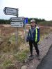
The Waterfront Trail between Toronto and St Catherines (didn't quite make Niagara-on-the-Lake) is good. There is a bit too much 'North Service Road' for my liking but some of it has a decent space on the right for bikes.
BEST: Burlington to the Allan's candy factory in Stoney Creek. All off road. The lift bridge is a bit of a challenge; take the sidewalk on the west side.
WORST: North Service Road up to Jordan Harbour.
STEALTH CAMPING: Almost impossible. Megopolis gives way to grape vines and orchards. Just by luck I found a great spot near Jordan on the Bruce Trail.
Last edited by stokell; 04-30-06 at 02:02 PM.
05-02-06, 02:42 PM
#7
Senior Member
Join Date: Oct 2005
Location: Norn'Iron
Posts: 1,399
Bikes: Gardin
Mentioned: 0 Post(s)
Tagged: 0 Thread(s)
Quoted: 0 Post(s)
Likes: 0
Liked 0 Times
in
0 Posts
Originally Posted by stokell
WORST: North Service Road up to Jordan Harbour.
05-02-06, 06:46 PM
#8
Senior Member
Thread Starter
Join Date: Dec 2002
Location: On the Road
Posts: 1,260
Bikes: Custom built tourer, custom electric bike, beaters everywhere
Mentioned: 0 Post(s)
Tagged: 0 Thread(s)
Quoted: 2 Post(s)
Likes: 0
Liked 1 Time
in
1 Post
Originally Posted by Lolly Pop
Shame you didn't take Highway 8. You would have avoided the North Service Road.
05-02-06, 11:14 PM
#9
Newbie
Join Date: May 2006
Location: hamilton, ontario
Posts: 4
Bikes: 2005 Devinci Destination
Mentioned: 0 Post(s)
Tagged: 0 Thread(s)
Quoted: 0 Post(s)
Likes: 0
Liked 0 Times
in
0 Posts
riding by the escarpment
If you were up for taking a bit of a detour from the lake, you'll get a wonderful view from ontop of the ecarpment. I ride from Stoney Creek to St Catherines about once or twice a week and I go Ridge Rd to Fly Rd (around Beamsville) to 8th Road; it's an awesome ride. Very few cars, not too many trucks, all well-paved.
05-03-06, 04:08 PM
#10
Senior Member
Join Date: Oct 2005
Location: Norn'Iron
Posts: 1,399
Bikes: Gardin
Mentioned: 0 Post(s)
Tagged: 0 Thread(s)
Quoted: 0 Post(s)
Likes: 0
Liked 0 Times
in
0 Posts
Sorry about sending you to Hwy 8 Stokell! It wasn't too bad when I rode it but that was ages ago.
