


Strava heat map of the Columbia River question
 05-04-21, 01:24 PM
#1
Full Member
Thread Starter
Strava heat map of the Columbia River question
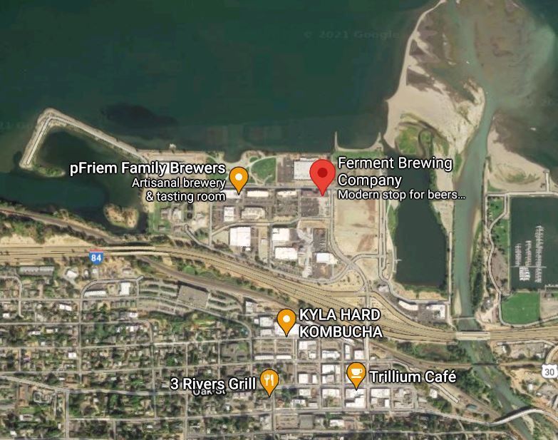
Whilst browsing the Strava Global Heat map I saw some huge plumes in the Columbia river near Hood River Oregon.
any idea what this about? It's on the scale of a nuke plant but I see nothing like in the area. There are quite a few smaller plumes in the Columbia river both up and down stream.
Looking at Google maps, there are just a couple of small brewerys in the area of the apparent discharge.
url for the strava location:
https://www.strava.com/heatmap#12.03...71235/hot/ride
 05-04-21, 03:00 PM
#3
Senior Member
Join Date: Mar 2006
Location: Chicago, IL, USA
Posts: 2,873
Mentioned: 2 Post(s)
Tagged: 0 Thread(s)
Quoted: 1455 Post(s)
Liked 1,477 Times
in
867 Posts
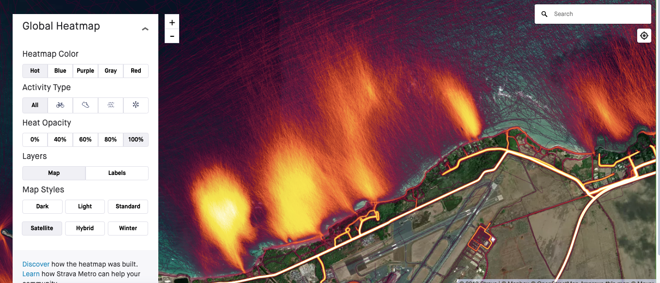
You guys know that the Strava "heat map" doesn't actually measure heat, right? It only shows user uploaded GPS tracks as "hot"
My guess (knowing nothing about this area) is that this is probably people in kayaks, boats, swimming, etc tracking routes in/on the water.
It looks like there are a few SUP, Kayak and Windsurfing rental places in that location, and I see tons of small boats on Google Maps.
My guess (knowing nothing about this area) is that this is probably people in kayaks, boats, swimming, etc tracking routes in/on the water.
It looks like there are a few SUP, Kayak and Windsurfing rental places in that location, and I see tons of small boats on Google Maps.
Likes For msu2001la:
05-04-21, 05:06 PM
#4
Full Member
Thread Starter
05-04-21, 10:22 PM
#5
Senior Member
Join Date: May 2005
Location: northWET washington
Posts: 1,197
Mentioned: 3 Post(s)
Tagged: 0 Thread(s)
Quoted: 383 Post(s)
Liked 690 Times
in
396 Posts
You guys know that the Strava "heat map" doesn't actually measure heat, right? It only shows user uploaded GPS tracks as "hot"
My guess (knowing nothing about this area) is that this is probably people in kayaks, boats, swimming, etc tracking routes in/on the water.
It looks like there are a few SUP, Kayak and Windsurfing rental places in that location, and I see tons of small boats on Google Maps.
My guess (knowing nothing about this area) is that this is probably people in kayaks, boats, swimming, etc tracking routes in/on the water.
It looks like there are a few SUP, Kayak and Windsurfing rental places in that location, and I see tons of small boats on Google Maps.
Or maybe a large barge was making its way up/down the river.
05-05-21, 08:18 AM
#7
Senior Member
Join Date: Mar 2006
Location: Chicago, IL, USA
Posts: 2,873
Mentioned: 2 Post(s)
Tagged: 0 Thread(s)
Quoted: 1455 Post(s)
Liked 1,477 Times
in
867 Posts

Here is what a popular surfing area in Maui looks like. Some surfers use Strava to track their activities while in the water. When this gets repeated thousands of times in the same area, it looks like a "plume", but these are all just individual GPS tracks:
 05-05-21, 08:36 AM
#8
Senior Member
Join Date: Oct 2016
Posts: 728
Mentioned: 6 Post(s)
Tagged: 0 Thread(s)
Quoted: 365 Post(s)
Liked 418 Times
in
247 Posts
Well, to be fair, in your original post you did mention several possible sources of actual heat energy (e.g. nuke plant, brewery, discharge) and you did not mention any possible sources of Strava GPS "heat" (e.g. boaters/SUPers/kyakers/etc. using Strava to record their activities). So, it is not unreasonable for a reader of your post to conclude that you were confusing heat energy with using "heat" as a proxy for the frequency of GPS tracks from Strava.
