


NYC to Southampton route...
 07-13-10, 10:10 AM
#1
Senior Member
Thread Starter
Join Date: May 2009
Location: NYC
Posts: 2,780
Bikes: Felt AR1, Cervelo S2
Mentioned: 1 Post(s)
Tagged: 0 Thread(s)
Quoted: 17 Post(s)
Likes: 0
Liked 3 Times
in
2 Posts
NYC to Southampton route...
I'm considering riding this weekend out to southampton.
I could take the train out to some intermediate location or just ride from the upper east side.
I did the Montauk Century @ about 15mph pace, with rest stops, and it took me from 7am-6pm (riding with girlfriend). I could keep a substantially faster pace on my own.
(1)Google has me riding on the north shore, then swooping down at the end, which seems weird.
(2) I could take the LIE service road most of the way out.
(3) The Montauk route went through Southampton, and was relatively chill and flat on the south shore, but snaked around a bit.
(4) I could just ride along the Montauk LIRR line, starting at Babylon.
What do you recommend?
 07-13-10, 11:02 AM
#2
Car-Free Flatlander

Join Date: Sep 2004
Location: Below 14th Street
Posts: 1,976
Bikes: Sirrus
Mentioned: 0 Post(s)
Tagged: 0 Thread(s)
Quoted: 0 Post(s)
Likes: 0
Liked 0 Times
in
0 Posts
You can always drag and drop points on the Google Maps if you want to modify the route.
'Anonymous' posted a 59th Street Bridge to Montauk Cue sheet that's based on 5BBC's Montauk Century but is supposed to be without all the twists and turns. Looks like Southhampton is just before the 100 mile mark.
'Anonymous' posted a 59th Street Bridge to Montauk Cue sheet that's based on 5BBC's Montauk Century but is supposed to be without all the twists and turns. Looks like Southhampton is just before the 100 mile mark.
07-13-10, 11:42 AM
#3

Senior Member

Join Date: May 2007
Location: Highland Park, NJ, USA
Posts: 3,798
Bikes: "Hildy", a Novara Randonee touring bike; a 16-speed Bike Friday Tikit; and a Specialized Stumpjumper frame-based built-up MTB, now serving as the kid-carrier, grocery-getter.
Mentioned: 0 Post(s)
Tagged: 0 Thread(s)
Quoted: 11 Post(s)
Likes: 0
Liked 1 Time
in
1 Post
If you're going te near the north shore in western long island, bike routes 25/25A are very good for riding, but not so much car 25/25A.
The LIE service road is a good cycling route. I was skeptical, but finally tried it out. It all looks pretty much like this east of Queens and the Douglastown parkway:
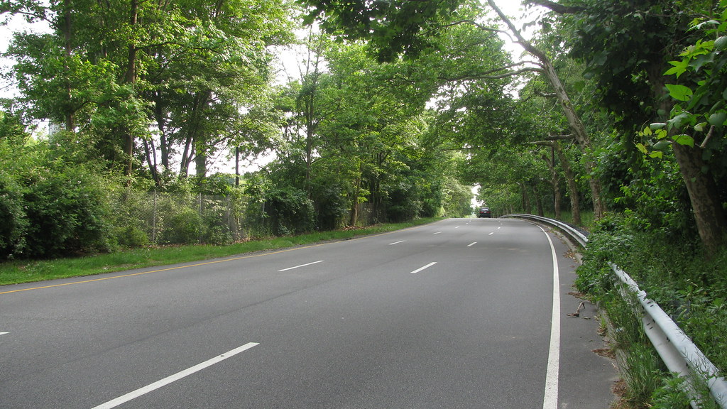
The LIE service road is a good cycling route. I was skeptical, but finally tried it out. It all looks pretty much like this east of Queens and the Douglastown parkway:
__________________
Tour Journals, Blog, ride pix
My bands:
Tour Journals, Blog, ride pix
My bands:
- Uke On! - ukulele duo - Videos
- Ukulele Abyss - ukulele cover videos - Videos
- Baroque and Hungry's (Celtic fusion) full-length studio album Mended.
- Artistic Differences - 8-track EP Dreams of Bile and Blood.
07-13-10, 01:40 PM
#4
Senior Member
Thread Starter
Join Date: May 2009
Location: NYC
Posts: 2,780
Bikes: Felt AR1, Cervelo S2
Mentioned: 1 Post(s)
Tagged: 0 Thread(s)
Quoted: 17 Post(s)
Likes: 0
Liked 3 Times
in
2 Posts
You can always drag and drop points on the Google Maps if you want to modify the route.
'Anonymous' posted a 59th Street Bridge to Montauk Cue sheet that's based on 5BBC's Montauk Century but is supposed to be without all the twists and turns. Looks like Southhampton is just before the 100 mile mark.
'Anonymous' posted a 59th Street Bridge to Montauk Cue sheet that's based on 5BBC's Montauk Century but is supposed to be without all the twists and turns. Looks like Southhampton is just before the 100 mile mark.
I may edit it to just stay on the service road except for a Starbucks every once in a while.
Last edited by Inertianinja; 07-13-10 at 01:47 PM.
07-13-10, 05:26 PM
#5
Senior Member
Join Date: Mar 2007
Location: Long Island, NY
Posts: 636
Mentioned: 0 Post(s)
Tagged: 0 Thread(s)
Quoted: 8 Post(s)
Likes: 0
Liked 0 Times
in
0 Posts
LIE Service Road is the easiest to follow and on a weekends is a decent route.
Here's a MapMyRide link: https://beta.mapmyride.com/route/detail/19803128/
It starts at the LIE at Little Neck Parkway and you can head up to PU the service road anywhere you choose, the map then shows the detours around the Seaford-Oyster Bay Expw at mile 14, as well as the Sagtikos Parkway at mile 25, then continues east to finally get off to take Union and Long Island avenues to Horse Block Rd. You can also stay on the service road instead of heading down to Union, but the intersection at CR 97/Nicolls Rd is a bear. Note also the need to go left up the ramp from LI Ave. to get on to Horse Block Rd. , just watch for the overpass. The Union/LI Ave. route is also the recommended route on the NY State Bike Map.
https://www.transalt.org/files/resources/mapnassau.html
https://www.transalt.org/files/resources/mapsuffolk.html
Then down to Montauk Hwy to follow the Montauk Century route (not shown).
SB

