


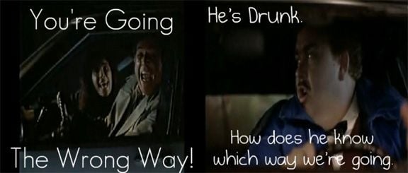
Nothing slows you down more than a guy with a map
 07-30-19, 10:19 AM
#1
Senior Member
Thread Starter
Join Date: Jul 2017
Location: Walnut Creek, CA
Posts: 760
Bikes: 1969 Peugeot PX10, 1992 Della Santa, Linus Roadster 8, Biria 700C ST-8
Mentioned: 3 Post(s)
Tagged: 0 Thread(s)
Quoted: 794 Post(s)
Liked 508 Times
in
322 Posts
Nothing slows you down more than a guy with a map
On Sunday I was taking my usual loop through the East Bay town of Walnut Creek. I like to cross Ygnacio Valley Road at San Carlos and cruise through the neighborhoods. I'm pretty slow and the streets are wide and traffic very light, typical suburban area built in the 1950's. I know that because the swim club, Rancho San Miguel is celebrating their founding in 1959. A group of three riders passed me but then I soon caught up to them standing in the road looking at a map, they seemed to be deciding to turn left. I asked where they are going and got the reply "Diablo". My reply "you're going the wrong way". So I continued on, I could see the locally famous mountain straight ahead. After getting through the neighborhoods I came out on Walnut Ave and turned right heading up. Looking back to the left I could see those three riders. They came by and I said "told you so". I hope they had a nice ride but they could have done better and learned something by just looking around them and following the obvious route. I'm a fan of keeping the map in my pocket and figuring it out on my own, it's way more fun. Even worse is slavishly following some computerized route.
 07-30-19, 10:25 AM
#2

Veteran, Pacifist

Join Date: Dec 2004
Location: Seattle area
Posts: 13,328
Bikes: Bikes??? Thought this was social media?!?
Mentioned: 284 Post(s)
Tagged: 0 Thread(s)
Quoted: 3898 Post(s)
Liked 4,836 Times
in
2,229 Posts
best to know where you are going and equally important is how to get home.
What aids you may need are rider dependent, and really unimportant.
What aids you may need are rider dependent, and really unimportant.
__________________
Vintage, modern, e-road. It is a big cycling universe.
Vintage, modern, e-road. It is a big cycling universe.
Likes For Wildwood:
07-30-19, 10:25 AM
#3

Non omnino gravis

I wonder what it was that compelled you to inform them of their "error." I routinely ride to my wife's workplace for a lunch date-- the shortest route is just over 26 miles. But I might take 30, 40, or even 70 to get there.
How would you have responded if a complete stranger told you, out of nowhere, that you're "going the wrong way."
How would you have responded if a complete stranger told you, out of nowhere, that you're "going the wrong way."
__________________

07-30-19, 11:23 AM
#5
Senior Member
Join Date: Jan 2010
Posts: 39,249
Mentioned: 211 Post(s)
Tagged: 1 Thread(s)
Quoted: 18422 Post(s)
Liked 15,570 Times
in
7,335 Posts
"You're going the wrong way" wasn't helpful. Good thing they were smart enough to have and consult a map. According to your description they were going the wrong way. Imagine if they didn't have a map.
When touring in unfamiliar territory I still prepare paper cue sheets. I call them my PGS: Paper Guidance System. The unit never needs charging.
When touring in unfamiliar territory I still prepare paper cue sheets. I call them my PGS: Paper Guidance System. The unit never needs charging.
07-30-19, 12:09 PM
#6
Veteran, Pacifist
Join Date: Dec 2004
Location: Seattle area
Posts: 13,328
Bikes: Bikes??? Thought this was social media?!?
Mentioned: 284 Post(s)
Tagged: 0 Thread(s)
Quoted: 3898 Post(s)
Liked 4,836 Times
in
2,229 Posts
As a former Wilderness Ranger, it's funny to see people 'kinda lost' and upset that there is no internet connection, or their battery expired.
Even funnier is people who expect directional signs to be posted in the Wilderness.
"Where's your map?" Always a Ranger's 1st question.
OK, back to cycling.
Even funnier is people who expect directional signs to be posted in the Wilderness.
"Where's your map?" Always a Ranger's 1st question.
OK, back to cycling.
__________________
Vintage, modern, e-road. It is a big cycling universe.
Vintage, modern, e-road. It is a big cycling universe.
Likes For Wildwood:
07-30-19, 12:50 PM
#7
Senior Member
I like maps...and charts...land or sea dependent.
 07-30-19, 03:14 PM
#9
Senior Member
Join Date: Apr 2017
Location: Arlington, TX
Posts: 89
Bikes: Bianchi Infinito CV Disc Ultegra | Fuji Sportif 1.5 - 2017 | Windsor Cyclo Cross Bike
Mentioned: 1 Post(s)
Tagged: 0 Thread(s)
Quoted: 40 Post(s)
Liked 29 Times
in
14 Posts
I can see things off in the distance right now, but I'm not sure I could determine a more efficient route to get to them by just continuing to navigate by line of sight as opposed to a map or guidance system of some sort. I'm no spring chicken but I do much better with my Garmin than anything.


 07-30-19, 04:40 PM
#11
Senior Member
Join Date: Jul 2014
Location: Toronto, CANADA
Posts: 6,204
Bikes: ...a few.
Mentioned: 47 Post(s)
Tagged: 0 Thread(s)
Quoted: 2012 Post(s)
Liked 409 Times
in
235 Posts
Living in the suburbs of a large metropolitan city I occasionally have to venture downtown somewhere, usually to pick up something I found in the classifieds, I try to plot out a route that avoids major arterial roads, and this always means there are dozens of turns into secondary and tertiary roads. As much as I can I try to commit the route to memory, but I, too, have a PGS, @indyfabz, that I have to consult from time to time to make sure I've made the right turns. It's not unusual that I might have made a wrong turn somewhere and have to stop to look at my directions.
07-30-19, 04:48 PM
#12

Senior Member
Join Date: Sep 2014
Posts: 3,893
Mentioned: 20 Post(s)
Tagged: 0 Thread(s)
Quoted: 1062 Post(s)
Liked 665 Times
in
421 Posts
Similar situation in my locale. Madison is on a narrow isthmus between lakes, so the roads are not neatly laid out in a grid. And I just can't remember the geography for ****. Out of town, there are lots of winding roads due to rivers and hills, sometimes poorly marked. A couple weeks ago I took a wrong turn at roughly mile 35 with my daughter, roughly 90 degrees F in the shade. I wanted to be darn sure we knew where we were going, someone waiting for us at our destination. The cell phone came out. Upon arriving back home, there was my map, on the dinner table. Oops.
For longer rides, I usually print out a crude map that's good enough to recover from getting lost. I also find a compass to be helpful -- I consult it after every turn to confirm my bearings. It's a combination bell and compass that's typically found on kids bikes.
For longer rides, I usually print out a crude map that's good enough to recover from getting lost. I also find a compass to be helpful -- I consult it after every turn to confirm my bearings. It's a combination bell and compass that's typically found on kids bikes.
07-30-19, 05:52 PM
#13
climber has-been

Join Date: Dec 2004
Location: Palo Alto, CA
Posts: 7,111
Bikes: Scott Addict R1, Felt Z1
Mentioned: 10 Post(s)
Tagged: 0 Thread(s)
Quoted: 3432 Post(s)
Liked 3,567 Times
in
1,793 Posts
I don't know about that, I like spending quality time with ridewithgps designing a cool route. Then while on the bike, a voice from the phone in my pocket tells me where to turn, leaving me to enjoy the ride.
Like this ride from last Saturday.
Like this ride from last Saturday.
__________________
Ride, Rest, Repeat. ROUVY: terrymorse

Ride, Rest, Repeat. ROUVY: terrymorse
Likes For terrymorse:
07-30-19, 06:32 PM
#14
Senior Member

Join Date: Apr 2012
Location: Middle Earth (aka IA)
Posts: 20,435
Bikes: A bunch of old bikes and a few new ones
Mentioned: 178 Post(s)
Tagged: 0 Thread(s)
Quoted: 5888 Post(s)
Liked 3,471 Times
in
2,079 Posts
Hey I still have a front handlebar bag with a map case. I take it on multi day tours so you know the map doesn't get wet if it rains.
07-30-19, 11:46 PM
#15
Junior Member
I know exactly where you are talking about and I�ll bet they were deciding because the �bike route� signs tell you to turn left when you can in fact go straight and still reach Walnut Ave. Not too dumb of them if they�re not familiar with the roads.
07-31-19, 12:08 AM
#16
Junior Member
07-31-19, 02:20 AM
#17
In Real Life

Join Date: Jan 2003
Location: Down under down under
Posts: 52,152
Bikes: Lots
Mentioned: 141 Post(s)
Tagged: 0 Thread(s)
Quoted: 3203 Post(s)
Liked 596 Times
in
329 Posts
I hope they had a nice ride but they could have done better and learned something by just looking around them and following the obvious route. I'm a fan of keeping the map in my pocket and figuring it out on my own, it's way more fun. Even worse is slavishly following some computerized route.
__________________
Rowan
My fave photo threads on BF
Century A Month Facebook Group
Machka's Website
Photo Gallery
Rowan
My fave photo threads on BF
Century A Month Facebook Group
Machka's Website
Photo Gallery
07-31-19, 04:31 AM
#18
Senior Member

Join Date: Aug 2018
Location: Allen, TX
Posts: 2,636
Bikes: 2021 S-Works Turbo Creo SL, 2020 Specialized Roubaix Expert
Mentioned: 7 Post(s)
Tagged: 0 Thread(s)
Quoted: 762 Post(s)
Liked 4,040 Times
in
1,430 Posts
07-31-19, 05:47 AM
#19
Senior Member
Join Date: Jun 2008
Location: Vancouver, BC
Posts: 9,201
Mentioned: 11 Post(s)
Tagged: 0 Thread(s)
Quoted: 1186 Post(s)
Liked 289 Times
in
177 Posts
I don't know about that, I like spending quality time with ridewithgps designing a cool route. Then while on the bike, a voice from the phone in my pocket tells me where to turn, leaving me to enjoy the ride.
Like this ride from last Saturday.
Like this ride from last Saturday.
If I see riders from out of town looking lost I�m inclined to stop and chat and direct them on the best route. The most direct route through a city is seldom optimal for cyclists.
Likes For gregf83:
07-31-19, 01:51 PM
#20
Senior Member

Join Date: Apr 2010
Location: Mountain View, CA USA and Golden, CO USA
Posts: 6,341
Bikes: 97 Litespeed, 50-39-30x13-26 10 cogs, Campagnolo Ultrashift, retroreflective rims on SON28/PowerTap hubs
Mentioned: 9 Post(s)
Tagged: 0 Thread(s)
Quoted: 550 Post(s)
Liked 325 Times
in
226 Posts
You plan a route on ridewithgps.com selecting the most pleasant looking streets for riding, split it into 60 mile chunks so Garmin's bad software doesn't crash, download it to your GPS, and follow the turn directions when it beeps at you.
That avoids unpleasant surprises like a road that's smooth in Monterey county becoming a bone shaking lunar landscape crossing the San Benito county line.
Often the most obvious route is not the best.
Last edited by Drew Eckhardt; 07-31-19 at 01:57 PM.
07-31-19, 01:55 PM
#21
Senior Member
Join Date: Jan 2010
Posts: 39,249
Mentioned: 211 Post(s)
Tagged: 1 Thread(s)
Quoted: 18422 Post(s)
Liked 15,570 Times
in
7,335 Posts
Likes For indyfabz:
07-31-19, 02:47 PM
#22
- Soli Deo Gloria -
Join Date: Aug 2015
Location: Northwest Georgia
Posts: 14,779
Bikes: 2018 Rodriguez Custom Fixed Gear, 2017 Niner RLT 9 RDO, 2015 Bianchi Pista, 2002 Fuji Robaix
Mentioned: 235 Post(s)
Tagged: 0 Thread(s)
Quoted: 6844 Post(s)
Liked 736 Times
in
469 Posts
"I told you so" really wasn't necessary.
Its one thing to offer help and another to rub it in someone's face.
-Tim-
Its one thing to offer help and another to rub it in someone's face.
-Tim-

Likes For Skipjacks:
08-01-19, 02:19 PM
#25
nothing to see here
Join Date: Sep 2007
Location: Antioch, CA
Posts: 564
Mentioned: 2 Post(s)
Tagged: 0 Thread(s)
Quoted: 218 Post(s)
Liked 145 Times
in
78 Posts
On Sunday I was taking my usual loop through the East Bay town of Walnut Creek. I like to cross Ygnacio Valley Road at San Carlos and cruise through the neighborhoods. I'm pretty slow and the streets are wide and traffic very light, typical suburban area built in the 1950's. I know that because the swim club, Rancho San Miguel is celebrating their founding in 1959. A group of three riders passed me but then I soon caught up to them standing in the road looking at a map, they seemed to be deciding to turn left. I asked where they are going and got the reply "Diablo". My reply "you're going the wrong way". So I continued on, I could see the locally famous mountain straight ahead. After getting through the neighborhoods I came out on Walnut Ave and turned right heading up. Looking back to the left I could see those three riders. They came by and I said "told you so". I hope they had a nice ride but they could have done better and learned something by just looking around them and following the obvious route. I'm a fan of keeping the map in my pocket and figuring it out on my own, it's way more fun. Even worse is slavishly following some computerized route.
Maybe change the thread title to: Being an ******* to other riders will slow you down.