


Maps of the ridable levees in DAllas
 08-13-08, 07:33 AM
#1
crash survivor
Thread Starter
Join Date: Aug 2007
Location: Irving, TX
Posts: 654
Bikes: C-dale rush, Mountain cycle fury, Monocog 29er, Haro hard tail VX, Scattante R330
Mentioned: 0 Post(s)
Tagged: 0 Thread(s)
Quoted: 0 Post(s)
Likes: 0
Liked 0 Times
in
0 Posts
Maps of the ridable levees in DAllas
Anyone got a good map of all the rideable levees around Dallas. AS it was told to me all are now open to cyclist, but I can't find a map of which ones are actually rideable. I have ridden from the Irving border to the train track one day n my MTB (see map below) But it was rough, the other side of the river looked like a better ride. I know the levee goes a long way and plan to explore one day soon, but was hoping other have already
https://www.gmap-pedometer.com/?r=2167450
https://www.gmap-pedometer.com/?r=2167450
 08-13-08, 02:49 PM
#2
Senior Member
Join Date: Jul 2008
Location: Flo Mo, TX
Posts: 161
Bikes: '08 Specialized Tricross, '05 Haro MTB, '94 Raliegh M-30, et al.
Mentioned: 0 Post(s)
Tagged: 0 Thread(s)
Quoted: 0 Post(s)
Likes: 0
Liked 0 Times
in
0 Posts
tate, I grew up in the NW area of Dallas... just about all the levees have a white rock/gravel surface rode on the top. I was just looking at some satallite views of the area. Example, if you start at I-30 just West of Loop-12, you can get on the levee and ride a long ways - it goes North and turns East into that Stemmons corridor area. It's actually called Trinity River Greenbelt Park. Follow it past I-35E, all the way to downtown Dallas, and it looks like it goes goes further, past I45. There was another place that looked like a good place to start- real close to Regal Row and I-35E - head South and turns to the East, and ends up being about the same route but on N. side of river. My advice though, is 1. Make sure you can change a flat, and 2. Make sure you can protect yourself by whatever means necessary. It's not the best part of town. Not that anyone is going to mess with you on the levee - you may not even see another person. But you never know. I have seen a few places where the road is gated - not sure if that is to keep general traffic off the levees or what, but I doubt anyoneone working for the Trinity River Authority or COE would care. Parking your car may be a challenge... maybe that Sterling Hotel at Regal Row and I-35. Good luck!
08-13-08, 10:25 PM
#3
Borracho For Life
Join Date: Sep 2007
Location: Taos, NM
Posts: 128
Mentioned: 0 Post(s)
Tagged: 0 Thread(s)
Quoted: 0 Post(s)
Likes: 0
Liked 0 Times
in
0 Posts
Homeless live under virtually every bridge along the south levee, the north levee not so much.
Avoid the south levee at all costs.
Avoid the south levee at all costs.
08-14-08, 06:54 AM
#4
Strong with the Fred

Join Date: May 2008
Location: Dallas, TX
Posts: 970
Mentioned: 0 Post(s)
Tagged: 0 Thread(s)
Quoted: 2 Post(s)
Likes: 0
Liked 2 Times
in
2 Posts
True, homeless live under the bridges. They haven't bothered my yet but my friends know of friends that have been yelled at and chased by them. I'm off on Mondays and would ride then and rarely see any homeless home (only one dude). Maybe they're out bumming on weekdays? I usually park at Sylvan park on Mondays and ride the north side of the levee up to the south side of Harry Hines. (roughly 15 miles). I'm trying to get to Bachman lake but I get too tired to continue once I get to The tracks along the south side of Harry Hines. I think it's a city water facility. I love the levee hills as they make for a nice climb. I haven't ridden since it got really hot. Here is a link to a rough map of my route.
Ernest
Ernest
Last edited by Big_e; 10-04-08 at 05:56 PM.
08-24-08, 04:19 PM
#5

Uber Goober

I just ran across this, and didn't realize ANY of those levees were rideable. Cool.
__________________
"be careful this rando stuff is addictive and dan's the 'pusher'."
"be careful this rando stuff is addictive and dan's the 'pusher'."
10-04-08, 05:42 PM
#6
Strong with the Fred
Join Date: May 2008
Location: Dallas, TX
Posts: 970
Mentioned: 0 Post(s)
Tagged: 0 Thread(s)
Quoted: 2 Post(s)
Likes: 0
Liked 2 Times
in
2 Posts
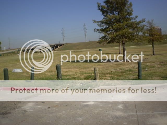
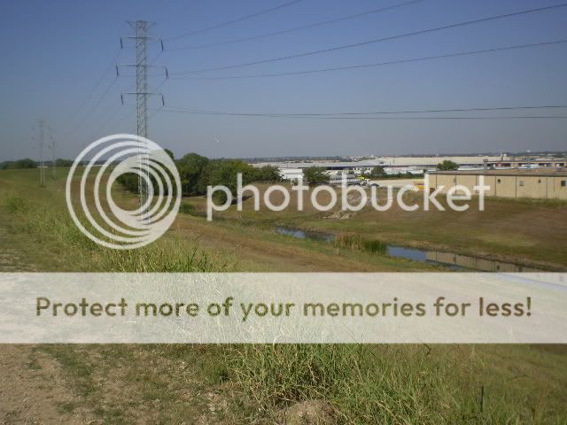
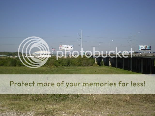
I got some nice tires for my mtb thanks to Mr_Christopher and went to the Trinity levee today. I ride on the North side of the levee from Sylvan park up to Harry Hines and back. Not much as far as scenery is concerned, mostly grassland, swampy ponds and small quantity of wildflowers. In the spring, the smell of wild onions is delightfully strong. It does have really good climbs and builds up endurance.
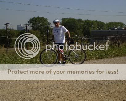
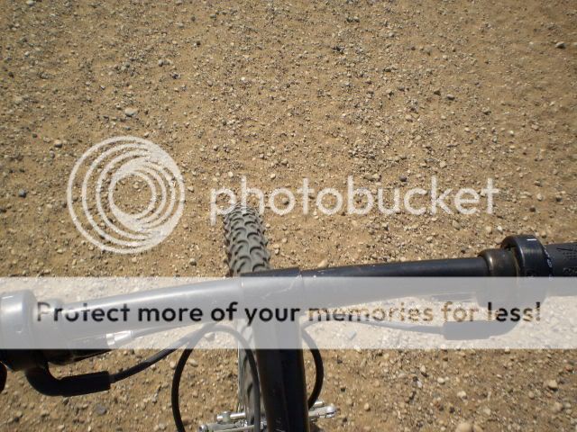
My bike, I used my Gary Fisher Wahoo,

The starting point, Sylvan park. It's quiet in the daytime but watch for broken bottles,
Approaching Sylvan Bridge,
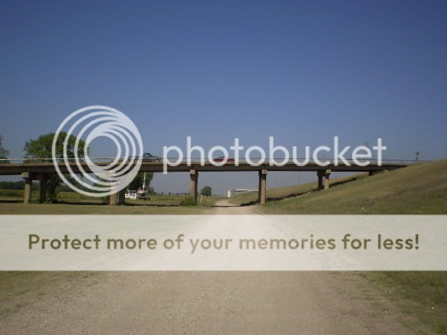
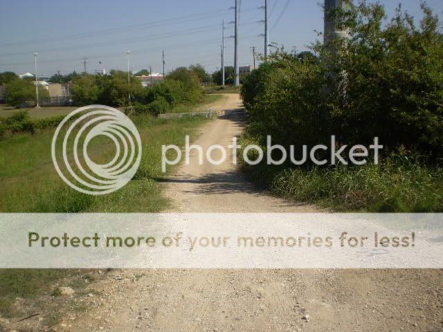
Approaching Inwood Bridge,

Inwood Bridge,

A nice climb after Inwood Bridge,

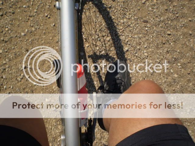
Me,
Some of the landscape,

More landscape,

Irving Bridge. Surprisingly this is the only bridge that had signs of homeless living under it. Nobody was home but I peddled by quickly nontheless,

My bike, I used my Gary Fisher Wahoo,
The starting point, Sylvan park. It's quiet in the daytime but watch for broken bottles,
Approaching Sylvan Bridge,
Approaching Inwood Bridge,
Inwood Bridge,
A nice climb after Inwood Bridge,
Me,
Some of the landscape,
More landscape,
Irving Bridge. Surprisingly this is the only bridge that had signs of homeless living under it. Nobody was home but I peddled by quickly nontheless,
Last edited by Big_e; 10-04-08 at 05:59 PM.
10-04-08, 05:52 PM
#7
Strong with the Fred
Join Date: May 2008
Location: Dallas, TX
Posts: 970
Mentioned: 0 Post(s)
Tagged: 0 Thread(s)
Quoted: 2 Post(s)
Likes: 0
Liked 2 Times
in
2 Posts
Nice climb after Irving Bridge,

The back of some factories between Irving and John Carpenter. Yhere is a Frito lay factory in the area and the smell of the corn chips is delicious,
Approaching 183- John Carpenter Frwy,

183 bridge,

I-35
I-35 Stemmons and the trail going under the bridge,

There's a small pond on the other side of the bridge and I saw these 2 turtles sunning themselves,

This is where the levee ends to the North. At a small city water plant along Harry Hines. HH is on the other side of the trees and water plant.
Going back, I was kinda tired by this time,
Granny gearing it most of the way,
The back of some factories between Irving and John Carpenter. Yhere is a Frito lay factory in the area and the smell of the corn chips is delicious,
Approaching 183- John Carpenter Frwy,
183 bridge,
I-35
I-35 Stemmons and the trail going under the bridge,
There's a small pond on the other side of the bridge and I saw these 2 turtles sunning themselves,
This is where the levee ends to the North. At a small city water plant along Harry Hines. HH is on the other side of the trees and water plant.
Going back, I was kinda tired by this time,
Granny gearing it most of the way,
10-04-08, 06:14 PM
#8
Senior Member

Join Date: Dec 2005
Location: northern California
Posts: 5,603
Bikes: Bruce Gordon BLT, Cannondale parts bike, Ecodyne recumbent trike, Counterpoint Opus 2, miyata 1000
Mentioned: 0 Post(s)
Tagged: 0 Thread(s)
Quoted: 1 Post(s)
Likes: 0
Liked 0 Times
in
0 Posts
A few years ago a city engineer who manages all the stream beds and flood control channels (some 60 miles of them) in my town asked me to check them out for general condition and bike-ability. He handed me a big map showing every channel including where there were dirt access roads aside them. Try the Dallas City Engineers office for starters. Then/or try what I did. Ride along every channel you can get to and note where they are not usable.
10-04-08, 11:58 PM
#9
insert witty comment here

Join Date: Aug 2008
Location: Dallas Texas
Posts: 846
Bikes: 2016 Specialized AWOL, 2011 Electra Bike Ticino, '09 Trek 7.2 FX, Peugeot UE 18
Mentioned: 1 Post(s)
Tagged: 0 Thread(s)
Quoted: 12 Post(s)
Likes: 0
Liked 0 Times
in
0 Posts
Hey Ernest about how many miles are you riding when you do the levee? I'm might want to join you some time. And how rough is the terrain? I have an old Trek mountain bike that I'm running these Forte' Gotham Road and MTB combination tires that are 26 x 1.75 and I'm not sure if they would hold up. They have deep treads but they're kinda narrow.
Chris
Chris
10-05-08, 07:51 AM
#10
Borracho For Life
Join Date: Sep 2007
Location: Taos, NM
Posts: 128
Mentioned: 0 Post(s)
Tagged: 0 Thread(s)
Quoted: 0 Post(s)
Likes: 0
Liked 0 Times
in
0 Posts
The levee trails are easy to get to from the Katy Trail. Take Victory Ave, to Hi-Line Drive to Oak Lawn. Oak Lawn dead ends into the levee pretty much. You can ride south as far as the DART bridge. South side of the river has the most homeless. Stick to the north side.
10-05-08, 09:24 AM
#11
Strong with the Fred
Join Date: May 2008
Location: Dallas, TX
Posts: 970
Mentioned: 0 Post(s)
Tagged: 0 Thread(s)
Quoted: 2 Post(s)
Likes: 0
Liked 2 Times
in
2 Posts
Chris, it's 15 miles according to mapmyride.com. Here's a link to a rough map of my ride. I'm really looking to find a way to Bachman Lake, It's just a matter of finding a way around the water plant. I'm always too tired by the time I get there.
The ground is mostly gravel with some loose patches. Those tires should do the job. Really no jumps on the trail, just the dirt trail and the climbs. I love the climbs because they've helped me build up my speed. I'm thinking of taking my Edgewood hybrid out there for the comfort level and it has about the same kind of tires. My Gary Fisher has NO suspension whatsoever so my hybrid may be of use. My work schedule is such that I work 4/ 10 hour work days so I get Mondays off. Weather permitting, I'll be out there next Monday. I'm still resting up from yesterday and I need to catch up on chores tomorrow.
Ernest
10-05-08, 02:06 PM
#12
Senior Member
Join Date: Jul 2008
Location: Flo Mo, TX
Posts: 161
Bikes: '08 Specialized Tricross, '05 Haro MTB, '94 Raliegh M-30, et al.
Mentioned: 0 Post(s)
Tagged: 0 Thread(s)
Quoted: 0 Post(s)
Likes: 0
Liked 0 Times
in
0 Posts
Guys, There are a couple of ways to make that last 1/2 mile to Bachman - you can stay on that levee road after I-35 and get real close to Harry Hines and Shorecrest. You gotta ride 1/4 mile up Shorecrest to corner of Denton Dr and HH and the MUP for Bachman Lake is right there at the corner. Those are my old stompon' grounds over there - I'd like to meet y'all for a ride.
