


Touring Without a Smart Phone
 04-20-16, 04:29 AM
#26
Senior Member
Join Date: Sep 2013
Location: Spain
Posts: 1,063
Mentioned: 4 Post(s)
Tagged: 0 Thread(s)
Quoted: 271 Post(s)
Liked 487 Times
in
236 Posts
I've never toured with a smart phone ... or actually with any phone at all ... or with a GPS ...
Mostly I tour with paper maps and sign observation.
Although, more recently we have started touring with small notebook computers and in an evening we look up routes for the next day on Google maps and compare them with our paper maps.
That said, we have only just acquired smartphones ... so who knows, maybe they will start accompanying us on tours.
Meanwhile I still like the adventure of figuring out where to go next while we're out there using the paper maps and signs.
 )
)
 04-20-16, 04:33 AM
#28

In Real Life

Join Date: Jan 2003
Location: Down under down under
Posts: 52,152
Bikes: Lots
Mentioned: 141 Post(s)
Tagged: 0 Thread(s)
Quoted: 3203 Post(s)
Liked 596 Times
in
329 Posts
Or just go whichever direction feels right.
That's pretty much how we do it.
__________________
Rowan
My fave photo threads on BF
Century A Month Facebook Group
Machka's Website
Photo Gallery
Rowan
My fave photo threads on BF
Century A Month Facebook Group
Machka's Website
Photo Gallery
04-20-16, 04:38 AM
#29
Senior Member
Join Date: Sep 2013
Location: Spain
Posts: 1,063
Mentioned: 4 Post(s)
Tagged: 0 Thread(s)
Quoted: 271 Post(s)
Liked 487 Times
in
236 Posts
and water.then the smart phone is very helpful ..
Last edited by str; 04-20-16 at 04:48 AM.
04-20-16, 04:41 AM
#30

smartphone/gps is more adventure-empowering
For me a smartphone/gps is more adventure-empowering because it has small and off-road detail that paper maps don't (other than awesome but impracticable typographics). I like serendipitously finding a trail, quiet town road, or forest road, checking my GPS to see where it leads and then taking it.
04-20-16, 05:01 AM
#31
In Real Life
Join Date: Jan 2003
Location: Down under down under
Posts: 52,152
Bikes: Lots
Mentioned: 141 Post(s)
Tagged: 0 Thread(s)
Quoted: 3203 Post(s)
Liked 596 Times
in
329 Posts
We've been travelling a lot of years that way ... just seeing where the wind blows us.
__________________
Rowan
My fave photo threads on BF
Century A Month Facebook Group
Machka's Website
Photo Gallery
Rowan
My fave photo threads on BF
Century A Month Facebook Group
Machka's Website
Photo Gallery
04-20-16, 05:13 AM
#32
Senior Member
Join Date: Sep 2013
Location: Spain
Posts: 1,063
Mentioned: 4 Post(s)
Tagged: 0 Thread(s)
Quoted: 271 Post(s)
Liked 487 Times
in
236 Posts
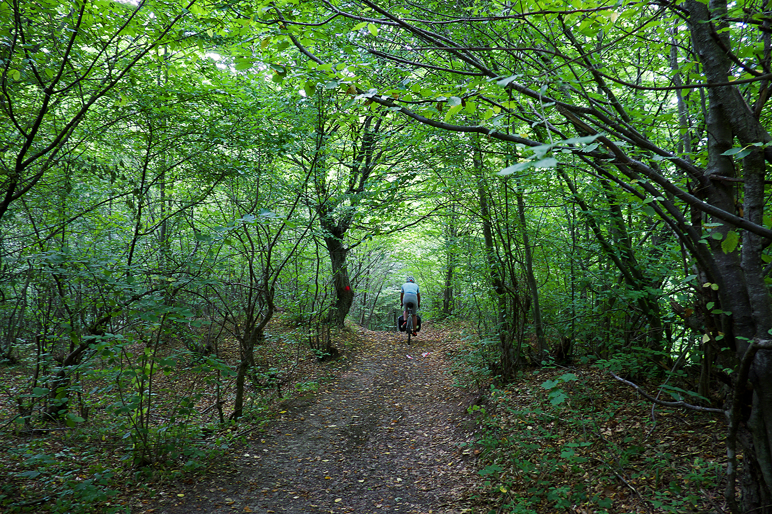
i saw in Flickr that you tour a lot in organised civilisation, for that we sure don't need a smart phone, paper maps are fine. when you leave into deep country side in the ex communist east EU countries no paper map helps you.
for example Romania, has aprox 30.000km unpaved roads, the villas you pass there all day long have nothing, no shops, no hotels, zero .... no food... having a smart phone there is very helpful from time to time.
for example Romania, has aprox 30.000km unpaved roads, the villas you pass there all day long have nothing, no shops, no hotels, zero .... no food... having a smart phone there is very helpful from time to time.
04-20-16, 05:49 AM
#33
Senior Member
Join Date: Mar 2009
Location: Jiaxing, China
Posts: 60
Bikes: Rodriguez 6-Pack, Giant Halfway
Mentioned: 0 Post(s)
Tagged: 0 Thread(s)
Quoted: 10 Post(s)
Likes: 0
Liked 2 Times
in
2 Posts
I have but don't use my smartphone. Yet I have a garmin which goes on tour for help with location. If traveling using the ACA maps I wouldn't be too concerned about needing a smart phone in order to locate grocery stores or other things on the route. However use of some form of locating device be on the compass and a map is great when traveling less popular areas.
04-20-16, 07:31 AM
#34
Senior Member
Join Date: Jan 2010
Posts: 39,214
Mentioned: 211 Post(s)
Tagged: 1 Thread(s)
Quoted: 18397 Post(s)
Liked 15,493 Times
in
7,316 Posts
Dumb phone primarily in case of an emergency and to let my sole heir/cat tender know where I am and that I am o.k., or not o.k., as the case may be. If I become disabled on a remote road I would at least like the chance of being found before the buzzards lick out my eyes. I may check email if I am in a town with a public library that has computers, but I find that to be somewhat of a drag as there is nothing that cannot wait.
04-20-16, 07:35 AM
#35
aka Timi
04-20-16, 07:58 AM
#36
Senior Moment

Join Date: Aug 2014
Location: Connecticut
Posts: 188
Bikes: Velo Orange Campeur, 1976 Motobecane Grand Touring
Mentioned: 0 Post(s)
Tagged: 0 Thread(s)
Quoted: 3 Post(s)
Likes: 0
Liked 6 Times
in
4 Posts
My vintage flip phone works great as a phone, my last tour I used it so little that I never needed to charge it in 37 days, but I always left it off unless I wanted to make a call.
I used to carry a netbook, but switched to a 7 inch android tablet instead. (But on one trip I brought a 4.7 inch screen smartphone without a sim card, used it only as a wifi device.) Something that you can use on wifi for checking e-mail, news, make reservations, etc., can be convenient in a restaurant that has wifi.
I used to carry a netbook, but switched to a 7 inch android tablet instead. (But on one trip I brought a 4.7 inch screen smartphone without a sim card, used it only as a wifi device.) Something that you can use on wifi for checking e-mail, news, make reservations, etc., can be convenient in a restaurant that has wifi.
04-20-16, 08:02 AM
#37
Senior Member
Join Date: Sep 2015
Location: QC Canada
Posts: 1,961
Bikes: Custom built LHT & Troll
Mentioned: 12 Post(s)
Tagged: 0 Thread(s)
Quoted: 838 Post(s)
Liked 149 Times
in
106 Posts
A smartphone is, first and foremost, a pocket size computer. A tablet is a cargo pants size computer and a laptop is a suitcase size computer. The power of smaller devices is increasingly close to that of their larger relative (screen definition, CPU benchmark)
Smartphones and tablets are natively mobile. They typically have an integrated GPS and require a fraction of the power needed to operate a laptop. Working on a laptop supposes access to the power grid every other day at the very least whereas you can stretch a tablet's life to more than a week with a battery bank the size of a laptop charger.
I would suggest that touring with a tablet + Bluetooth keyboard + hub is
best for most applications. The hub allows you to connect to mass storage if needed. The N7 has an excellent form factor and while I would not use it as a workstation, it makes a decent platform on the road.
04-20-16, 08:26 AM
#38
Senior Member

Join Date: Oct 2013
Location: D'uh... I am a Cutter
Posts: 6,139
Bikes: '17 Access Old Turnpike Gravel bike, '14 Trek 1.1, '13 Cannondale CAAD 10, '98 CAD 2, R300
Mentioned: 62 Post(s)
Tagged: 0 Thread(s)
Quoted: 1571 Post(s)
Likes: 0
Liked 12 Times
in
9 Posts
I was once injured locally while using a dumbphone. I called my wife and found it painstaking to try to talk her to my location. With our smartphones we can drop-a-pin (in maps), and text a link, the smartphone user at the receiving end gets voice prompts direct to the pin location. It works with friends, EMT, Police, whatever.
Last edited by Dave Cutter; 04-20-16 at 08:29 AM.
04-20-16, 08:47 AM
#39
Senior Member
Join Date: Sep 2015
Location: Left Coast, Canada
Posts: 5,126
Mentioned: 24 Post(s)
Tagged: 0 Thread(s)
Quoted: 2236 Post(s)
Liked 1,314 Times
in
707 Posts
I have a dumb phone I leave turned off and rely mainly on line maps I draw ahead of time using google maps. I look at my routes and note points or turns I need with a few alternatives and hit the road. That's just a personal thing for me as I am resisting smartphone technology in general (so far). I have seen it change peoples behavior so much in a way I don't like.
Convenience is a funny thing. If you look at it logically it would be far more convenient to drive and stay in hotels but I bike tour to challenge myself and disconnect from the automaton nature of daily modern life.
Convenience is a funny thing. If you look at it logically it would be far more convenient to drive and stay in hotels but I bike tour to challenge myself and disconnect from the automaton nature of daily modern life.
04-20-16, 08:49 AM
#40
Senior Member
Join Date: Sep 2013
Location: Spain
Posts: 1,063
Mentioned: 4 Post(s)
Tagged: 0 Thread(s)
Quoted: 271 Post(s)
Liked 487 Times
in
236 Posts
Long before I had a smartphone... my cell phone was dumb. It didn't know were I was... or who to call. And 911 is still just a great idea in some remote areas. Smartphones solve a lot of those problems and can even let the user "drop-a-pin". A great feature.
I was once injured locally while using a dumbphone. I called my wife and found it painstaking to try to talk her to my location. With our smartphones we can drop-a-pin (in maps), and text a link, the smartphone user at the receiving end gets voice prompts direct to the pin location. It works with friends, EMT, Police, whatever.
I was once injured locally while using a dumbphone. I called my wife and found it painstaking to try to talk her to my location. With our smartphones we can drop-a-pin (in maps), and text a link, the smartphone user at the receiving end gets voice prompts direct to the pin location. It works with friends, EMT, Police, whatever.
 04-20-16, 09:14 AM
#41
Senior Member
Join Date: Aug 2010
Location: Madison, WI
Posts: 11,177
Bikes: 1961 Ideor, 1966 Perfekt 3 Speed AB Hub, 1994 Bridgestone MB-6, 2006 Airnimal Joey, 2009 Thorn Sherpa, 2013 Thorn Nomad MkII, 2015 VO Pass Hunter, 2017 Lynskey Backroad, 2017 Raleigh Gran Prix, 1980s Bianchi Mixte on a trainer. Others are now gone.
Mentioned: 47 Post(s)
Tagged: 0 Thread(s)
Quoted: 3453 Post(s)
Liked 1,453 Times
in
1,132 Posts
I agree with almost everything said here, but I still prefer a dedicated GPS unit for navigation. I use two different ones, a vintage Etrex Vista that has a black and white screen and long AA battery life, but unfortunately limited memory size for basemaps. The other is a Garmin 62S, but that has worse battery life, but has good memory capability and can hold several different basemaps on a micro SD card. I carry the Vista on the handlebars (as in the photo), but turn on the 62S when I need more detail or want the routing features, or to use for searching for locations.

Also, my tablet and smartphone are too dim in sunlight to be of any use as a navigation device, the dedicated GPS units were designed for use outdoors and are rain proof.
I prefer to look at downloaded maps on the tablet or smartphone in the evening when planning my route for the next day. But otherwise those are generally off during the day.
On my android based smartphone, combining Google Voice, Google Hangouts and Google Hangouts Dialer, also have free phone service where I have wifi. I used to use different Android app for this (Groove IP Lite), recently switched to Hangouts.
On Pacific Coast trip I did not have cell service quite often, same with my touring partner and he was on a different system. We were at a restaurant that had wifi and since neither of us had cell service, I could use my 7 inch android tablet with these apps to make a phone call to place a reservation.
I also use Google Voice on my netbook computer. When one of my credit cards stopped working in Budapest (Hungary) I called my credit card company in USA on Google Voice with my netbook computer for free.
An FYI - They recently changed the name to Maps.Me. If your version is not routable, you might want to update it as it now can be used to plot routes.
Also, my tablet and smartphone are too dim in sunlight to be of any use as a navigation device, the dedicated GPS units were designed for use outdoors and are rain proof.
I prefer to look at downloaded maps on the tablet or smartphone in the evening when planning my route for the next day. But otherwise those are generally off during the day.
Have you looked at Freetone? I have the iOS app, but there is also an Android version. With it I can make free phone calls to any phone number using VoIP. Of course, you need to find a wi-fi hotpoint, but considering how ubiquitous McDonalds are this should not pose too onerous a requirement--assuming that you don't have an emergency.
On Pacific Coast trip I did not have cell service quite often, same with my touring partner and he was on a different system. We were at a restaurant that had wifi and since neither of us had cell service, I could use my 7 inch android tablet with these apps to make a phone call to place a reservation.
I also use Google Voice on my netbook computer. When one of my credit cards stopped working in Budapest (Hungary) I called my credit card company in USA on Google Voice with my netbook computer for free.
An FYI - They recently changed the name to Maps.Me. If your version is not routable, you might want to update it as it now can be used to plot routes.
04-20-16, 09:31 AM
#42
Senior Member

Join Date: Apr 2015
Location: Metro Detroit/AA
Posts: 8,207
Bikes: 2016 Novara Mazama
Mentioned: 63 Post(s)
Tagged: 0 Thread(s)
Quoted: 3640 Post(s)
Liked 81 Times
in
51 Posts
Regarding the original question, I've used USB GPS systems. They work, but they only work as well as whatever base mapping software you use them with. If you've already got the GPS, maybe just look for free mapping software with POIs for the computer?
As to if you actually want internet connection or not, (and admittedly not knowing your budget), I've been using Cricket Wireless for going on three years now. $35 a month will get you 2.5GB of data (plenty enough for looking up services, especially if you precache maps) and unlimited talk/text, and they generally have free smartphones with new activation. They run off ATT's network, so you should be covered pretty much anywhere you can realistically expect cell service.
As to if you actually want internet connection or not, (and admittedly not knowing your budget), I've been using Cricket Wireless for going on three years now. $35 a month will get you 2.5GB of data (plenty enough for looking up services, especially if you precache maps) and unlimited talk/text, and they generally have free smartphones with new activation. They run off ATT's network, so you should be covered pretty much anywhere you can realistically expect cell service.
04-20-16, 09:45 AM
#43
Senior Member
" Death Valley managers now ..... have posted warnings on the park's website, telling visitors not to rely on cell phones or GPS units."
Death by GPS in Dessert
'Death by GPS' in desert | The Sacramento Bee
04-20-16, 09:50 AM
#44
Senior Member
Join Date: Sep 2015
Location: QC Canada
Posts: 1,961
Bikes: Custom built LHT & Troll
Mentioned: 12 Post(s)
Tagged: 0 Thread(s)
Quoted: 838 Post(s)
Liked 149 Times
in
106 Posts
Now that I've been convinced by influential members of this community that I should install a dynohub, the battery argument is losing its appeal.
I have a gracefully aging S5 (water resistant) that might be sacrificed on the handlebars.
This being said, Garmin units are a pleasure to use when they work and the turn-by-turn directions are godsend to someone like me who is directionally challenged...
04-20-16, 09:52 AM
#45

Senior Member
Just an FYI, if you're touring on the coast in the Pacific Northwest, know that there are significant gaps in cell coverage between towns, at least on AT&T, which I use. In many of the major state park camping sites, even down into Northern California, you will have limited cell coverage unless you are on Verizon, which has a significantly better network out west. I do believe that if you have to place an emergency 911 call it will utilize the Verizon network.
Last edited by mtnroads; 04-20-16 at 09:56 AM.
04-20-16, 10:44 AM
#46
Senior Member
Join Date: Aug 2010
Location: Madison, WI
Posts: 11,177
Bikes: 1961 Ideor, 1966 Perfekt 3 Speed AB Hub, 1994 Bridgestone MB-6, 2006 Airnimal Joey, 2009 Thorn Sherpa, 2013 Thorn Nomad MkII, 2015 VO Pass Hunter, 2017 Lynskey Backroad, 2017 Raleigh Gran Prix, 1980s Bianchi Mixte on a trainer. Others are now gone.
Mentioned: 47 Post(s)
Tagged: 0 Thread(s)
Quoted: 3453 Post(s)
Liked 1,453 Times
in
1,132 Posts
That is or was also my thinking, but I find myself increasingly annoyed by the glitches that affect the Garmin Edge Touring - - this past week it suddenly popped the dreaded "unable to compute route" warning, after maybe 1 hour into the ride. And the glare from the snow (not a typo) was such that I saw myself pulling my phone from my jacket to be able to locate myself on the map, at a crucial intersection.
Now that I've been convinced by influential members of this community that I should install a dynohub, the battery argument is losing its appeal.
I have a gracefully aging S5 (water resistant) that might be sacrificed on the handlebars.
This being said, Garmin units are a pleasure to use when they work and the turn-by-turn directions are godsend to someone like me who is directionally challenged...
But the few times I tried routing on my Garmin 62S, it worked fine. But since that one goes thru batteries faster, I rarely use that on the handlebars.
I have heard that every time you stop and start rolling again with your dynohub that Garmin and possibly other devices get confused by the stopping and re-starting the charging. If you plug your navigation device into a USB port supplied by your hub, use a cache battery so that the charging is not interrupted.
My GPS units use AA batteries and I use rechargeable batteries, I have some AA smart chargers that are powered by USB so I can charged the batteries off of my hub.
04-20-16, 11:04 AM
#47
Senior Member
And to be honest, I am so new at all this, I have never done any routing stuff or anything like that, so I am pretty much starting at 0. I have only looked at it a few times while commuting here in Montreal to see if it actually shows me where I am, and so far it has worked perfectly each time Ive done a test.
So far, I see it simply as an extra tool if ever there is uncertainty to where I am, in conjunction with road maps.
bottom line for me (if I didnt say it before) is that I would like to become more familiar with gps stuff, dont own a car gps and have only used one a few times in borrowed cars. Want to be able to take advantage of the good handy aspects of gps use while biking (looking up grocery stores, campgrounds, etc etc) as well as inner city crossing/navigation that many say saves them hours when on a trip going through unknown, complex city streets--this especially I could see how it would be a great help--on the open road, not so much, paper maps are generally easy to follow and I like having the paper map in front of me on my handlebar bag.
04-20-16, 11:32 AM
#48
-

If your smartphone is ATT frequency compatible look into H2O wireless, $10/90 days=$3.33/month. I use WiFi for almost all data and never text, so this is the cheapest reliable provider I have found.
For dumbphones where you need only voice/text it is hard to beat the Verizon-network based Pageplus, $10/120 days=$2.50/month. I have an old, small, lightweight LG flip phone with a battery that will standby with phone off for an entire year. I had Verizon for ~20 years before Pageplus, they're identical in call quality/coverage because they are literally the same network/people, except for the ones handling CS calls and billing. My cell phone cost dropped from $70/month to <$3/month as a result of this switch.
Note both of these providers are good choices only for infrequent cell phone users, who don't wish to pay much for the "security" of a working cell phone. Then again Everyone now has 1 or 2 cellphones on them at all times, so maybe the more clever solution is to do without and simply borrow one if needed.
As far as offline GPS navigation goes, I find 7-8" tablet to be much easier to use than a smartphone due simply to the screen size being 3-5X larger. WRT mtnroad's comment, it's worth noting that a GPS-based device with offline-mapped GPS navigation software will work everywhere, all the time regardless of cellular service.
Verizon data service map - I recall there used to be a lot more white area in the West:
04-20-16, 11:51 AM
#49
Senior Member
Join Date: Sep 2015
Location: Left Coast, Canada
Posts: 5,126
Mentioned: 24 Post(s)
Tagged: 0 Thread(s)
Quoted: 2236 Post(s)
Liked 1,314 Times
in
707 Posts
yes, I noticed that.
And to be honest, I am so new at all this, I have never done any routing stuff or anything like that, so I am pretty much starting at 0. I have only looked at it a few times while commuting here in Montreal to see if it actually shows me where I am, and so far it has worked perfectly each time Ive done a test.
So far, I see it simply as an extra tool if ever there is uncertainty to where I am, in conjunction with road maps.
bottom line for me (if I didnt say it before) is that I would like to become more familiar with gps stuff, dont own a car gps and have only used one a few times in borrowed cars. Want to be able to take advantage of the good handy aspects of gps use while biking (looking up grocery stores, campgrounds, etc etc) as well as inner city crossing/navigation that many say saves them hours when on a trip going through unknown, complex city streets--this especially I could see how it would be a great help--on the open road, not so much, paper maps are generally easy to follow and I like having the paper map in front of me on my handlebar bag.
If people could be more disciplined with smartphones I see them as a very valuable tool but my experience has been an almost non stop need to check tweets, emails Fb posts etc... to the point that they miss the world around them. I see it with my own immediate family that appears to be completely disconnected from the natural world on trips in favour of staring at their 2" screens. I already spend a lot of time on my desktop and am a little afraid of going down that same rabbit hole so I'm trying to skip the SP era and will wait for full cranial implant technology.
Last edited by Happy Feet; 04-20-16 at 11:55 AM.
04-20-16, 12:13 PM
#50
Senior Member
This is an interesting dilemma for the modern age, and I appreciate all the insightful comments. I've been thinking about it myself recently. I don't have time to do much more than a weekender for the foreseeable future, but I do wonder how people deal with their cell phones on a longer tour, or if they even choose to use one.
I'm old enough to have done 3 week tours with no cell phone - because they didn't exist. But back then there would have been a phone booth in any little gas station/general store that you might run into in the middle of nowhere, should you need to use one.
My smart phone has cool GPS apps and what not, but they are far too battery hungry. They'd work for a day trip. I can see how people that like to blog while traveling across the country (etc) would probably want to run a dynamo hub these days to stay charged and connected. I prefer to get away.
My inclination is to get a separate GPS that uses actual batteries and pack a few spares. This seems like the best way to go if you prefer to travel light, which I do. I don't think I'd be willing to leave the phone at home though, even if it stays off most of the time. It's too useful and IMO important to have for emergencies.