


Finding a bike route
 08-19-17, 11:13 PM
#26
Upgrading my engine
Join Date: Aug 2004
Location: Alamogordo
Posts: 6,218
Mentioned: 5 Post(s)
Tagged: 0 Thread(s)
Quoted: 125 Post(s)
Likes: 0
Liked 0 Times
in
0 Posts
Oh my! Google Maps everywhere!!
What ever happened to using other sources - more reliable sources?
Google Maps is big - but than again, so was the Titanic.
Nearly every state posts online traffic volume maps and detailed county road maps.
Unfortunately, many state are now going to online data maps which preclude a general overview.
(Technology is not always helpful when the result is the loss of the big picture.)
Here is the fixed Kansas Traffic Volume Map -
https://www.ksdot.org/Assets/wwwksdot...untmap2016.pdf
What's nice about a map such as this is that you can spot good routes easily.
Since you want to stay under 2000 AADT - ideally under 1000 AADT - you look for the gray and purple.
Obviously the western part of Kansas has less traffic - but you can find the best possible routes.
(These are US and state highways - there are regional maps which include county roads.)
Notice how Highway 18 has much less traffic than most other E-W routes in central Kansas.
Kentucky has good county traffic volume maps, but not a statewide map -
Traffic Counts
Tennessee has county maps and traffic data but it is in a terrible format.
<<<>>>
Than, perhaps, you can use Google Streetview to see road conditions / shoulders etc.
If you're riding across multiple states, one single state map doesn't allow you to see the big picture. That's the great thing about Google Maps. It's quick and easy to use. You can do a lot of zooming in and zooming out. You can easily drag your route around and compare different possibilities. It's really good for doing rough sketches. The other resources out there are good for filling in the details.

 08-20-17, 05:24 AM
#28

In Real Life

Join Date: Jan 2003
Location: Down under down under
Posts: 52,152
Bikes: Lots
Mentioned: 141 Post(s)
Tagged: 0 Thread(s)
Quoted: 3203 Post(s)
Liked 596 Times
in
329 Posts
So how do I find a good bicycle route for a tour? I know about adventure bicycles maps, but not much else. I've heard of google bicycle maps, but have no knowledge. I was reading about the person who wanted to pick up the Blue ridge on a Trans Am. So just as an example I was looking at how to do Berea Ky to the southern end of the Blue Ridge. Are there any good you tubes on how to?
Thanks for your advice.
Thanks for your advice.
Personally, at some point during the week, I think about where we might like to go on our day-rides on the weekend. I open up Google Maps, I select a start and end point and choose bicycle to see the elevation, then make adjustments until I end up with a ride of the length and elevation I want.
I might put it into Ride with GPS if it is a route I particularly like and may want to repeat.
And, as someone else mentioned, the points I choose on the route could be places we'd like to go. For example, there's a historic town on the other side of Hobart which has a decent bakery. We might do a route that includes that town and bakery.
Same as I do for a tour.
Incidentally, I would use a paper map, but haven't found any really decent ones for this area. Some areas have better maps than others. And Google Maps has "Street View" which can be quite helpful.
__________________
Rowan
My fave photo threads on BF
Century A Month Facebook Group
Machka's Website
Photo Gallery
Rowan
My fave photo threads on BF
Century A Month Facebook Group
Machka's Website
Photo Gallery
Last edited by Machka; 08-20-17 at 05:31 AM.
08-20-17, 08:26 AM
#29
Hooked on Touring
Hmmmm - first you say that state websites are a hassle -
Then you say that if there is traffic and shoulder data they are the gold standard.
Now those would appear to be contradictory statements.
I find it odd that so many megabytes here are devoted to gear inches, tires, spokes, bar ends, etc.
When just a little time looking up easily available data would allow for much nicer riding.
Isn't that what gear inches are about - more pleasant riding up hills?
Wouldn't you think a road with 485 AADT would be more pleasant than one with 3500?
(AADT - average annual daily traffic)
Google Maps don't say a thang about AADT.
Not to mention that Google Maps can put you on closed, non-existent, private roads, too.
 08-20-17, 11:00 AM
#31
Senior Member
Join Date: Sep 2015
Location: Left Coast, Canada
Posts: 5,126
Mentioned: 24 Post(s)
Tagged: 0 Thread(s)
Quoted: 2236 Post(s)
Liked 1,314 Times
in
707 Posts
For example; Hwy2 from Souris to Antler had less traffic than the Trans Can (Hwy1) but a loose gravel shoulder that caused me to slough wildly whenever I rode on it. Fortunately the traffic that day was unusually light, even though it is a southern corridor for trucking so I simply rode the opposite side of the road whenever traffic came along. If it had even been moderate I would have had a horrible 100km ride stopping and starting on the gravel shoulder. In contrast, Hwy 1 had more traffic but an 8 foot nicely paved shoulder.
Google maps also always tells me if the route crosses boundaries, uses a ferry or accesses private roads.
Having said that I often grab a local map from the info center when I'm in an area as I find them easier and more fun to use on the road. Last example was an excellent map by Parks Can for the Icefield Parkway that showed elevation, stops of interest and distances both in birdseye and sideview fashion. Oddly enough, it was made for car traffic along the route but acted as the perfect cycling map.
 Parkway by dc460, on Flickr
08-20-17, 12:13 PM
Parkway by dc460, on Flickr
08-20-17, 12:13 PM
#32
Hooked on Touring
Not necessarily. Depends on the road.
For example; Hwy2 from Souris to Antler had less traffic than the Trans Can (Hwy1) but a loose gravel shoulder that caused me to slough wildly whenever I rode on it. Fortunately the traffic that day was unusually light, even though it is a southern corridor for trucking so I simply rode the opposite side of the road whenever traffic came along. If it had even been moderate I would have had a horrible 100km ride stopping and starting on the gravel shoulder. In contrast, Hwy 1 had more traffic but an 8 foot nicely paved shoulder.
For example; Hwy2 from Souris to Antler had less traffic than the Trans Can (Hwy1) but a loose gravel shoulder that caused me to slough wildly whenever I rode on it. Fortunately the traffic that day was unusually light, even though it is a southern corridor for trucking so I simply rode the opposite side of the road whenever traffic came along. If it had even been moderate I would have had a horrible 100km ride stopping and starting on the gravel shoulder. In contrast, Hwy 1 had more traffic but an 8 foot nicely paved shoulder.
Never ridden much in Manitoba, but have in southern Saskatchewan.
Here is the website for the Manitoba traffic flow map:
https://umtig.eng.umanitoba.ca/mhtis/flowmap2016.pdf
Note that Hwy 2 west of Souris doesn't have 485 AADT, but 1340 AADT.
And much of Hwy 2 west to the SK border has counts above 1000 -
not bad for most folks, but you need to pay attention.
HOWEVER -
If you look again at the MB traffic flow map, you will see a much better option -
at least, better in my opinion than the Trans Can with 6000-8000 AADT and heavy truck traffic.
Notice - Hwy 23 has 340 AADT and Hwy 345 has only 130 AADT - and they are paved.
Pretty darn flat no matter which road you take - but sweet & empty on the last option.
And it took me 30 seconds to find the Manitoba traffic flow map.
You may prefer riding on the shoulder of a busy 4-lane highway,
but I prefer listening to the wheat and songbirds.
08-20-17, 04:01 PM
#33
Senior Member
Join Date: Sep 2015
Location: Left Coast, Canada
Posts: 5,126
Mentioned: 24 Post(s)
Tagged: 0 Thread(s)
Quoted: 2236 Post(s)
Liked 1,314 Times
in
707 Posts
Nope.
I said I prefer a shoulder I can ride on rather than ditching it into loose gravel when traffic comes. Now look at Hwy 23 at Elgin or Baldur (for example), no shoulder. Hwy 345 near Bernice, Broomhill etc... same thing. Use google street view. You tried to prove a point by suggesting roads that show exactly what I was talking about.
The route you suggest would also add 50 km or 1/2 days ride to the route.
That map link shows very little besides statistically averaged yearly traffic use. Summer/winter? Weekdays? Harvest time?
Google maps gives you w a y more useful info.
Another thing to consider when selecting routes is the lack of services along the way. When I planned that trip I spent a lot of time looking at google street views of the towns I would pass through to see if there were stores, cafes, campgrounds etc.. As it was, even on the 2, 13 and 39, many of the towns shown were half abandoned and lacked even a corner store. Very sucky if that's where you planned to eat lunch/dinner. The route you suggest would have almost no services at all.
This was a point that was discussed some time ago on the forum in regards to how many tools/spare parts one takes on a trip. I paid attention in the small towns I visited and from Winnipeg to Moose Jaw it was almost 450km's without any sort of bicycle related store.
And.. The Trans Can is a two lane divided Hwy each way separated by a very wide median. I did however just ride a 4 lane Hwy (3) through most of Manning Park and it was beautiful. We even did 60km's of it downhill in the dark flat out because of the good shoulders.
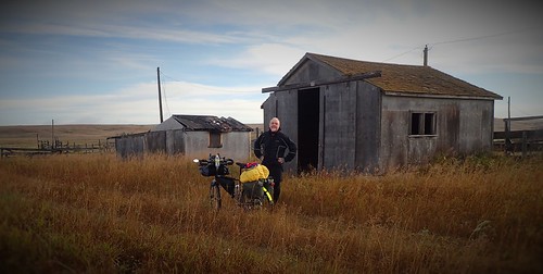
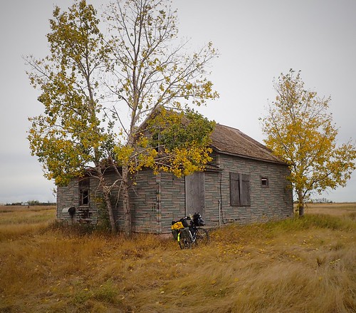
The thing about a wide shoulder, even on busier Hwys is that it is more relaxing as one need not focus on the traffic in the same way as one does on a sketchy road because they have their lane and you have yours. On a narrow/no shoulder I am always looking in the mirror to sees what's coming. On the Trans Can I never do. This frees me up to actually enjoy the scenery which, having done both in the Prairies I can attest is pretty much the same.
Trans Can photos from that trip:
 P3241785 by dc460, on Flickr
 P3241801 by dc460, on Flickr
 P4011842 by dc460, on Flickr
 P4031884 by dc460, on Flickr
 P4031863 by dc460, on Flickr
I said I prefer a shoulder I can ride on rather than ditching it into loose gravel when traffic comes. Now look at Hwy 23 at Elgin or Baldur (for example), no shoulder. Hwy 345 near Bernice, Broomhill etc... same thing. Use google street view. You tried to prove a point by suggesting roads that show exactly what I was talking about.
The route you suggest would also add 50 km or 1/2 days ride to the route.
That map link shows very little besides statistically averaged yearly traffic use. Summer/winter? Weekdays? Harvest time?
Google maps gives you w a y more useful info.
Another thing to consider when selecting routes is the lack of services along the way. When I planned that trip I spent a lot of time looking at google street views of the towns I would pass through to see if there were stores, cafes, campgrounds etc.. As it was, even on the 2, 13 and 39, many of the towns shown were half abandoned and lacked even a corner store. Very sucky if that's where you planned to eat lunch/dinner. The route you suggest would have almost no services at all.
This was a point that was discussed some time ago on the forum in regards to how many tools/spare parts one takes on a trip. I paid attention in the small towns I visited and from Winnipeg to Moose Jaw it was almost 450km's without any sort of bicycle related store.
And.. The Trans Can is a two lane divided Hwy each way separated by a very wide median. I did however just ride a 4 lane Hwy (3) through most of Manning Park and it was beautiful. We even did 60km's of it downhill in the dark flat out because of the good shoulders.
The thing about a wide shoulder, even on busier Hwys is that it is more relaxing as one need not focus on the traffic in the same way as one does on a sketchy road because they have their lane and you have yours. On a narrow/no shoulder I am always looking in the mirror to sees what's coming. On the Trans Can I never do. This frees me up to actually enjoy the scenery which, having done both in the Prairies I can attest is pretty much the same.
Trans Can photos from that trip:
P3241785 by dc460, on FlickrP3241801 by dc460, on FlickrP4011842 by dc460, on FlickrP4031884 by dc460, on FlickrP4031863 by dc460, on Flickr
Last edited by Happy Feet; 08-20-17 at 04:22 PM.
08-20-17, 04:23 PM
#34
Bike touring webrarian
I planned my recent ride from Amsterdam to Passau across Western Europe using Strava's heat map: https://labs.strava.com/heatmap.
This is a compilation of all the routes ridden for an entire year by Strava's user base. It will let you route from A to B and drag the route to other road, as well as, set waypoints for the route to go through. It was very useful on the Western Europe route. I used much of it on my trip.
Note that Germany and Austria don't allow Google street view and some of the smaller countries have limited street view coverage.
08-20-17, 05:35 PM
#35
Senior Member

Join Date: Sep 2011
Location: Western Florida
Posts: 1,581
Bikes: 2017 Kona TI, 2016 Bike Friday Haul-A-Day, 2015 Bike Friday New World Tourist (for sale), 2011 Mezzo D9, 2004 Marin Mount Vision Pro - for now :)
Mentioned: 2 Post(s)
Tagged: 0 Thread(s)
Quoted: 103 Post(s)
Liked 5 Times
in
5 Posts
Google maps for general direction, and then venture outside your main route using the state Gazetteer. Some roads are too sandy or not passable (too sandy here in Florida for example) so you have to be ready to turn around, but you can get good alternatives to US highways.
08-20-17, 08:36 PM
#36
Hooked on Touring
300 AADT means 300 vehicles per day average traffic.
If there is zero traffic at night - that means 150 cars each direction over 15 hours.
Or 10 cars per hour. Given a "rush hour" in the early morning and late afternoon -
You might have 6 cars per hour - on average - during the day - or one every 10 minutes.
I don't need a shoulder with an AADT of 300.
And I don't hear the noise of 8000 vehicles or smell the exhaust.
And you find empty backroads by using state/prov traffic maps.
After 100,000 miles - - Just sayin'.
Pix -
Pandora Road, east of Rosalia, Washington
Old Trail Road near Larwill, Indiana
08-20-17, 09:11 PM
#37
Senior Member
Join Date: Sep 2015
Location: Left Coast, Canada
Posts: 5,126
Mentioned: 24 Post(s)
Tagged: 0 Thread(s)
Quoted: 2236 Post(s)
Liked 1,314 Times
in
707 Posts
Ok. Having used the mileage card I guess I can't play any more because I really haven't kept score overall but I still find off the track roads using G Maps. Why is that a problem?
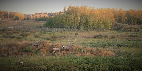
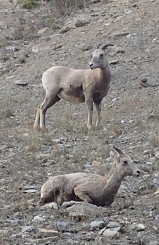
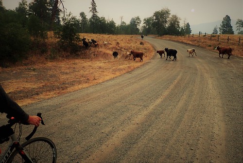
Like this section connecting the 5 and 5a we did two weeks ago. Thirty km of gravel with one truck encountered. GM showed distance, elevation, campgrounds and satellite view showed houses, what the intersections looked like so we wouldn't miss a turn etc... I don't know about other places but in Canada GM shows roads down to Forestry service level. There really aren't any other roads smaller than that around here. I don't really need a special map to tell me if a road is well traveled or not.
 P2180648 by dc460, on Flickr
20170804_192143[1] by dc460, on Flickr
or this one we plan to do next.
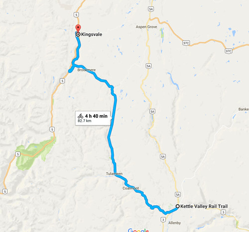 Captureaz by dc460, on Flickr
GM is such a powerful 3 dimensional tool I can't understand why anyone would argue against it. Of course one has to use common sense in all things but the amount of data it presents is pretty staggering when you know how to use it. even something as fundamental as calculating distance is stupid easy compared to non interactive maps. How would one calculate the distance shown above otherwise.. piece of string carefully wound across the VDT laid flat on a table and then held up to a legend scale?
But anyways - Cheers.
Like this section connecting the 5 and 5a we did two weeks ago. Thirty km of gravel with one truck encountered. GM showed distance, elevation, campgrounds and satellite view showed houses, what the intersections looked like so we wouldn't miss a turn etc... I don't know about other places but in Canada GM shows roads down to Forestry service level. There really aren't any other roads smaller than that around here. I don't really need a special map to tell me if a road is well traveled or not.
P2180648 by dc460, on Flickr20170804_192143[1] by dc460, on Flickr
or this one we plan to do next.
Captureaz by dc460, on FlickrGM is such a powerful 3 dimensional tool I can't understand why anyone would argue against it. Of course one has to use common sense in all things but the amount of data it presents is pretty staggering when you know how to use it. even something as fundamental as calculating distance is stupid easy compared to non interactive maps. How would one calculate the distance shown above otherwise.. piece of string carefully wound across the VDT laid flat on a table and then held up to a legend scale?
But anyways - Cheers.
Last edited by Happy Feet; 08-20-17 at 09:53 PM.
08-20-17, 11:40 PM
#38
Senior Member
Join Date: Mar 2009
Location: Oregon
Posts: 6,489
Mentioned: 31 Post(s)
Tagged: 0 Thread(s)
Quoted: 1182 Post(s)
Liked 833 Times
in
435 Posts
The scenery is about the same on the Canadian Prairies regardless of the route. I tend to go with good shoulders in this situation.
The Trans-Canadian Highway was a very pleasant place to ride.

The Trans-Canadian Highway was a very pleasant place to ride.
 08-21-17, 12:04 AM
#39
Senior Member
Join Date: Jan 2010
Location: Eugene, Oregon
Posts: 7,048
Mentioned: 10 Post(s)
Tagged: 0 Thread(s)
Quoted: 509 Post(s)
Likes: 0
Liked 9 Times
in
8 Posts
I planned my recent ride from Amsterdam to Passau across Western Europe using Strava's heat map: https://labs.strava.com/heatmap.
This is a compilation of all the routes ridden for an entire year by Strava's user base. It will let you route from A to B and drag the route to other road, as well as, set waypoints for the route to go through. It was very useful on the Western Europe route. I used much of it on my trip.
Note that Germany and Austria don't allow Google street view and some of the smaller countries have limited street view coverage.
This is a compilation of all the routes ridden for an entire year by Strava's user base. It will let you route from A to B and drag the route to other road, as well as, set waypoints for the route to go through. It was very useful on the Western Europe route. I used much of it on my trip.
Note that Germany and Austria don't allow Google street view and some of the smaller countries have limited street view coverage.
I tend to find my own routes and 90% of the time they are better for me than what is popular. Mostly, this involves being able to read a map with Google maps being a last resort. Of course, what is better for me may be horrid for you. I know many riders don't like hills. Some folks want a hotel at the end of the day. (I enjoy this at times too.) For others, having no stores or restaurants available would ruin the day. For others, a bit of gravel is a deal breaker. Some even dislike roads without shoulders, even though many of these have near-zero motorized traffic.
As for me, give me some knowledge of my next food source, some hope of cleaning up at day's end, water I can filter and low traffic counts and I'm happy. Pavement is nice, but not required and I expect the low-traffic routes to have lots of climbing since the flat routes are easy to widen and thus attract more cars and trucks.
08-21-17, 02:05 AM
#40
Senior Member
Join Date: Sep 2015
Location: Left Coast, Canada
Posts: 5,126
Mentioned: 24 Post(s)
Tagged: 0 Thread(s)
Quoted: 2236 Post(s)
Liked 1,314 Times
in
707 Posts
So.. Just off the top of your head, what course would you suggest? Local knowledge aside, If you are going to suggest those logging roads does a paper map tell you which is currently active with trucks hauling logs.
A quick look on G Maps shows two basic routes from Eugene to the coast (Florence) or some variants thereof; the 126 at 62 miles and the 36 at 77miles. The high points being between Noti and Walton and Low Pass respectively. On the 126 you are going up 1194' and down 1565'. I can also see local stores and use street view to see what they are like. The Noti Pub is recognizable by it's Pepsi sign and the provided link gives the phone number and 28 reviews with an average of 4.5 out of 5. There's a gas station and cafe at Low Pass (12 reviews giving it 4.3) but the cafe looks closed. It has one review from four months ago but the street view seems sketchy. Google maps shows secondaries like the Old Stagecoach Road (5020) and every logging road as well btw.
I can see all this on my VDT right now and, if I want, I could do the same for areas outside of Las Vegas or Prince George or Port Hardy without having to spend a cent on paper maps. I wouldn't buy a paper map until I knew I was going to tour a specific area and how do I decide to tour a specific area unless I look at a map?
Oh yeah.. Google maps.
08-21-17, 04:52 AM
#41
Hooked on Touring
How much traffic does Hwy 126 have?
How much traffic does Hwy 36 have?
Can one assume that the two-digit highway is busier?
Or would AADT help clear that up?
How much traffic does Hwy 36 have?
Can one assume that the two-digit highway is busier?
Or would AADT help clear that up?
08-21-17, 05:13 AM
#42
In Real Life
Join Date: Jan 2003
Location: Down under down under
Posts: 52,152
Bikes: Lots
Mentioned: 141 Post(s)
Tagged: 0 Thread(s)
Quoted: 3203 Post(s)
Liked 596 Times
in
329 Posts
What is AADT? Never heard of it.
__________________
Rowan
My fave photo threads on BF
Century A Month Facebook Group
Machka's Website
Photo Gallery
Rowan
My fave photo threads on BF
Century A Month Facebook Group
Machka's Website
Photo Gallery
08-21-17, 05:26 AM
#43
Senior Member
Join Date: Jan 2010
Posts: 39,238
Mentioned: 211 Post(s)
Tagged: 1 Thread(s)
Quoted: 18415 Post(s)
Liked 15,543 Times
in
7,329 Posts
08-21-17, 05:31 AM
#44
Hooked on Touring
See above discussion -
AADT - Average Annual Daily Traffic
My rough chart:
Under 500 - Majorly sweet
500 - 999 - Pleasant riding, no need for shoulder
1000 - 1999 - Shoulder helpful, but o.k. without with caution
2000 - 3999 - Pretty rough riding without shoulder, doable but unpleasant
4000+ - Dangerous without shoulder, sometimes necessary for short stretches
AADT is an average.
Traffic levels vary by season - more traffic in summer, esp. in beach or park areas.
Traffic levels vary by day of week - many rural highways have higher weekend traffic
Traffic levels vary by time of day - morning and late afternoon have higher traffic, work & school
08-21-17, 09:02 AM
#45
Senior Member
Join Date: Sep 2015
Location: Left Coast, Canada
Posts: 5,126
Mentioned: 24 Post(s)
Tagged: 0 Thread(s)
Quoted: 2236 Post(s)
Liked 1,314 Times
in
707 Posts
Sure great. You can get traffic volume from them I guess (I'll accept your word for it). But my point is that there are only really two roads between those points (connectors and frontages not withstanding) unless someone is going totally off the beaten path on logging roads which is a whole different level of planning (just look at the matrix in that area) so the average tourist planning a route will pick one or the other. And most will want to know a little bit about conditions and what you will see/encounter along the way. I get most of that initial info from GM and then, if I decide that is the area I want to tour I can pursue more info from other sources like the one you indicate. Even with google I can zoom in and use street view to tell which of the two probably gets more traffic but also what each road condition looks like. That also influences my decisions.
It's not that I don't think one should look at other sources but for initial route finding/research GM is hard to beat.
It's not that I don't think one should look at other sources but for initial route finding/research GM is hard to beat.
08-21-17, 10:11 AM
#46
Senior Member
Join Date: Mar 2009
Location: Oregon
Posts: 6,489
Mentioned: 31 Post(s)
Tagged: 0 Thread(s)
Quoted: 1182 Post(s)
Liked 833 Times
in
435 Posts
That is my perception from being on those roads, it would be interesting to see what the AADT really is.
Last edited by Doug64; 08-21-17 at 03:28 PM.
08-21-17, 03:09 PM
#47
Senior Member
Join Date: Aug 2011
Posts: 1,247
Mentioned: 5 Post(s)
Tagged: 0 Thread(s)
Quoted: 138 Post(s)
Likes: 0
Liked 17 Times
in
16 Posts
Where do I want to start, where do I want to stop. RWGPS click on avoid highway/driving. Point click on where I want to start, point and click on where I want to finish. The website draws the route for me. I follow it the next day.
Most of my time is spent figuring out where I want to go the next day and finding possible camp sites for the next evening. That's been getting a lot simpler thanks to the computer program I've been writing up and the data collection I've been doing to show me where the services that I'm looking for are located, what their hours or operation are and other details so I can take a very quick look and decide just where I want to go for the next day/several days in a matter of a minute or so, and then point click on RWGPS.
Doing the actual route is very simple. I don't ride bike path, only highways. RWGPS/googl has major road construction areas marked so if there's a bridge/road that is closed it will route you around it and you won't have the route around it yourself. Doesn't get much simpler does it.
08-21-17, 03:26 PM
#48
Senior Member
Join Date: Jan 2010
Location: Eugene, Oregon
Posts: 7,048
Mentioned: 10 Post(s)
Tagged: 0 Thread(s)
Quoted: 509 Post(s)
Likes: 0
Liked 9 Times
in
8 Posts
So.. Just off the top of your head, what course would you suggest? Local knowledge aside, If you are going to suggest those logging roads does a paper map tell you which is currently active with trucks hauling logs.
A quick look on G Maps shows two basic routes from Eugene to the coast (Florence) or some variants thereof; the 126 at 62 miles and the 36 at 77miles. The high points being between Noti and Walton and Low Pass respectively. On the 126 you are going up 1194' and down 1565'. I can also see local stores and use street view to see what they are like. The Noti Pub is recognizable by it's Pepsi sign and the provided link gives the phone number and 28 reviews with an average of 4.5 out of 5. There's a gas station and cafe at Low Pass (12 reviews giving it 4.3) but the cafe looks closed. It has one review from four months ago but the street view seems sketchy. Google maps shows secondaries like the Old Stagecoach Road (5020) and every logging road as well btw.
I can see all this on my VDT right now and, if I want, I could do the same for areas outside of Las Vegas or Prince George or Port Hardy without having to spend a cent on paper maps. I wouldn't buy a paper map until I knew I was going to tour a specific area and how do I decide to tour a specific area unless I look at a map?
Oh yeah.. Google maps.
A quick look on G Maps shows two basic routes from Eugene to the coast (Florence) or some variants thereof; the 126 at 62 miles and the 36 at 77miles. The high points being between Noti and Walton and Low Pass respectively. On the 126 you are going up 1194' and down 1565'. I can also see local stores and use street view to see what they are like. The Noti Pub is recognizable by it's Pepsi sign and the provided link gives the phone number and 28 reviews with an average of 4.5 out of 5. There's a gas station and cafe at Low Pass (12 reviews giving it 4.3) but the cafe looks closed. It has one review from four months ago but the street view seems sketchy. Google maps shows secondaries like the Old Stagecoach Road (5020) and every logging road as well btw.
I can see all this on my VDT right now and, if I want, I could do the same for areas outside of Las Vegas or Prince George or Port Hardy without having to spend a cent on paper maps. I wouldn't buy a paper map until I knew I was going to tour a specific area and how do I decide to tour a specific area unless I look at a map?
Oh yeah.. Google maps.
1. Get to Wolf Creek Rd, out in Crow, by any of a variety of routes depending on time of day and inclination to add a bit of distance/hills (Crow Rd is okay now that its shoulders have been repaired, but not necessarily the best choice unless one really doesn't want to climb). Then take Wolf Creek to Siuslaw River Rd and turn off on Oxbow (Alma site on the map) (becomes S. Sister) After Oxbow, it's all downhill (almost) to the coast along the Smith River to Gardner, just north of Reedsport. Total distance of about 85 miles to the nearest state campground (free warm shower, yippee!). There's other variations that bring one out at the same place that involve a bit more riding on the Smith and/or Siuslaw Rivers and more climbs, all of which are fun. The only traffic of any note at all is the last eight miles or so before getting to hwy 101, and that's mostly just folks living along Lower Smith River Rd (not a lot). I think the ACA finally added this route a couple of years ago as an option. No services from Crow to Reedsport, and Crow is iffy. One bar a dozen miles east of hwy 101 is sometimes open, but don't count on it.
2. Start out the same, but don't turn on Oxbow. Just keep rolling down the Siuslaw River for another 25 miles to Austa. Cross under hwy 126 and over the Wildcat Covered Bridge and turn left (downstream, west). Three miles of gravel brings you to Stage Coach Rd. Take that downstream (ten miles?, mostly gravel in the middle six miles) to Swiss Home and then turn west on hwy 36 to Mapleton, at which point one picks up hwy 126 to Florence. The downside of this route is it really doesn't work on a Friday (too much traffic on 36 and 126 for my taste). There will always be traffic on the 14 miles of hwy 126 from Mapleton to Florence, but the shoulder is eight to ten feet wide and usually relatively free of debris. Services in Mapleton.
One variation on this theme is to take the C-line road (private logging road) from mile post seven on Wolf Creek Rd to mile post eight on Siuslaw River Rd. This substitutes 18 miles of gravel going down-creek for 23 miles of pavement that has some hills (a two-mile climb and two one-mile climbs). I like this road a lot on weekends when it is guaranteed to not have any logging going on.
There are other routes that bring you to Yachats or Waldport, but they take longer and are even less ridden than the two above. You won't find any of them on Strava.
Oddly enough, a friend of mine, a recently retired ophthalmologist, used to ride to Florence on hwy 126 to do a clinical day once every couple of weeks. Not surprisingly, he no longer rides at all as he is convinced it is too dangerous. If I did much riding on hwy 126, I'd agree with him. Fortunately, I have mostly ridden the section of 126 from Stage Coach to Eugene in the wee hours of weekdays (2:00-4:00 AM) when there was next to zero traffic, so I never had any trouble. I would no longer consider the stretch from Veneta to Eugene as rideable since that suburb grew in population over the past decade, but there is an alternate (with a bit of gravel, of course).
As far as active logging goes, the log truck drivers are really only a problem on the main roads near town. Out in the coast hills on those very narrow river roads, they are very considerate as long as you are. Remember, they're all chatting on the radio, so if you behave nicely to one, all of them know about it. Ditto for being rude. Also, since they are communicating with each other, once one of them sees you, they all know where to look for you. Even when there are several active sites going, I rarely get passed by more than three trucks all day long. It can be a bit busier if they are graveling a new logging road, but that's not very common.
By the way, in this area Google Maps shows some roads that don't actually exist and fails to show some that do. And, since these are tiny roads with lots of tree-cover, it can be difficult to determine from the satellite view if the road is there or not and if it is paved or not. The USFS maps are MUCH better in this regard. If the USFS shows a road, it's there. If it shows it as paved, it's paved. Occasionally, it shows a road as unpaved that has been paved since the publication date. I've never known the USFS maps to not show a road that exists. Google is fine for an initial look, but I wouldn't plan a tour in the west based on Google Maps alone.

