(continued from above)
The sky was rather gloomy, with the top of hills covered in low clouds


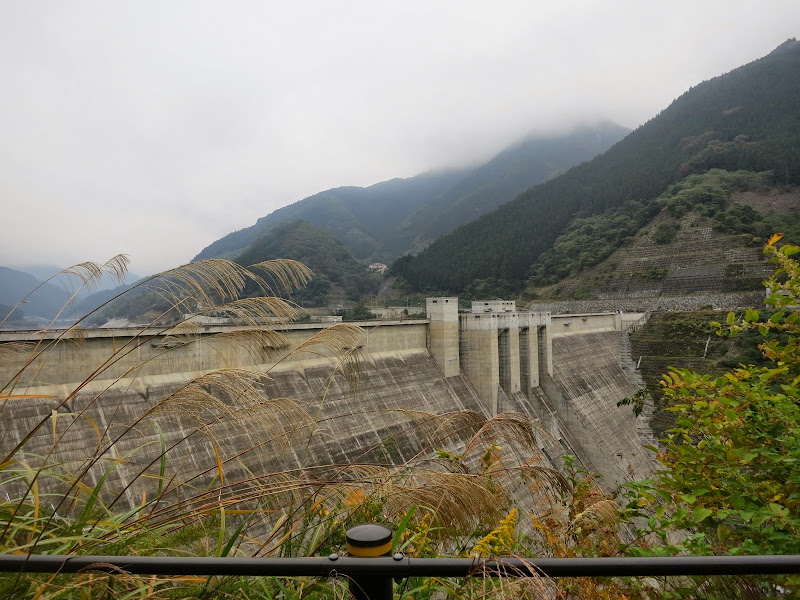
At the lake and dam:
It got a little more colourful as elevation increased:

Working to prevent rock slides:

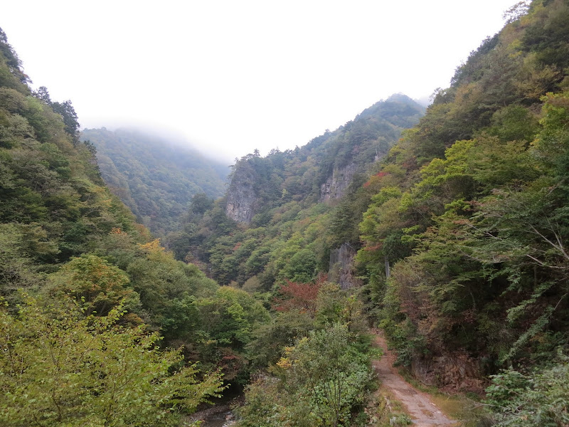
Following the river:

View from in front of the lower tunnel:
It was only 14 C by then and I was rushing against daylight. I wanted to at least reach the upper tunnel by sunset.
I periodically topped up charge on my GPS and phone (for the map), but suddenly and without any warning my phone went dark. I had to power it up again from scratch. Unsurprisingly for the location, it came up without network connection. I launched Google Maps but soon the phone lost power again. I repeated this a few times, then gave up on it. Basically, once you're past the lower tunnel, you can't get really lost as long as you follow the road, turn right at the Rt299 junction and then follow the signs to Chichibu (秩父). It was still disconcerting: If I had a major technical problem or accident on my own, I could not alert anybody. So maybe this ride was not such a smart idea

At the ruins:

Once I passed the ruins, it was already twilight. The fog of mountain top clouds got thicker and thicker. I got to the tunnel around 17:30. Passing through it, it seemed much longer than I remembered it. On the other side it was dark. No twilight, only night and thick fog. The temperature was down to 10 C.
I changed into my winter jacket and put on my rain pants, using the bicycle headlight. It took me half an hour to descend the 7 km from the tunnel to the Rt299 junction because of limited visibility in the night time fog, which I experienced as a slight drizzle as I moved through it. Twice I startled deers in the darkness and one small animal (could have been a tanuki) fled from the road.
I was much relieved when I turned on to 299 and the fog lifted as I descended. I passed the first villages and 18 km from the Rt299 junction found the first convenience store. Coffee and food time, yeah!
Somehow the GPS missed the speed sensor signal when I started up again (weak button cell in the sensor?) and the next 12 km went unrecorded, until I manually resumed when I noticed it. Strava counted 10 km as the crow flies while RWGPS missed the gap altogether.
The route back to Chichibu is well signposted, so not having the map on the phone wasn't a problem. I arrived at Seibuchichibu station around 20:35 and caught a Red Arrow to Ikebukuro at 21:25. I tried charging the phone again and it started working again. Not sure what gremlin (or ghost) had gotten into it near the ruins. Maybe a dodgy phone battery. I slept on the train, reassembled the bike at Ikebukuro and then cycled home to Setagaya, getting back to the house just after midnight. It was a very long day, but I'm glad to have extended my "Century ride (160+ km) a month" series to 26 months (Sep 2012-Oct 2014), regardless of how Saturday's 200 km brevet goes.
I'll be leaving for the US on Sunday, but would like to try the route again when I get back, this time with an earlier start from Chichibu to avoid the night ride on the mountain, which wasn't really much fun. The leaves should be great by then. We would just need some sunshine for
nice autumn pictures like last year
