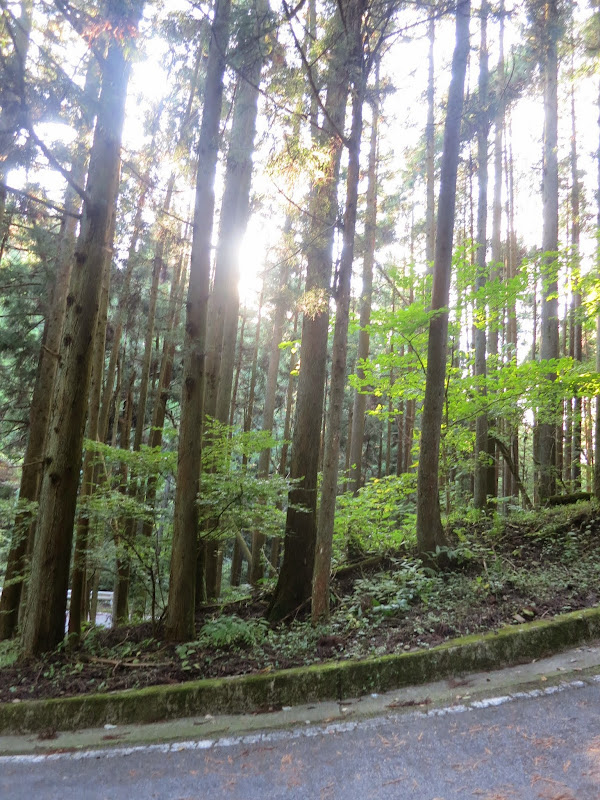
(continued from above)
A couble of km down beyond the top, the route took a detour to the "Kintaro yuhi no taki" ("Kintaro evening sky waterfall"), where AJ Nishi-Tokyo staff was taking care of us with a barbecue.

I was greeted by Maya, a senior cyclist who I'd met at the Izu brevet in March. She and her husband always had time for picture stops or talking to people, which I really liked. She recounted her latest adventure, a 1200 km brevet from the Netherlands through Germany and Austria to Italy, that she rode in September.

I had to head on for the final third of the course. While it didn't have any climbs as long as the ones in Akiyama, Tsuru-Kawaguchiko or Ashigara toge, it was a constant up and down. Hill after hill after hill. The bits in between that were in towns had traffic lights and lots of cars. When I had arrived at the barbecue place, I was about an hour ahead of the cutoff time. When I headed on, I was on my own and not sure how I would be doing with all those hills and traffic.
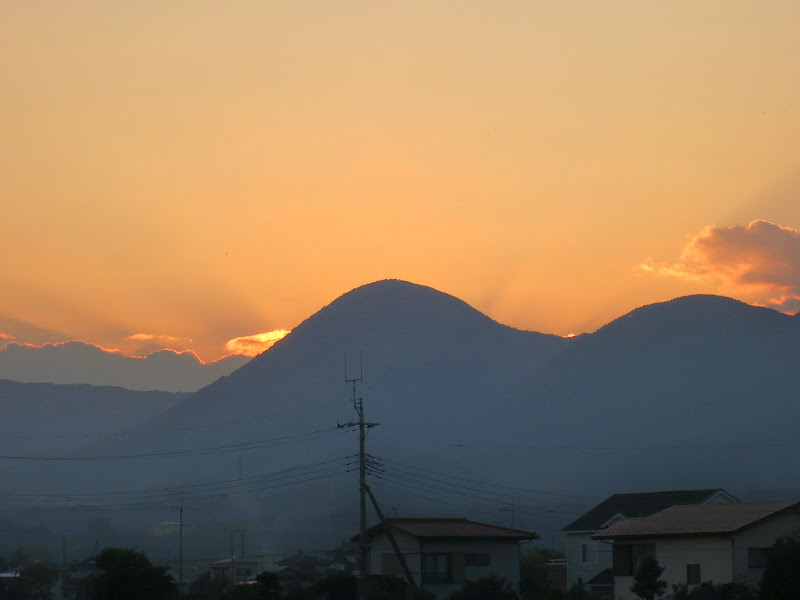
Near Matsuda I was passed by another cyclist as I was taking pictures of the sunset and finally glimpsed a view of the top of Mt Fuji (snow covered at this time of the year).

As it got dark I finally put on my wind breaker against the chill. Navigating became more of a challenge, as I always had to activate the backlight of either the phone or GPS to view a map. A few times I didn't bother and overshot a turn, having to back up to where I should have turned. Until then I knew that my GPS distance readout was 6 km ahead of the cue sheet distances for turns and check points (due to the 6 km ride from the station to the start). That arithmetic no longer worked.
After passing one Circle K convenience store with a cyclist outside, I decided to check the cue sheet. My distance read-out was 8 km past PC3, which was supposed to be a Circle K. So I went inside and bought some French toast. The woman at the counter talked to me how hard it was to cycle 200 km and I knew I was in the right place. This was PC3 and I had almost missed it! I exchanged a few words with my fellow randonneur, who was feeling cold off the bike.
Not far down the road we met again at a traffic light. We were both feeling our legs by then. He stayed behind me for the next 30 km, as I was navigating for us by my Android now, climbing hill after hill together. I knew the time buffer had melted with the hills, traffic and navigation errors. That was getting me a little worried. I managed to avoid any more wrong turns, but the hope that the route would flatten out as we got closer to Machida was dashed again and again. My fellow cyclist later told the staff that I kept speeding up further and further as we neared Machida.
I wasn't quite sure how we were on time, but looking at the displayed route on the map and the time of day, I reckoned we would perhaps finish with no more than 10 minutes spare on a 13 1/2 hour course limit, which is not much margin for error. Finally, as we were going full steam ahead on Rt508, still about 5 km from Cherubim, we passed a convenience store with several cyclists in reflective randoneur vests outside and somebody called out: "Joe-san!" SoI stopped and turned back. I had almost cycled past the finish!
It was only then that my foggy brain remembered that the cue sheet covered a distance of 206 km, with the finish at a convenience store 201 km into the course -- 5 km before the finish reception at Cherubim! It had been explained to us at the briefing, but the brain will do strange things after hours of intense cycling. The timing stopped here and we had finished the 201 km course in under 13 hours, with 35 minutes spare. Yeah!
I went inside to buy an item for a receipt to present at the finish desk, where the brevet card and all the evidence are checked. A coup of freshly brewed coffee seemed like a well deserved choice. Sipping it, I chatted to brevet staff and fellow riders. My companion and I had been the last participants on the course, so PC3 could close after us. We cycled the final 5 km to Cherubim at a relaxed pace. After having out cards and receipts checked, I had some refreshments and talked to more people.

The staff returned my train bag, which I had dropped off with them before the event, but I decided not to use it and instead cycle back to Setagaya via Onekansen. Near Noborito I came across another randonneur on his way home and rode with him for a few km. I got home around 23:00, with 242 km of distance and 3010 m of climbing, as measured by Strava.

This concludes my 2014 brevet season. My next event probably will be in February of 2015. Next year I'll take another shot at finishing all 4 categories and thus SR status, even though at the moment 400 and 600 km within the time limit still seems way out of my league.