With Saturday's ride, 60 consecutive months (5 years) of "A Century A Month" are now complete!
August is the peak typhoon season. We can have pouring rain any time. On Saturday it was mostly overcast, but I never felt a raindrop. Meanwhile, Yakushima island, where I had been hiking the weekend before, was being battered by the storm, with power outages. It had taken my legs 4 complete days to recover from the 11 hour hike to Jomon Sugi, the 7000 year old tree in the center of the island, but I felt OK on Saturday.
I was going to do a loop through the mountains of Saitama west of Tokyo and announced it in a closed Facebook ride planning group the day before, but nobody decided to join me, so I felt a bit more adventurous and changed the course to try out a mountain road I had never done before.
Normally when I cycle to Chichibu I take the Yamabushi Toge pass (about 600 m / 2,000 ft elevation), but this time I took the turn-off for Arima dam, planning to climb to Arima Toge pass (about 1,100 m / 3,600 ft), then descend to Urayama dam. There were very few cars and almost no bicycles.
I had not downloaded the route to my Navi2Coach GPS and the route was mostly out of cell phone reach. At one campground I followed what I thought was the main road. After several km of climbing there was a barrier across the road but I slipped the bike underneath. A guy walking his dogs there asked me if I was going to climb here. "Yes, to the pass and down to the dam the other side," I replied.

But as I continued I encountered another barrier, behind which the road turned to dirt and gravel. And that dirt was wet, which made it so slippery that often it was impossible to start after a stop because the rear wheel would slip on the steep climb. I would have to push to a shallower part to remount the bike. This continued for a few km until I finally hit a spot with mobile phone reception again. According to the map, I was still 14 km (9 mi) from the pass at basically walking speeds on a very sketchy road. I decided I must have taken a wrong turn and turned back. Descending on the wet mud and gravel was a bit easier, at least I didn't have to get off and walk.
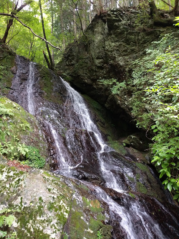
Back near the last camp ground I checked the map again and found where I had gone wrong. In total I did about 8 km (5 mi) of detour with about an extra 350 m (1,200 ft) of climbing. It was another 11 km (7 mi) to the pass, most of it at about 9%. Once I reached 1000 m it kind of leveled off, but there were no views. The pass was stuck in the clouds, which looked like fog from close-up.

I put on my wind breaker because it got a little cool, especially in my sweat-soaked jersey. At the other side it was a pretty comfortable 18 km (11 mi) descent, still with virtually no traffic. I reached Urayama lake and followed the road through a tunnel to the dam. I washed my upper body at the public restrooms next to the dam, then descended into Chichibu.
Welcome back to convenience store land, with hot coffee and all kinds of food!
Looking at how much distance I had covered so far (105 km) and the time, I decided that my original route back to Tokyo or a flatter but longer alternative both would take me far into the night. So I decided to head back via Yamabushi toge, the pass on which I had originally planned to ride here. It was my most predictable route back.
I made it back to Oume on the outskirts of Tokyo before sunset, from there it was another three hours until home. I got back at 21:45 and picked up a curry at the local Nepalese take-out before I rolled up to my front door, with 200 km (124 mi) for the day.