It was great to read about your experiences, I would like to start the challenge on May, so here goes...
Did a loop yesterday on the northern part of my country, Costa Rica. The route I planned was very mountainous and with a lot of elevation changes. Basically I went from the central inter-mountainous valley that sits around 1000 meters above see level (3280 feet) across a section of mountains that tops at 2100 meters/6889 feet and from there a big descent to some undulating terrain that drops until 157 meters/515 feet. From there the fun part begins, getting out of there: I had at least 3 options, I chose the longest one but with the more forgiving climb. The other 2 options entailed climbs of around 30 kms with constant gradient and almost no rest during the ascend. Another negative side of my decision was that at the feet of the climb I chose the temp was high: 35 Celsius/95 F, short climbs of about 3-5 kms but with ramps of 12%-16%, then some descent to rest and the same recipe during approximately 35 kms. Even after finishing that climb I still had several small peaks to manage until I reach back my home. I feared the rain because rainy season is starting over here but I was lucky and got just a drizzle by the end of the ride in the afternoon.
Some pics:
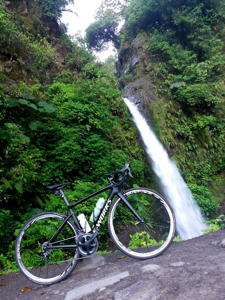 Catar�ta La Paz
 by
Abraham Cyrman, on Flickr
^ km 44, early in the ride I had already reached the highest point but still a looong way to go.
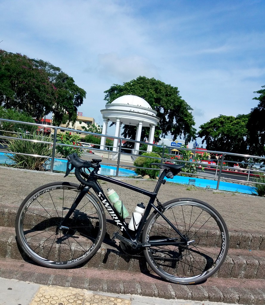 Parque Ciudad Quiesada
 by
Abraham Cyrman, on Flickr
^ km 99, almost half-way
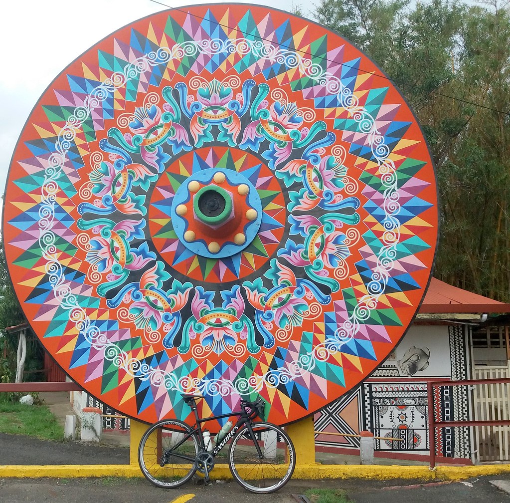 Sarch�
 by
Abraham Cyrman, on Flickr
^ km 181, feeling mentally better because I was closer to finishing. The town where I took that pic is famous for crafting ox carts with wheels painted like that huge wheel.
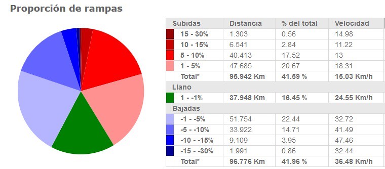 rampas
 by
Abraham Cyrman, on Flickr
^ this is an analysis of the inclination of the road during the ride, sorry it�s in Spanish and kms, I took it from the Spanish webiste
cicloide.com Red is for climbs, green flat terrain and blue descents...do you know of a website in English that give this type of analysis?
Distance 142 miles (229 kms)
Elevation 16909 feet (5154 meters)
Avg speed 13.6 mph (21.9 kph)
Moving time 10:28
Elapsed time: 11:13
Bike: Specialized Tarmac SL6
strava
More than the distance I am proud about the total elevation of this ride: 5154 meters/16909 feet. This is actually my best from all time and I think it would be very hard to improve it any time soon.
Hope you like the post, be well,