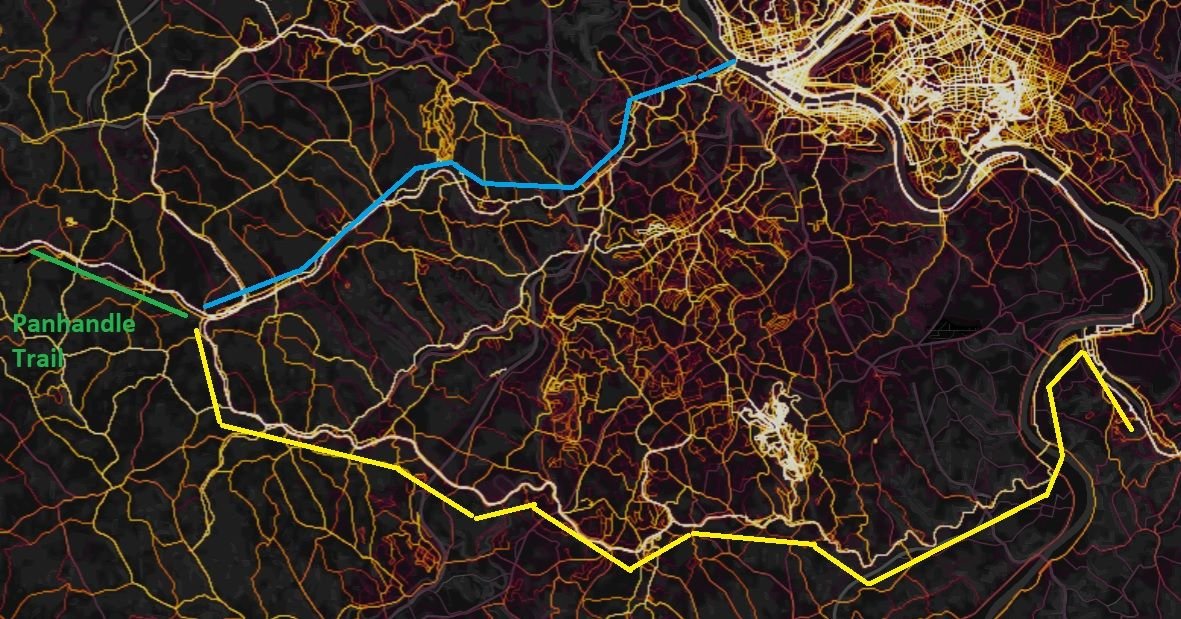
Those that have experience on the GAP around Pittsburgh - if coming from the west via connecting cycling routes - what is a
better route* to the GAP?
North in to Pittsburgh to the official northern terminus - traced roughly in blue, or;
South to cross the Clairton-Glassport Bridge - traced roughly in yellow?
*
As to what constitutes a "better route":
I don't have any experience with that area, from a cycling/touring perspective. I don't really have a good definition, however some ideas for basing a suggestion off of:
- History, museums, attractions, etc
- Scenery
- Elevation
- Trail conditions
- Perspective of fully self-supported touring (IE - not light/fast credit card touring)
- Safety - crime/problem areas to avoid
At first look of the route - I would be tempted to hit the northern terminus. However, the heat map shows a more traveled route down south. From experience with routing suggestions from the heat map - I can't trust what it shows on face value because the routes from another area of the country I rode in for years were road routes with a lot of traffic that bypassed and paralleled a long-distance trail route. My goal is to stick to trails/bike routes, but there is no way to easily differentiate what the heat map shows - and that is where local/first hand knowledge shines. However, one thing is for sure - if there is a "hot route" there is a reason for it. That is exactly what I am getting at with this post - those that have been on these routes - can you shed light on the reasons? And what can you offer on why to choose one or the other? Or another that I didn't highlight?