Originally Posted by
mschwett
yes. you're correct. the issue with the terrain models is actually not so simple - they are precise in the sense of repeatability - if you project the same 2d coordinate onto the model you will of course always get exactly the same result. but the frequency of sampling of the underlying data is very poor, which makes it inaccurate in a way that could also be described as imprecise. not in the sense of repeatability but in the sense of "
lacking exactness and accuracy of expression or detail." (per the definition of imprecise.)
in addition to the lack of spatial resolution, when the data is generated by remote sensing (as it usually is) things like trees, buildings, etc can make the sampled point just completely inaccurate. combine that with the low resolution, possible inaccuracy of the placement of the road on the map, the user's GPS position on the map, which may or may not be snapped to the road... and it's actually surprising to me that they aren't off by even MORE!
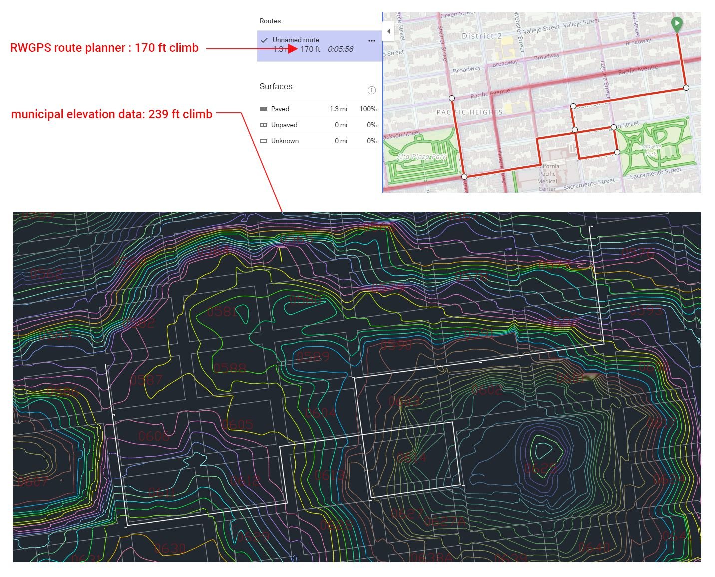
here's an example of a couple block spin around my neighborhood. RwGPS terrain model thinks it's a 1.3 mile segment with 170 feet of climbing. it's actually 1.25 miles (no way to know if RwGPS knows that but is just rounding...) and 239 feet of climbing. the actual vertical gain is almost 41 percent more! i've seen errors like this all over the place, with both strava and RwGPS, but there aren't all that many places in the world that "good" data is easy to come by.
How did you accumulate vertical gain from the municipal data? How often did you sample?
When calculating vertical gain, the length of your ruler has a significant impact on the answer. Even if your elevation data are perfect.