Originally Posted by
njkayaker

More detail might explain some of this. Garmin is using the same data* (Openstreetmap/OSM) as the alternative sources. The rail trail extension issue seems like the Garmin map isn't as up-to-date.
Here's a recent example. The inset is what the Edge thought we should do - take a sharp left off the waterway trail on "Unnamed Road" (or something like that) then a right on to Ocala Rd. Turns out that Unnamed Road shown with red dots on the Google Earth picture is really a drainage ditch with a fence all the way across it.
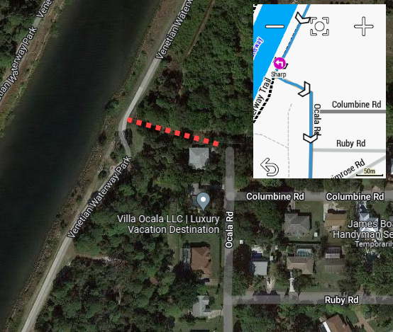 Garmin wants us to hop a fence and ride the drainage canal.
I sent in a report to Garmin with coordinates and gpx file a few months ago for the rail trail thing, guess the correct answer to that is "just wait longer!"