Garmin makes several different models of GPS that are general recreation that you can buy the optional GPS mount for handlebar.
The one I use is a Garmin 64, no longer sold but I think some of the 64 family are still sold as new old stock. I also use a 62S that has been out of production for several years. I know several randonneurs that use a Garmin Etrex GPS but I do not know exactly what model they use. You can put micro sized SD memory cards into some of these GPS units to hold extra maps.
Those GPS units use AA batteries. I use Ikea Ladda NiMH 2450 rechargeable AA batteries. Backpacking, I get about a day and a half on a pair of batteries, I carry as many spares as I think I may need. Bike touring, I recharge the batteries on my bike with a dynohub, but that is off topic.
Garmin also makes some Li Ion powered GPS units, but I am ignorant of those models.
These GPS units have to be plugged into a computer to load a RWGPS route or to load maps.
Maps are available from a couple of sources, but you need some computer skills to load the maps into the GPS. Example of two sources of maps that I have used are:
- For bike maps,
https://extract.bbbike.org/
- For topo maps that can be loaded into a Garmin GPS for backpacking,
https://www.gmaptool.eu/en/content/u...-topo-routable
But the above listed topo maps, they changed their formatting recently, and I had to go through a lot of hoops and hurdles to load them into my GPS. Much more complicated than I would want to try to explain. And the topo maps from that source, the topo lines are in metric increments and are not very close together.
NJKayaker on this forum might have some good suggestions, he is knowledgeable on this topic, but if you lack some computer skills, that might not be very helpful. Loading some of the maps from free internet sources is often from websites that are not very user friendly if your computer skills are not really good.
My Garmin 64, in use, below, photo is four years old on a bike tour:
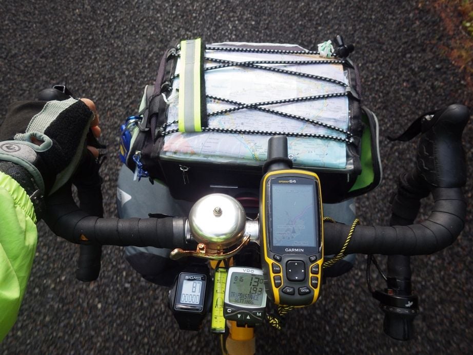
I have on several occasions not gotten my GPS into the handlebar mount quite right (user error), thus I was really happy that I used a tether cord on the GPS to keep it from falling on the ground. If you get a GPS like this, I suggest a tether, my tether in the photo above is the yellow and black cord.
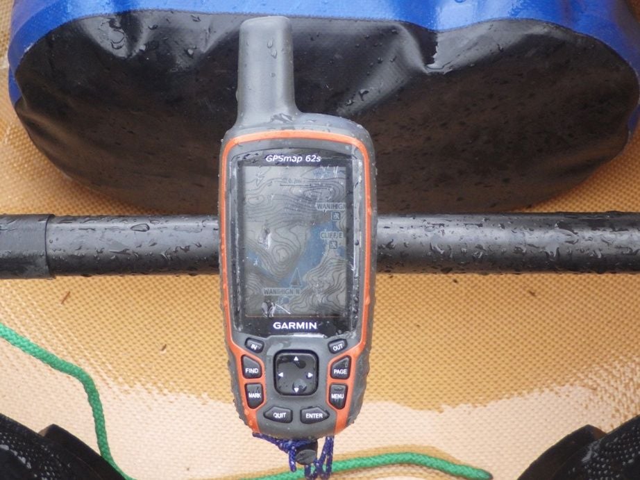
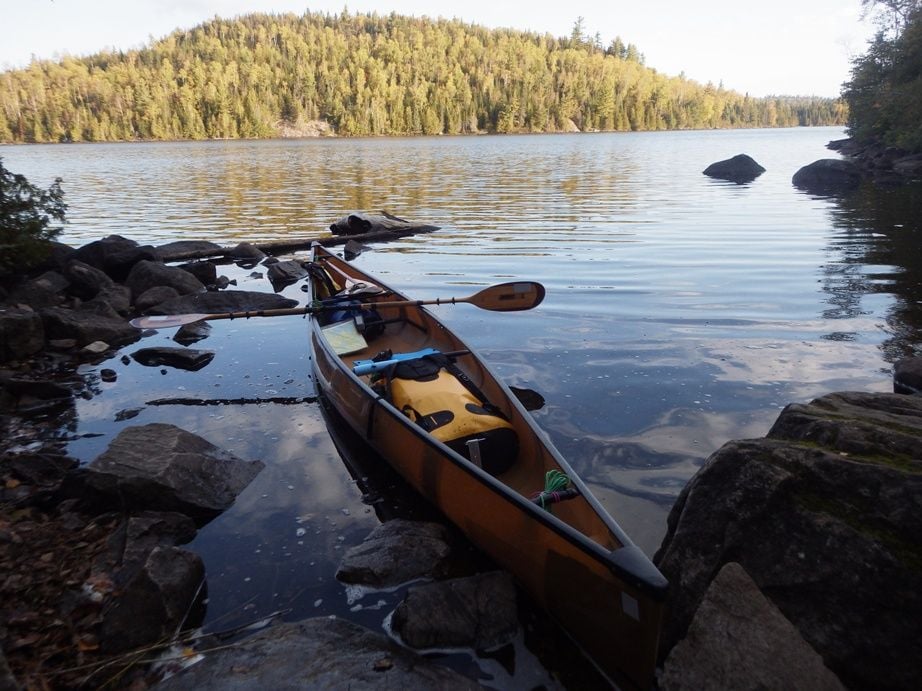
I use the older Garmin 62S for backpacking and canoe trips, but the 64 would work just as well. The 62S is mounted on my foot brace in my solo canoe using a handlebar mount, but it is a bit hard to see in this one year old photo.
This year I used the Garmin 62S for 11 days of backpacking on the Superior Hiking Trail. My older 62S I think has some internal damage and sometimes it shuts off, when it finally dies I will chuck it and use the 64. Garmin no longer repairs that model.
I recently (last month) bought a used Garmin 64 ST on Ebay for when my 62S or 64 finally die. That included a better topo map that was loaded at the factory.
If you live near an REI store, you could ask them what models would meet your needs. But they are probably not going to be able to help with loading free maps from the internet.
ADDENDUM:
Added photo of my 62S mounted on the foot brace of my canoe.