I like paper maps for the big picture. Like Jamawani, I like to spread the map out on the picnic table at camp to plan several days ahead. I prefer digital tools for close up detail. Komoot shows intricate detail when you zoom in close, however it's vague at the wide level.
RWGPS has the irritating habit of obscuring local road names and numbers with its red route highlight. Details are not visible until you zoom way in ...
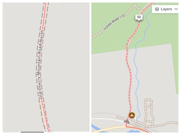 RWGPS
RWGPS
Even on a highway. US 302 is hidden by the red line ...
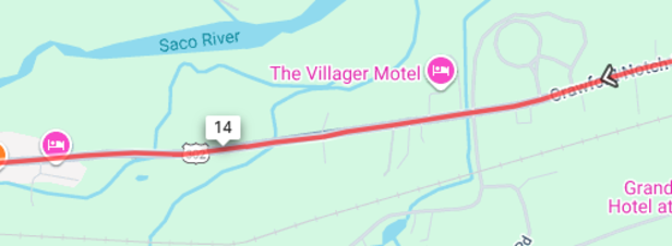 RWGPS
RWGPS