Originally Posted by
BobG
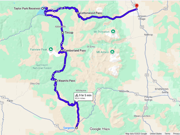
In 1983 I joined a long group road tour from Durango CO to Jasper AB. I left the group for two days near Monarch Pass to do this gravel side trip. Lots of climbing ... Cumberland Pass is 12,000' plus. Cottonwood Pass is now paved from Taylor Park to Buena Vista (red balloon). It was gravel in'83. I can't make RWGPS or Komoot work to map it. I'm sure you can!
 Taylor Park Reservoir
nice pictures!
in another version I have the the road from Buena Vista over Cottonwood Pass and on to Almont - Gunnison included, but I thought its too much tarmac, also not sure about the motorised traffic there. Your version south looks interesting. But then from from Sargents on on the Highway 50? Looks like traffic. ... or not?