I had a vacation day, so I figured I�d go exploring the Trinity Trail in Fort Worth, and just to make it more interesting, I went over by way of bike, DART and the Trinity Rail Express.
I left the house at 5:50 to try to make it to the Garland DART station for the 6:20 train.
I got on the DART train and they informed us that DART rail service was interrupted between Mockingbird and Union Station, and that they were running a bus shuttle between those places. So on the bus I went, after a considerable delay. Turns out, DART buses are not made for bikes, especially the ones with only the front door. But, I finally made it to Union Station, got on a TRE that only went as far as Centreport, waited there, and caught one of the silver units on to Fort Worth.
I discovered that the double-decker TRE train actually had a couple of Thule bike racks in it. They looked too flimsy to actually hold my bike, but the thought was good. This was in the car closest to the engine, but I don�t know if all the trains are like that. In contrast, the silver units have steep stairs, and are very awkward with a bike.
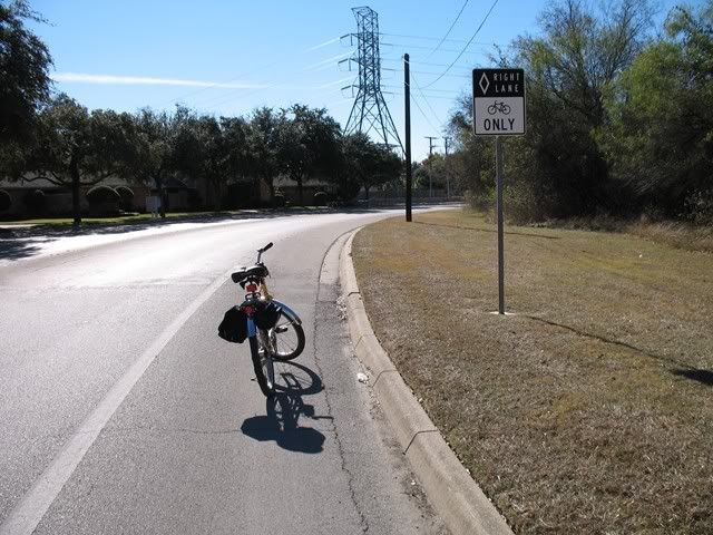
In Fort Worth, I went to the Intermodal Transport Center downtown. From there, I took Jones Street north to 3rd Street, and went east on 3rd (which turns into 4th). I crossed the Trinity River, went down to the parking lot and trail. Looking at the map, I discovered I needed to be on the trail on the other side, so I went back across the bridge, lifted my bike over a closed barricade and off I went. Later, I discovered that I should have just ridden across the dam here. 3rd Street was shown as a �bike route� on the trail map, and both Jones and 3rd were pretty decent for riding.
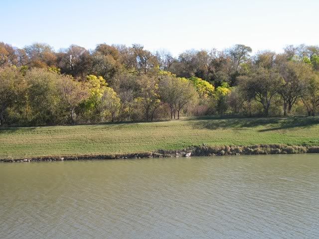
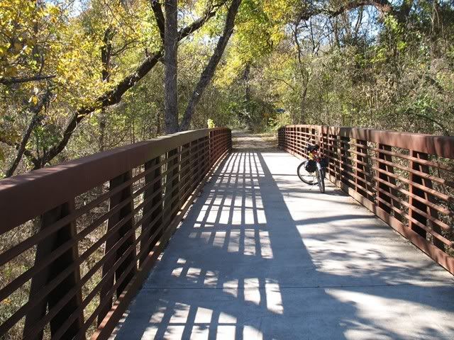
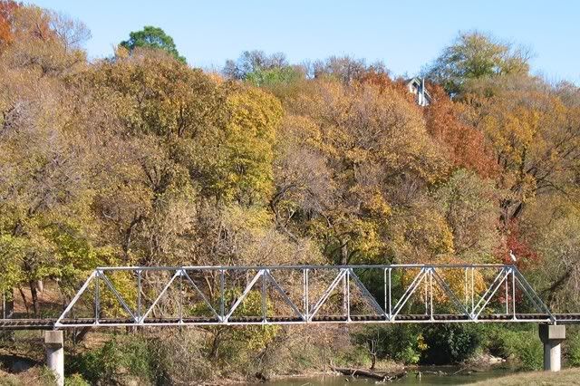
The Trinity Trail has a good mix of landscapes. You get the skyline views, a bit of nature in the right areas, urban parks, etc.
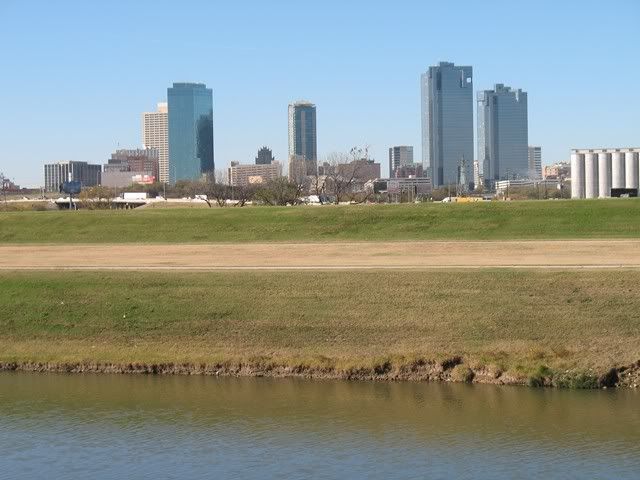
Even though it�s December, there is still quite a bit of green still to be seen.
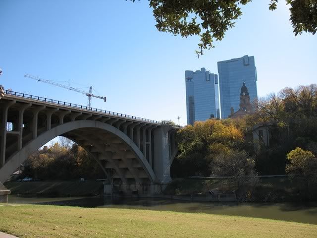
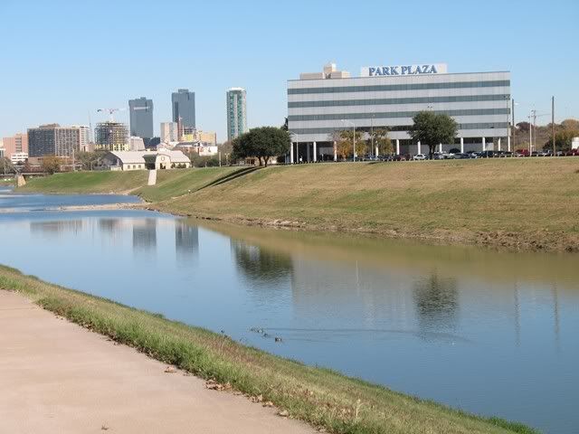
This is the old courthouse and Heritage Park area on the north side of downtown. I started on the east side of town, when up and around and back down the west side of town.
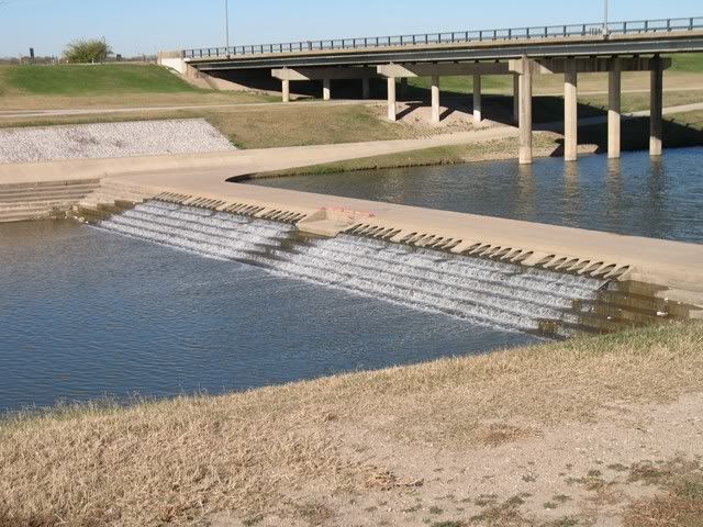
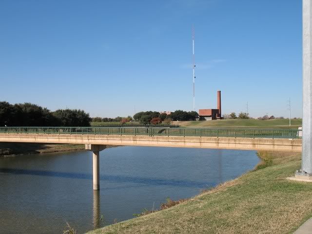
Another river crossing, with an old power plant in the background.
One thing I couldn�t figure out from the aerial photos was what happened to the trail at 183. Turns out ,the trail ends there- there is actually a post that says �finish� by the little parking area. But, if you go 100 yards back north, you can go across the river, and come out on Bellaire Drive, which has wide marked bike lanes. The Trinity Trails map shows this route as part of the Trinity Trail.
I followed Bellaire Drive on down until I saw trail signs again, right before River Bend Drive. So I took off on that trail. It was nice. The signs show that you enter two or more different parks on this section of trail.
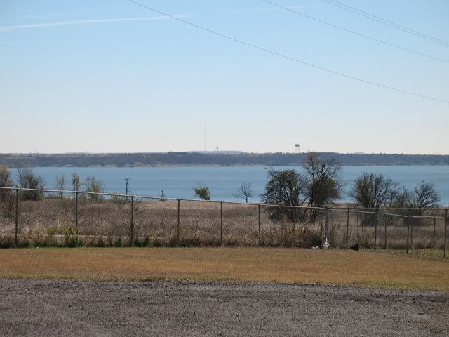
That trail came to an end at a trailhead. I wanted to get to Benbrook Lake just to say I had been, and I was hungry (no breakfast, and it was lunch time), so I continued up Memorial Oaks Drive to Winscott Road, went west on it to Hwy 377, and finally found sustenance at a Subway. This added another mile and half to the route. This was the end of my trail and I turned back here. I did spot Benbrook Lake on the way back. There is actually a beach area, although it was closed for some reason.
On the way back, I spotted this cute little bridge, for the miniature railroad by the zoo.
Shot coming back up the river.
I got back to the Intermodal Transportation Center and had a few minutes, so I circled around some Fort Worth blocks. It�s actually pretty easy to get around by bike there, although it helps if you know where you�re going. Traffic was light (at 3:00 in the afternoon) and generally slow.
Some additional notes on the Trinity Trail. The trail itself is in good condition. All the parts I rode on were paved, either concrete or asphalt, although are are some gravel sections elsewhere. There are minor rises and dips but the trails tend to be pretty level as they are following the river. A lot of the trail is fairly exposed, so you�ll feel the wind or sun in those areas.
The trail is very poorly marked for users. There are really no signs anywhere telling you where you need to go, or which branch leads where. Take a map if you�re not familiar with the trail. It�s easy to follow along on the different roads and railroads you encounter with a map. There are occasional trailheads and signs with maps, but none of these tell you where you are at- no big �you are here� dots, so the maps there are fairly useless. And the trailheads don�t generally have any kind of identification at the trail to tell you which trailhead or which road you�re at. Additionally, there are few warning signs for hazards, at least not until you get on that section down by Benbrook.
While a normal cyclist can make it around the trails with no problem, there are places where you could have problems, especially with little kids. On some of the river crossings, you go down a ramp and make a right angle turn- miss the turn and you�re in the river or on the rocks. There are one or two dips and low clearance spots that should be marked There are places where the trail is right at the top of a slope leading down to the river. You�re 30� or more from the river, but if you ever leave the trail at speed, you�re liable to get wet before you get stopped.
When you�re on the trail, you don�t have access to many stores or restaurants, and of course the lack of signage makes this worse. I think you can get to some places on University, or go to Benbrook like I did. People more familiar with the trail probably know other spots. There are a few porta-potties along the trail, but I noticed the one on 4th street didn�t have any toilet paper- maybe take a travel size with you. There are water fountains in places. It was pretty cold when I was out, but the fountains I tried were still operable- very commendable.
A map of the trail system is here:
http://www.trinityrivervision.org/We...ytrailsmap.swf
I had trouble getting this to print right, so if possible, request a printed version in advance.