Did this ride with DC Rand today. It started in Marshall, VA:

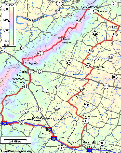
Some of the route looks like it may have come from BikeWashington.org:
http://www.bikewashington.org/routes/bluerdg/index.htm
It was only 22 deg F at the beginning of the ride. My iBike's wireless mount died within the first hour of riding. It wasn't until the first rest break that I had a chance to put in a fresh battery and that seemed to do the trick.
Anyway, the ride went up past Mt Weather.
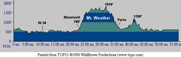
There was about 8,500ft total of climbing according to Chuck's GPS. I was able to cobble together from my iBike the elevation profile for 85 of the 99 miles ridden. The climb up Mt Weather is missing from the profile, though: