


Wellfleet. White Crest Beach to Duck Pond. the long way
 08-15-21, 07:51 PM
#1
Senior Member
Thread Starter
Join Date: Jul 2008
Location: 25 miles northwest of Boston
Posts: 29,549
Bikes: Bottecchia Sprint, GT Timberline 29r, Marin Muirwoods 29er, Trek FX Alpha 7.0
Mentioned: 112 Post(s)
Tagged: 0 Thread(s)
Quoted: 5224 Post(s)
Liked 3,581 Times
in
2,342 Posts
Wellfleet. White Crest Beach to Duck Pond. the long way
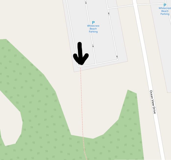
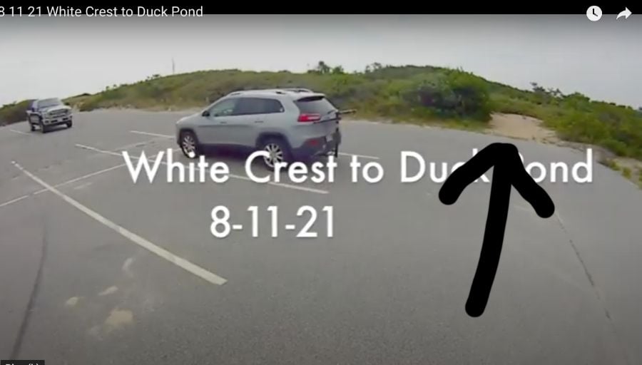
not sure I really want to share these favorite special places. so let's just keep this one under our collective hats, shall we? not a great video maker but I'll enjoy watching this during the winter months. they usually look better small, I think, like on a phone, but full screen on my computer at home is good. just not sure what youtube will deliver. so hot, so humid & I didn't have it in my legs that day. cudda been so many things. but it was an epic 5 hrs I'll remember & maybe tackle again. or maybe just part of it
such a rich area for riding. when I was younger, used to go 4-wheeling on most of these same trails, & many others in the area. now it's fun but harder to ride them on a bike. 40 yrs older doesn't make it easier either
Last edited by rumrunn6; 08-15-21 at 08:05 PM.

Likes For rumrunn6:
08-16-21, 01:34 PM
#2
Senior Member

Join Date: Jun 2016
Location: Boston Roads
Posts: 975
Bikes: 2012 Canondale Synapse 105, 2017 REI Co-Op ADV 3.1
Mentioned: 14 Post(s)
Tagged: 0 Thread(s)
Quoted: 507 Post(s)
Liked 237 Times
in
133 Posts
I always wondered about those trails, and the unpaved, unnamed roads on the other side of 'the highway'
https://www.openstreetmap.org/#map=14/41.9516/-70.0167
Lots you can learn from scouting online maps but as my recent experience in NH shows, even something marked as a rail trail could be completely unrideable on thinner tires due to a fresh unpacked dirt/sand surface so local eyes are always helpful
Likes For autonomy:
08-16-21, 07:47 PM
#3
Senior Member
Thread Starter
Join Date: Jul 2008
Location: 25 miles northwest of Boston
Posts: 29,549
Bikes: Bottecchia Sprint, GT Timberline 29r, Marin Muirwoods 29er, Trek FX Alpha 7.0
Mentioned: 112 Post(s)
Tagged: 0 Thread(s)
Quoted: 5224 Post(s)
Liked 3,581 Times
in
2,342 Posts
I always wondered about those trails, and the unpaved, unnamed roads on the other side of 'the highway'
https://www.openstreetmap.org/#map=14/41.9516/-70.0167
Lots you can learn from scouting online maps but as my recent experience in NH shows, even something marked as a rail trail could be completely unrideable on thinner tires due to a fresh unpacked dirt/sand surface so local eyes are always helpful
https://www.openstreetmap.org/#map=14/41.9516/-70.0167
Lots you can learn from scouting online maps but as my recent experience in NH shows, even something marked as a rail trail could be completely unrideable on thinner tires due to a fresh unpacked dirt/sand surface so local eyes are always helpful
but wow! someone or group of ppl really worked hard on that!
I've poked around a lot of the old Jeep trails w/ various 4x4s even my Chevy Citation but exploring the single tracks on a bike has been a whole new fun project. last summer I explored the cliff trails in Wellfleet & Truro but also some over by the bay
Last edited by rumrunn6; 08-16-21 at 08:04 PM.
Likes For rumrunn6:
08-17-21, 07:19 AM
#4
Senior Member
Join Date: Jun 2016
Location: Boston Roads
Posts: 975
Bikes: 2012 Canondale Synapse 105, 2017 REI Co-Op ADV 3.1
Mentioned: 14 Post(s)
Tagged: 0 Thread(s)
Quoted: 507 Post(s)
Liked 237 Times
in
133 Posts
oh wow! what an amazing map site! thank you! I was able to zoom in & identify exactly most of the trails I took, because it's fresh in my memory. I have photos of specific intersections. I can circle them or number them & then post a photo of the exact spot. also, you know I looked at the back end of the parking lot for a trail starting there & I saw some sandy patches but they didn't look like entry points. maybe they evolved & closed up. I might look again
There's also a cycle layer https://www.openstreetmap.org/#map=1....0418&layers=C
And this cool site that shows 'relations' - routes: https://cycling.waymarkedtrails.org/....4251!-71.1964
TrailForks is a good resource too but it's more MTB-oriented with actual official trails: https://www.trailforks.com/region/un...&lon=-70.00443
08-17-21, 04:06 PM
#5
Senior Member
Thread Starter
Join Date: Jul 2008
Location: 25 miles northwest of Boston
Posts: 29,549
Bikes: Bottecchia Sprint, GT Timberline 29r, Marin Muirwoods 29er, Trek FX Alpha 7.0
Mentioned: 112 Post(s)
Tagged: 0 Thread(s)
Quoted: 5224 Post(s)
Liked 3,581 Times
in
2,342 Posts
Wait, you didn't know about OSM? It's open-source mapping, anyone can add/modify things. I've been adding/improving trails for a while! It can be hit-or-miss in terms of actual access (overgrown, sometimes private, etc.). Lots of services uses the underlying maps, OsmAnd is a great smartphone app for example.
There's also a cycle layer https://www.openstreetmap.org/#map=1....0418&layers=C
And this cool site that shows 'relations' - routes: https://cycling.waymarkedtrails.org/....4251!-71.1964
TrailForks is a good resource too but it's more MTB-oriented with actual official trails: https://www.trailforks.com/region/un...&lon=-70.00443
08-18-21, 06:40 PM
#6
Senior Member
Thread Starter
Join Date: Jul 2008
Location: 25 miles northwest of Boston
Posts: 29,549
Bikes: Bottecchia Sprint, GT Timberline 29r, Marin Muirwoods 29er, Trek FX Alpha 7.0
Mentioned: 112 Post(s)
Tagged: 0 Thread(s)
Quoted: 5224 Post(s)
Liked 3,581 Times
in
2,342 Posts
 07-14-22, 06:12 PM
#7
Senior Member
Thread Starter
Join Date: Jul 2008
Location: 25 miles northwest of Boston
Posts: 29,549
Bikes: Bottecchia Sprint, GT Timberline 29r, Marin Muirwoods 29er, Trek FX Alpha 7.0
Mentioned: 112 Post(s)
Tagged: 0 Thread(s)
Quoted: 5224 Post(s)
Liked 3,581 Times
in
2,342 Posts
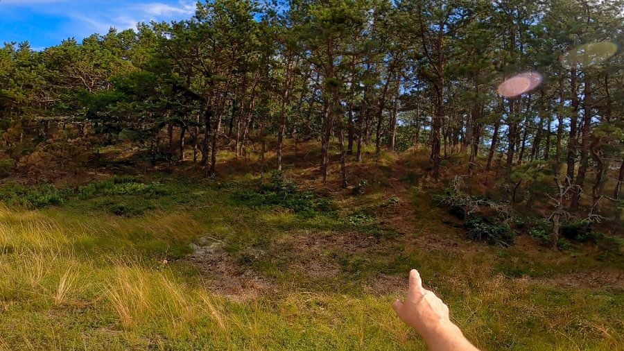
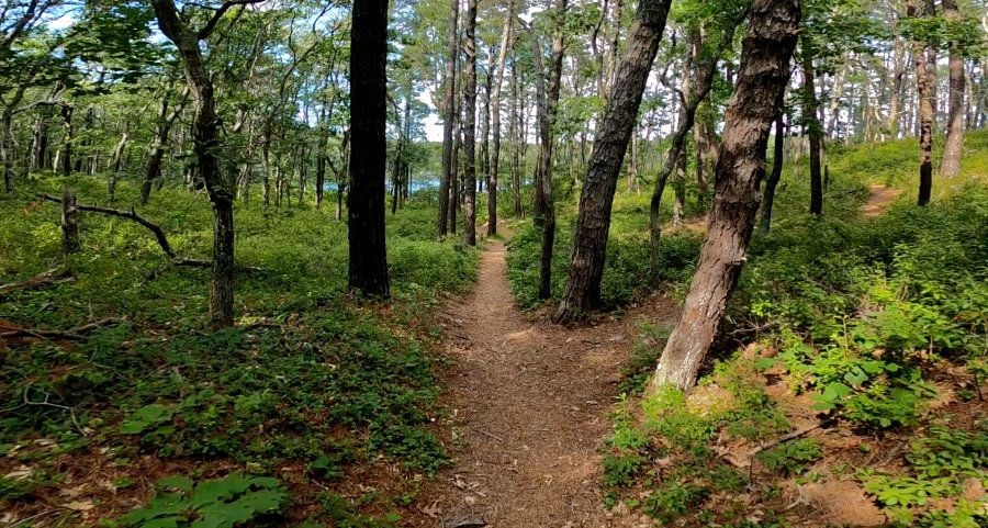
got back out there the beginning of this week. just down the road from White Crest, a friend rented a house. a 20 minute ride of approx. 2 miles, each way. enjoyed perfect weather, hot, sunny, breezy, not killer hot & humid. the soft spots were softer than I remembered

most of it is easily rideable w/ soft 2.25" tires, w/ sandals & bathing suit

thought it would be tricky spotting the turn off the railroad grade, but nope. recognized it right away. added some sticks to mark it but not necessary

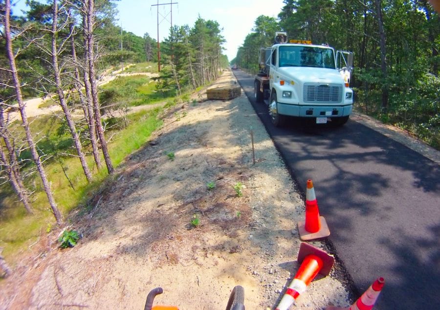
steep slide down to cross the power-line trails
the last stretch
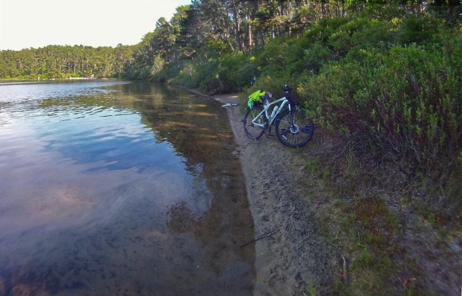
a long time favorite. we sit on the other side, when coming by Jeep
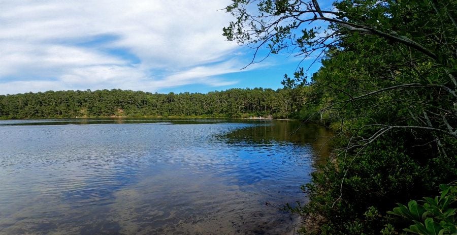
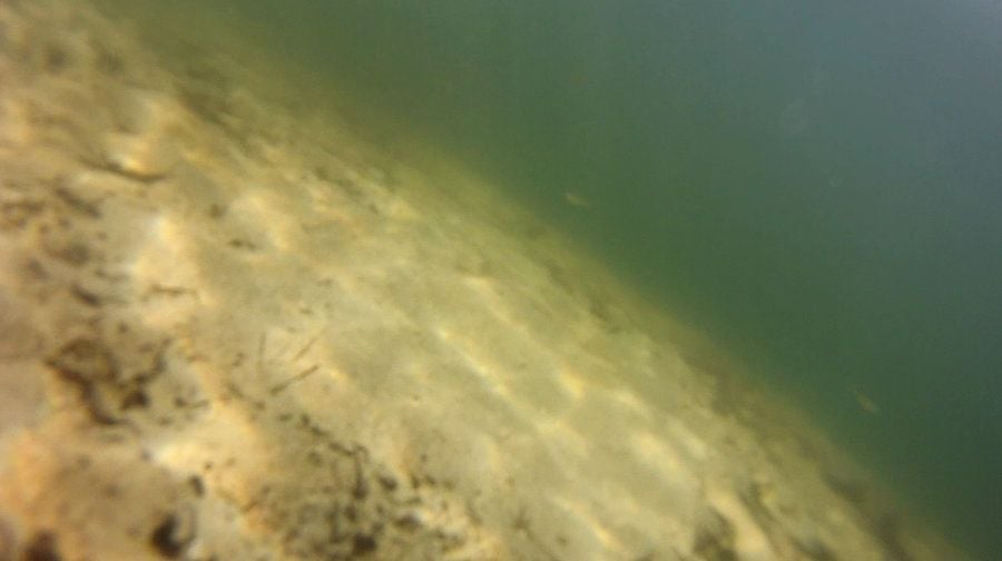
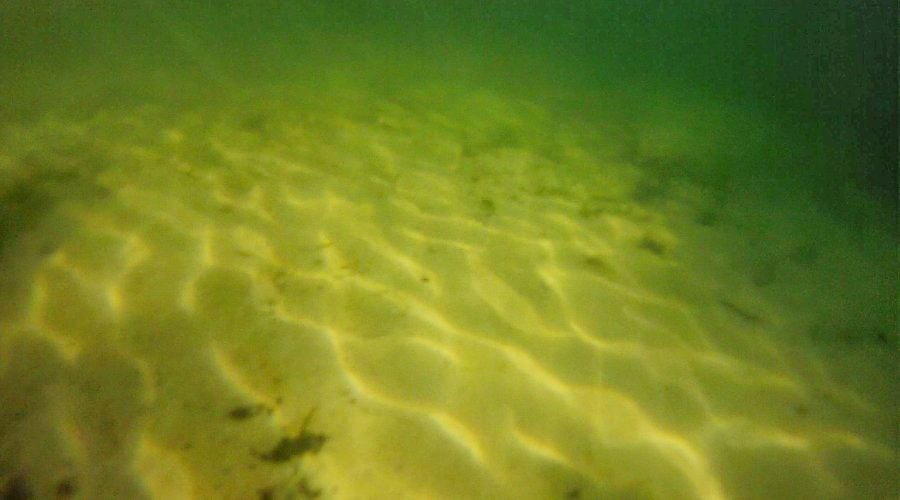
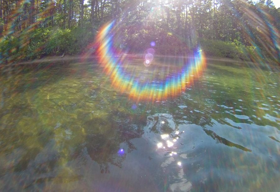
water was luscious
this side is shady in the afternoon
most of it is easily rideable w/ soft 2.25" tires, w/ sandals & bathing suit
thought it would be tricky spotting the turn off the railroad grade, but nope. recognized it right away. added some sticks to mark it but not necessary
steep slide down to cross the power-line trails
the last stretch
a long time favorite. we sit on the other side, when coming by Jeep
water was luscious
this side is shady in the afternoon
Last edited by rumrunn6; 07-24-22 at 07:54 PM.
07-18-22, 04:06 PM
#8
Senior Member
Join Date: Jun 2016
Location: Boston Roads
Posts: 975
Bikes: 2012 Canondale Synapse 105, 2017 REI Co-Op ADV 3.1
Mentioned: 14 Post(s)
Tagged: 0 Thread(s)
Quoted: 507 Post(s)
Liked 237 Times
in
133 Posts
I'm excited! I have been to Wellfleet only a handful of times (rail trail, riding through on the way to PTown), never enough to explore, but I just booked a weekend in August at the Wellfleet Hollow Campground which is apparently a new tent-only state-owned campground (woohoo, this opens up a good option for a bikepacking tour to PTown - only 20 miles away or so for a lazy last day plus mileage from ferry).
Definitely bringing bikes, going to explore some of these spots with my daughter. Apparently the CCRT has been extended right to the campground! Post up some more of your secrets!
Definitely bringing bikes, going to explore some of these spots with my daughter. Apparently the CCRT has been extended right to the campground! Post up some more of your secrets!
Likes For autonomy:
07-18-22, 05:51 PM
#9
Senior Member
Thread Starter
Join Date: Jul 2008
Location: 25 miles northwest of Boston
Posts: 29,549
Bikes: Bottecchia Sprint, GT Timberline 29r, Marin Muirwoods 29er, Trek FX Alpha 7.0
Mentioned: 112 Post(s)
Tagged: 0 Thread(s)
Quoted: 5224 Post(s)
Liked 3,581 Times
in
2,342 Posts
I'm excited! I have been to Wellfleet only a handful of times (rail trail, riding through on the way to PTown), never enough to explore, but I just booked a weekend in August at the Wellfleet Hollow Campground which is apparently a new tent-only state-owned campground (woohoo, this opens up a good option for a bikepacking tour to PTown - only 20 miles away or so for a lazy last day plus mileage from ferry).
Definitely bringing bikes, going to explore some of these spots with my daughter. Apparently the CCRT has been extended right to the campground! Post up some more of your secrets!
Definitely bringing bikes, going to explore some of these spots with my daughter. Apparently the CCRT has been extended right to the campground! Post up some more of your secrets!

how many secrets can one pack into a weekend? let me quote my Daughter: "no Daddy, we can't, that's too much fun!"
that campground is intriguing. the website says a lot!
these weird little rides are pretty secret
Last edited by rumrunn6; 07-18-22 at 05:59 PM.
Likes For rumrunn6:
07-23-22, 12:58 PM
#10
Senior Member
Thread Starter
Join Date: Jul 2008
Location: 25 miles northwest of Boston
Posts: 29,549
Bikes: Bottecchia Sprint, GT Timberline 29r, Marin Muirwoods 29er, Trek FX Alpha 7.0
Mentioned: 112 Post(s)
Tagged: 0 Thread(s)
Quoted: 5224 Post(s)
Liked 3,581 Times
in
2,342 Posts
or save yourself some agony & watch the sped up short version, approx. 5min.
Last edited by rumrunn6; 08-07-22 at 05:34 PM.
08-12-22, 12:06 PM
#11
Senior Member
Join Date: Jun 2016
Location: Boston Roads
Posts: 975
Bikes: 2012 Canondale Synapse 105, 2017 REI Co-Op ADV 3.1
Mentioned: 14 Post(s)
Tagged: 0 Thread(s)
Quoted: 507 Post(s)
Liked 237 Times
in
133 Posts
Didn't get to explore as much, but quality over quantity!

The new end of CCRT is looking fresh. However, right after that it gets extremely sandy - fine dust mixed with sand, was a challenge even for my 2" tires. My daughter was not a fan, so it was push-a-bike for us
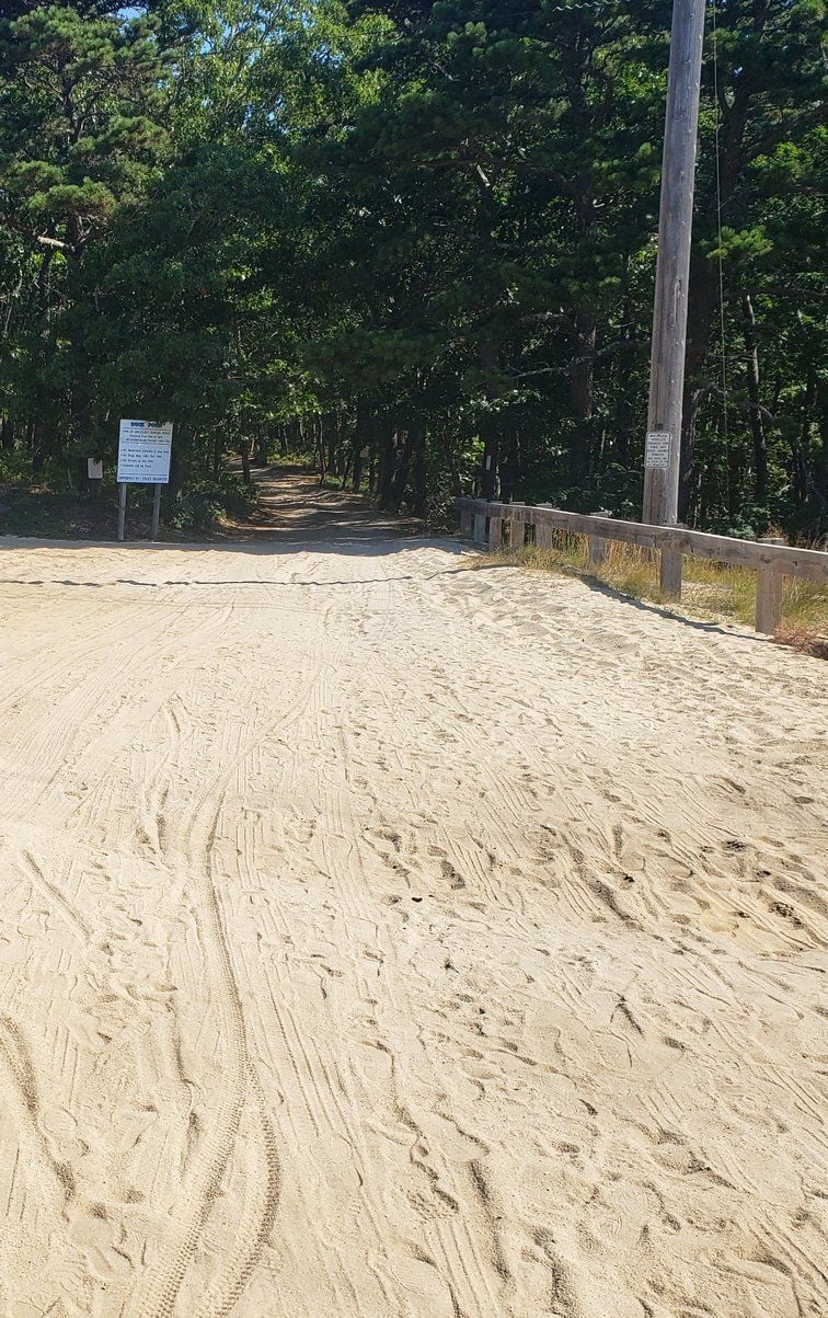
Sandy turn to Duck Pond

Duck Pond was awesome!
I managed not to take any pictures of our campground, probably because we didn't actually spend much time there. Sites are small and kind of close together but super quiet and Cape-quaint.
The new end of CCRT is looking fresh. However, right after that it gets extremely sandy - fine dust mixed with sand, was a challenge even for my 2" tires. My daughter was not a fan, so it was push-a-bike for us
Sandy turn to Duck Pond
Duck Pond was awesome!
I managed not to take any pictures of our campground, probably because we didn't actually spend much time there. Sites are small and kind of close together but super quiet and Cape-quaint.
08-12-22, 12:26 PM
#12
Senior Member
Thread Starter
Join Date: Jul 2008
Location: 25 miles northwest of Boston
Posts: 29,549
Bikes: Bottecchia Sprint, GT Timberline 29r, Marin Muirwoods 29er, Trek FX Alpha 7.0
Mentioned: 112 Post(s)
Tagged: 0 Thread(s)
Quoted: 5224 Post(s)
Liked 3,581 Times
in
2,342 Posts
Didn't get to explore as much, but quality over quantity!
The new end of CCRT is looking fresh. However, right after that it gets extremely sandy - fine dust mixed with sand, was a challenge even for my 2" tires. My daughter was not a fan, so it was push-a-bike for us
Sandy turn to Duck Pond
Duck Pond was awesome!
I managed not to take any pictures of our campground, probably because we didn't actually spend much time there. Sites are small and kind of close together but super quiet and Cape-quaint.
08-12-22, 12:31 PM
#13
Senior Member
Join Date: Jun 2016
Location: Boston Roads
Posts: 975
Bikes: 2012 Canondale Synapse 105, 2017 REI Co-Op ADV 3.1
Mentioned: 14 Post(s)
Tagged: 0 Thread(s)
Quoted: 507 Post(s)
Liked 237 Times
in
133 Posts
Went right after breakfast just to see what it's like, ended up staying for an hour before heading out to the ocean! Weather was fantastic all weekend long, HUGE lines in the evening at the local fried seafood places (PJs and Mac's)
08-12-22, 12:39 PM
#14
Senior Member
Thread Starter
Join Date: Jul 2008
Location: 25 miles northwest of Boston
Posts: 29,549
Bikes: Bottecchia Sprint, GT Timberline 29r, Marin Muirwoods 29er, Trek FX Alpha 7.0
Mentioned: 112 Post(s)
Tagged: 0 Thread(s)
Quoted: 5224 Post(s)
Liked 3,581 Times
in
2,342 Posts
great great love PJs & the beach comber on the dune, but yeah dealing w crowds has to be managed creatively
07-19-23, 07:17 PM
#15
Senior Member
Thread Starter
Join Date: Jul 2008
Location: 25 miles northwest of Boston
Posts: 29,549
Bikes: Bottecchia Sprint, GT Timberline 29r, Marin Muirwoods 29er, Trek FX Alpha 7.0
Mentioned: 112 Post(s)
Tagged: 0 Thread(s)
Quoted: 5224 Post(s)
Liked 3,581 Times
in
2,342 Posts
will be in striking distance, just not sure where
