


Bike friendly fire roads in Los Angeles and surrounding areas
 03-14-21, 06:47 PM
#1
Senior Member
Thread Starter
Join Date: Dec 2020
Location: Los Angeles
Posts: 919
Mentioned: 0 Post(s)
Tagged: 0 Thread(s)
Quoted: 446 Post(s)
Liked 1,045 Times
in
442 Posts
Bike friendly fire roads in Los Angeles and surrounding areas
I was wondering if there's a definitive way to find out which fire roads/trails are open to bikes in Los Angeles and surrounding areas? I've noticed some fire roads and trails merely prohibit motor vehicles, but there's no mention of bicycles being prohibited. Some trails have signs that specifically prohibit bicycles at the trail head such as in Griffith Park. I don't ride crazy or anything, I just want to enjoy some trail riding at the appropriate places. I'm presuming that there would be specific signs that would prohibit bicycles if they weren't allowed. Thanks for any feedback or resources.
 03-14-21, 07:31 PM
#2
Senior Member
Join Date: Oct 2006
Location: Orange County, CA
Posts: 4,770
Mentioned: 11 Post(s)
Tagged: 0 Thread(s)
Quoted: 630 Post(s)
Likes: 0
Liked 369 Times
in
206 Posts
It's trail specific. Best bet is to look at the heat maps:
https://www.strava.com/heatmap#13.08....13917/hot/all
https://www.strava.com/heatmap#13.08....13917/hot/all
Likes For Elvo:
03-16-21, 02:19 PM
#4

Senior Member
Cycling is not permitted on any trail in LA City Parks, especially Griffith Park.
Likes For Tycho Brahe:
03-16-21, 04:49 PM
#5
Senior Member
Join Date: May 2017
Location: Hacienda Hgts
Posts: 2,109
Bikes: 1999 Schwinn Peloton Ultegra 10, Kestrel RT-1000 Ultegra, Trek Marlin 6 Deore 29'er
Mentioned: 3 Post(s)
Tagged: 0 Thread(s)
Quoted: 822 Post(s)
Liked 1,961 Times
in
944 Posts
Schabarum Park-Turnbull Canyon, Chino Hills State Park 20-30 miles east of LA City.
03-20-21, 12:15 PM
#6
Junior Member

Join Date: Jun 2018
Location: L.A.
Posts: 139
Bikes: Giant Anyroad
Mentioned: 1 Post(s)
Tagged: 0 Thread(s)
Quoted: 44 Post(s)
Likes: 0
Liked 33 Times
in
22 Posts
Many amazing fire roads to explore in the LA area - all accessible to bikes Some of the fire roads in the San Gabriels are designated for OHV use (Shortcut, Rincon et al), but are also fine for riding. Others seem to be restricted, like for example Mt Lukens, which you access through the fire station and pass a sign that says "do not enter" or similar. Redbox, Rincon, Shortcut are now designated as recovering burn areas and have restrictions posted, though myself and others still ride or hike them. Mt. Pacifico from Chilao might state that the area is closed, but that refers to a winter closure for camping. Verdugo Mtns,, Santa Monica Mtns, Dirt Mulholland > Topanga are all good to go. Mt Wilson Toll Road is now difficult to access because of Covid restrictions for access to the Eaton Cyn trail head, but where theres's a will theres a way. Good luck
03-22-21, 11:13 AM
#7
Full Member
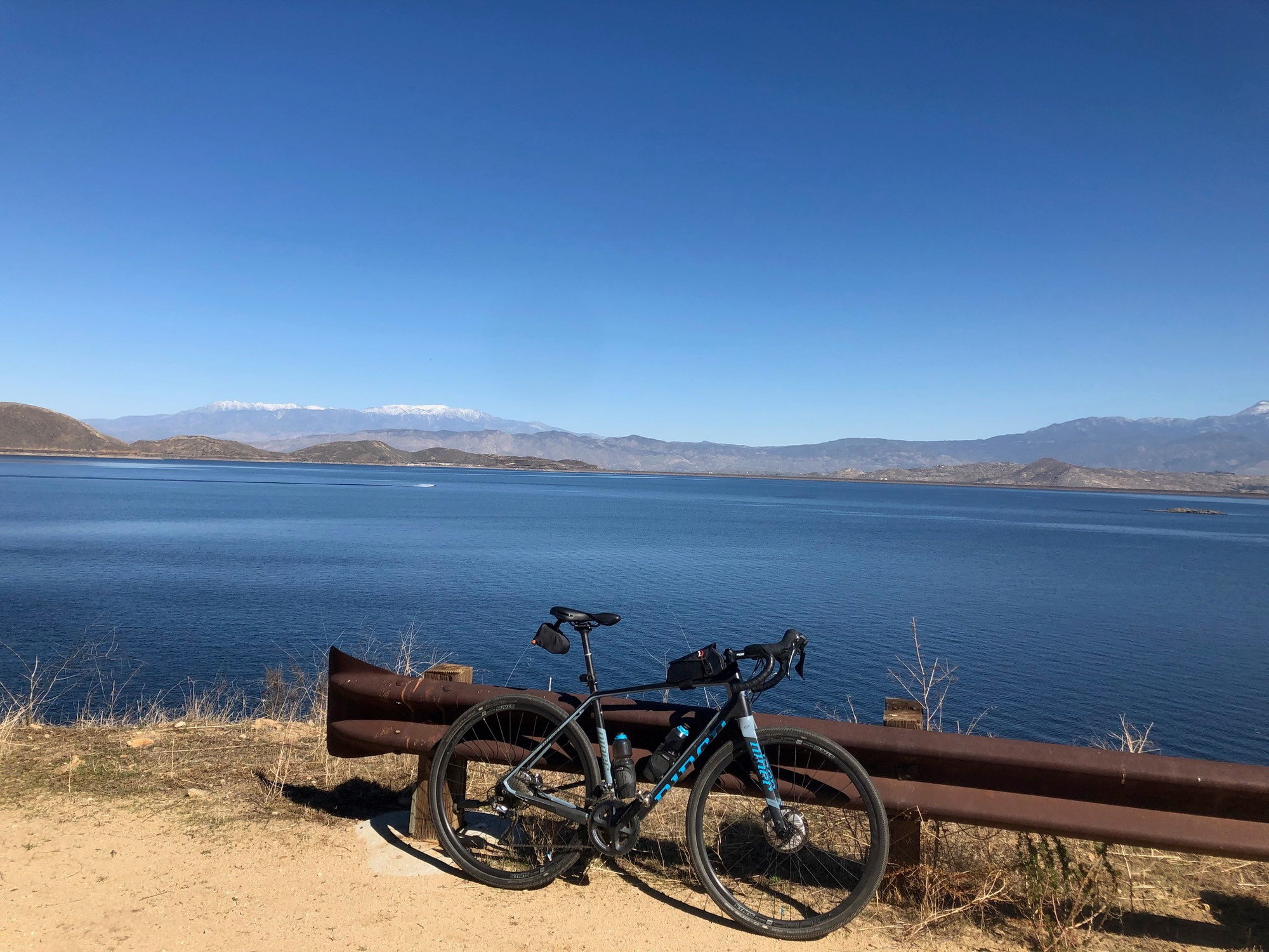
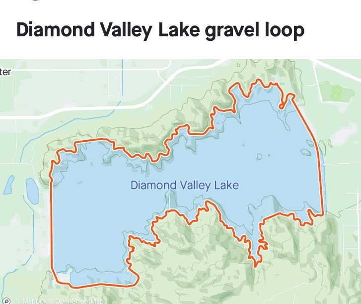
Take a drive out to Hemet and ride the great 21 mile gravel fire road loop around Diamond Valley Lake. Just go before May when it's suddenly uninhabitable and 110 degrees!
Likes For csrpenfab:
03-22-21, 01:06 PM
#8
Senior Member
Thread Starter
Join Date: Dec 2020
Location: Los Angeles
Posts: 919
Mentioned: 0 Post(s)
Tagged: 0 Thread(s)
Quoted: 446 Post(s)
Liked 1,045 Times
in
442 Posts
That's another thing, I'm trying to get as much biking in before temperatures start getting too hot, not to mention potential fires later in the summer.
03-22-21, 01:11 PM
#9
Full Member
Join Date: Jul 2013
Location: Southern California
Posts: 492
Bikes: Historical: Schwinn Speedster; Schwinn Collegiate; 1981 Ross Gran Tour; 1981 Dawes Atlantis; 1991 Specialized Rockhopper. Current: 1987 Ritchey Ultra; 1987 Centurion Ironman Dave Scott Master; 1992 Specialized Stumpjumper FS
Mentioned: 1 Post(s)
Tagged: 0 Thread(s)
Quoted: 209 Post(s)
Liked 178 Times
in
111 Posts

I myself like the SMMNRA (Santa Monica Mountains National Recreation Area), if that's still it's name. Unlike LA Recreation and Parks properties, anything under that label is legal to ride. Look for the dirt Mulholland ride, and any of the fire roads that spur off of that. You can even go see the old Nike rocket base at the top of Mandeville canyon. Back in the day when I lived on the West side, I'd ride on my knobbies from my house up to Sullivan or West Ridge, and then hit the dirt. Helluva warmup. You can always bail off down into Sullivan Canyon before you hit the top, but there's a very nasty climb at the end of that to get to dirt Mulholland and connect back to whichever ridge you want to go down.
Likes For Chinghis:
03-22-21, 01:13 PM
#10
Senior Member
Join Date: May 2017
Location: Hacienda Hgts
Posts: 2,109
Bikes: 1999 Schwinn Peloton Ultegra 10, Kestrel RT-1000 Ultegra, Trek Marlin 6 Deore 29'er
Mentioned: 3 Post(s)
Tagged: 0 Thread(s)
Quoted: 822 Post(s)
Liked 1,961 Times
in
944 Posts
Good youtube videos from this guy will give you a lot of options in SoCal:
https://gravelbikecalifornia.com/
Also do a search on the Old Ridge Route on the SoCal sub-forum.
https://gravelbikecalifornia.com/
Also do a search on the Old Ridge Route on the SoCal sub-forum.
Likes For CAT7RDR:
03-22-21, 04:16 PM
#11
velo-dilettante
Join Date: Apr 2009
Location: insane diego, california
Posts: 8,316
Bikes: 85 pinarello treviso steel, 88 nishiki olympic steel. 95 look kg 131 carbon, 11 trek madone 5.2 carbon
Mentioned: 26 Post(s)
Tagged: 0 Thread(s)
Quoted: 1628 Post(s)
Liked 3,114 Times
in
1,683 Posts
Good youtube videos from this guy will give you a lot of options in SoCal:
https://gravelbikecalifornia.com/
Also do a search on the Old Ridge Route on the SoCal sub-forum.
https://gravelbikecalifornia.com/
Also do a search on the Old Ridge Route on the SoCal sub-forum.
*edit-most of the national forest area east of the old ridge route is off limits/closed until june 1st, 2021. as best as i can (now) tell, the old ridge route itself is open to cyclists and fair game.
things look different on a desktop computer vs a cell phone.
https://www.fs.usda.gov/Internet/FSE...eprd780808.pdf
there is a map of the closure area on page 3 of the pdf. coulda sworn that the map showed the closure area extending all the way west to the 5 freeway when looking at it two months ago *rolls eyes.*
Last edited by diphthong; 03-22-21 at 04:28 PM.
03-22-21, 04:38 PM
#12
Senior Member
Join Date: May 2017
Location: Hacienda Hgts
Posts: 2,109
Bikes: 1999 Schwinn Peloton Ultegra 10, Kestrel RT-1000 Ultegra, Trek Marlin 6 Deore 29'er
Mentioned: 3 Post(s)
Tagged: 0 Thread(s)
Quoted: 822 Post(s)
Liked 1,961 Times
in
944 Posts
According to the Ridge Route Preservation website it is open to cyclists, hikers and horseback riders but there is no date stamp on the website.
Current Roadway Conditions and Status ? Ridge Route Preservation Organization
Reminds me of Hwy 39, it is only closed if CHP or LASD is parked at the gates. Travel at your own risk. No rescue is coming.
Current Roadway Conditions and Status ? Ridge Route Preservation Organization
Reminds me of Hwy 39, it is only closed if CHP or LASD is parked at the gates. Travel at your own risk. No rescue is coming.
Likes For CAT7RDR:
03-22-21, 04:49 PM
#13
velo-dilettante
Join Date: Apr 2009
Location: insane diego, california
Posts: 8,316
Bikes: 85 pinarello treviso steel, 88 nishiki olympic steel. 95 look kg 131 carbon, 11 trek madone 5.2 carbon
Mentioned: 26 Post(s)
Tagged: 0 Thread(s)
Quoted: 1628 Post(s)
Liked 3,114 Times
in
1,683 Posts
According to the Ridge Route Preservation website it is open to cyclists, hikers and horseback riders but there is no date stamp on the website.
Current Roadway Conditions and Status ? Ridge Route Preservation Organization
Reminds me of Hwy 39, it is only closed if CHP or LASD is parked at the gates. Travel at your own risk. No rescue is coming.
Current Roadway Conditions and Status ? Ridge Route Preservation Organization
Reminds me of Hwy 39, it is only closed if CHP or LASD is parked at the gates. Travel at your own risk. No rescue is coming.
old ridge route is mostly paved from the templin hwy gate to the northern terminus but the quality of pavement is such that it ends up riding more like
a fairly, well-graded dirt road. a must-do imho.
Last edited by diphthong; 03-22-21 at 05:09 PM.
