


Freetown-Fall River State Forest
 07-30-23 | 06:20 PM
#1
Thread Starter
Senior Member


Joined: Jul 2008
Posts: 30,497
Likes: 4,570
From: 25 miles northwest of Boston
Bikes: Bottecchia Sprint, GT Timberline 29r, Marin Muirwoods 29er, Trek FX Alpha 7.0
Freetown-Fall River State Forest
https://www.komoot.com/highlight/4262479
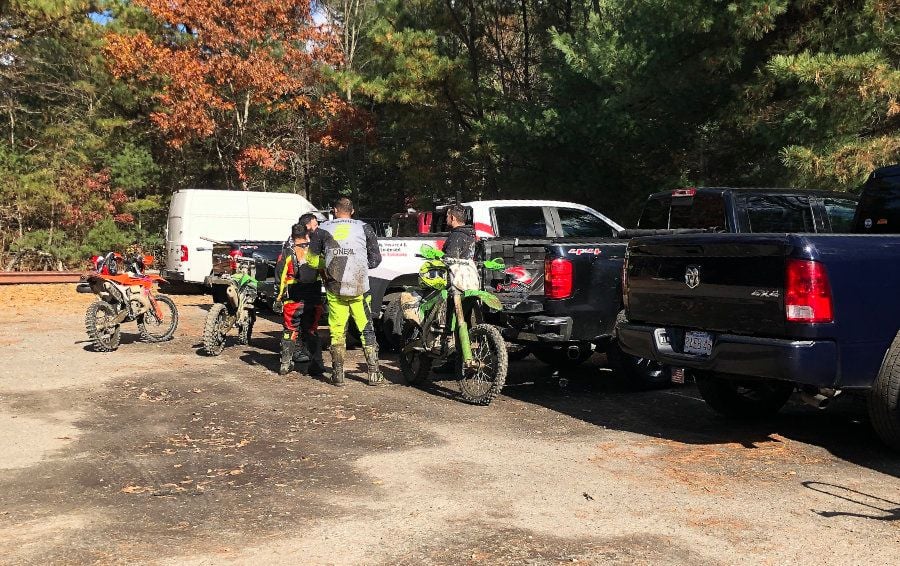
happened upon this place, by accident, after exploring the Copicut Wildlife Management Area. even tho it's a long drive for me I'll be going back. lots of trails over 5,000 acres. many roads open year round, many seasonal roads, motorized dirt bikes allowed seasonally. lots of dirt parking lots, but also several paved official parking areas. anyway, lots to explore!
https://www.mass.gov/locations/freet...r-state-forest
their map
https://www.mass.gov/doc/freetown-trail-map/download
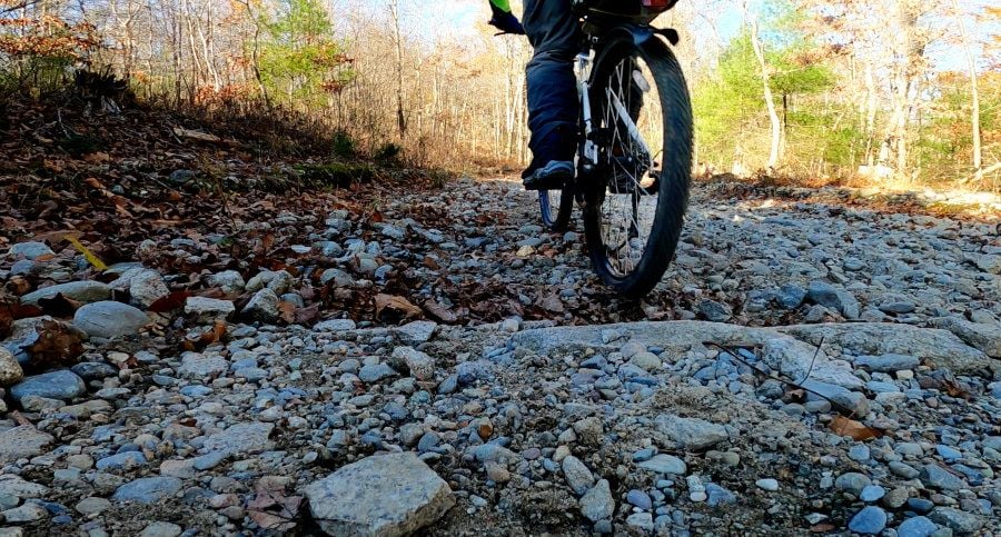
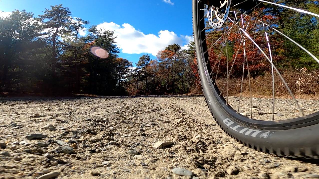
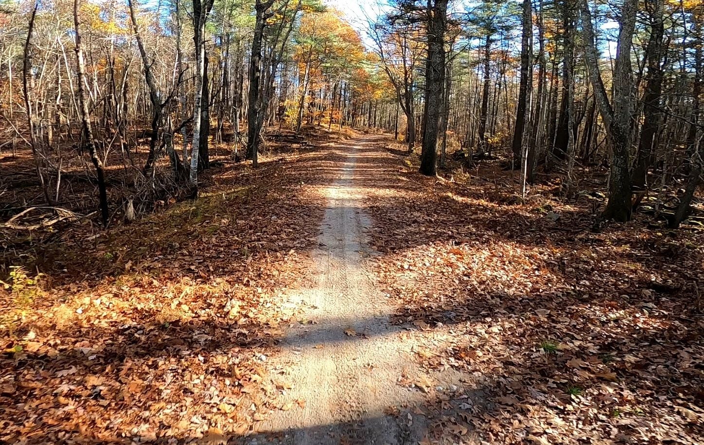
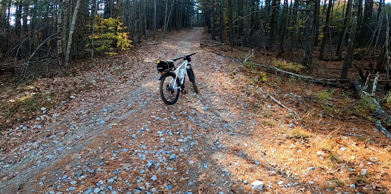
from what I could tell the ground isn't like Myles Standish, which is sandy w/ pine needles. this area is more hard packed dirt with rocks
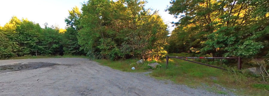
google street view by a dirt biker. this trail or road was gate closed when it was taken
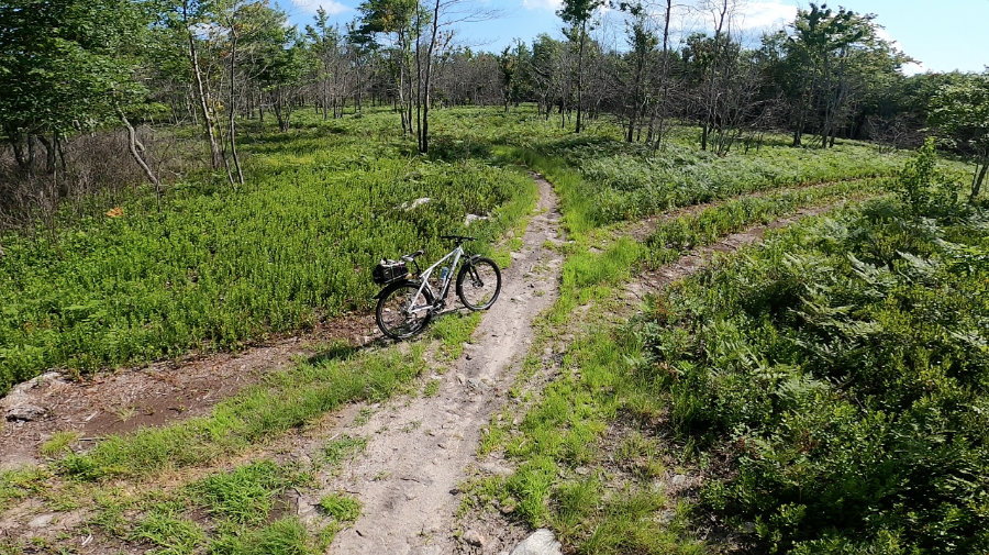
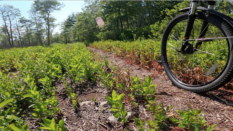
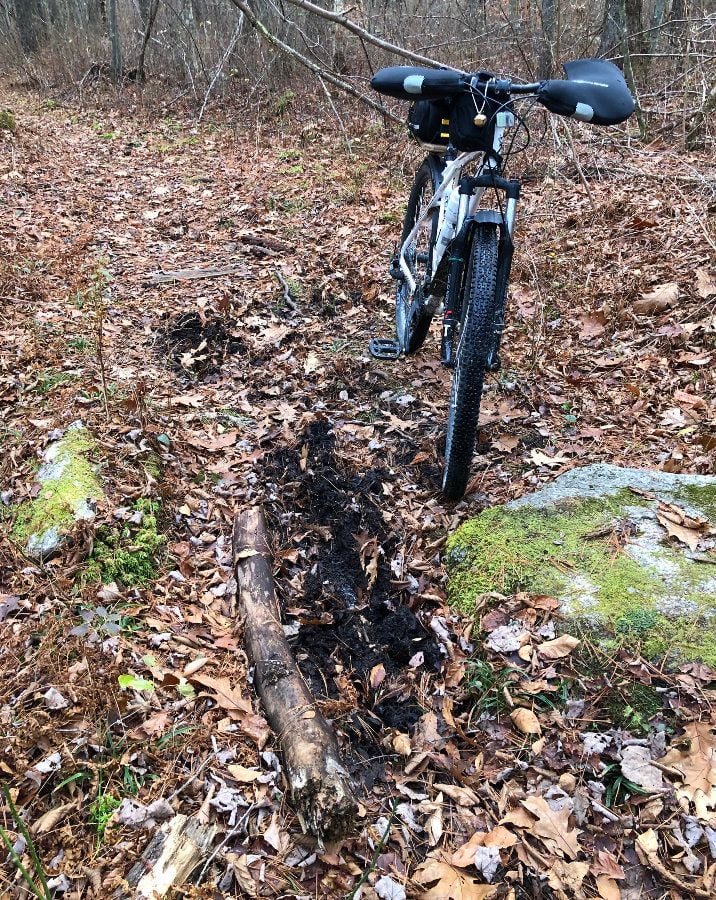
some pics of mine from the Copicut area South of the Freetown forest
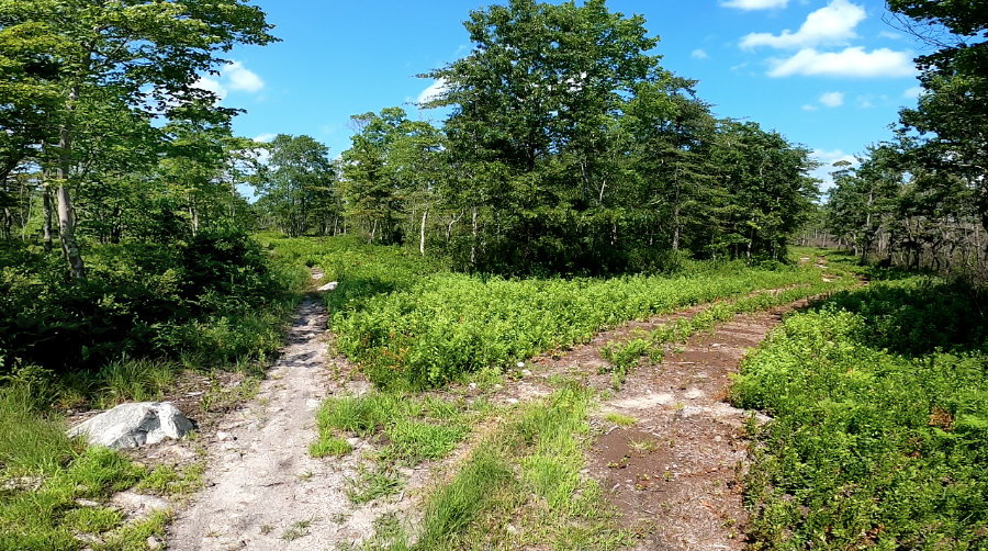
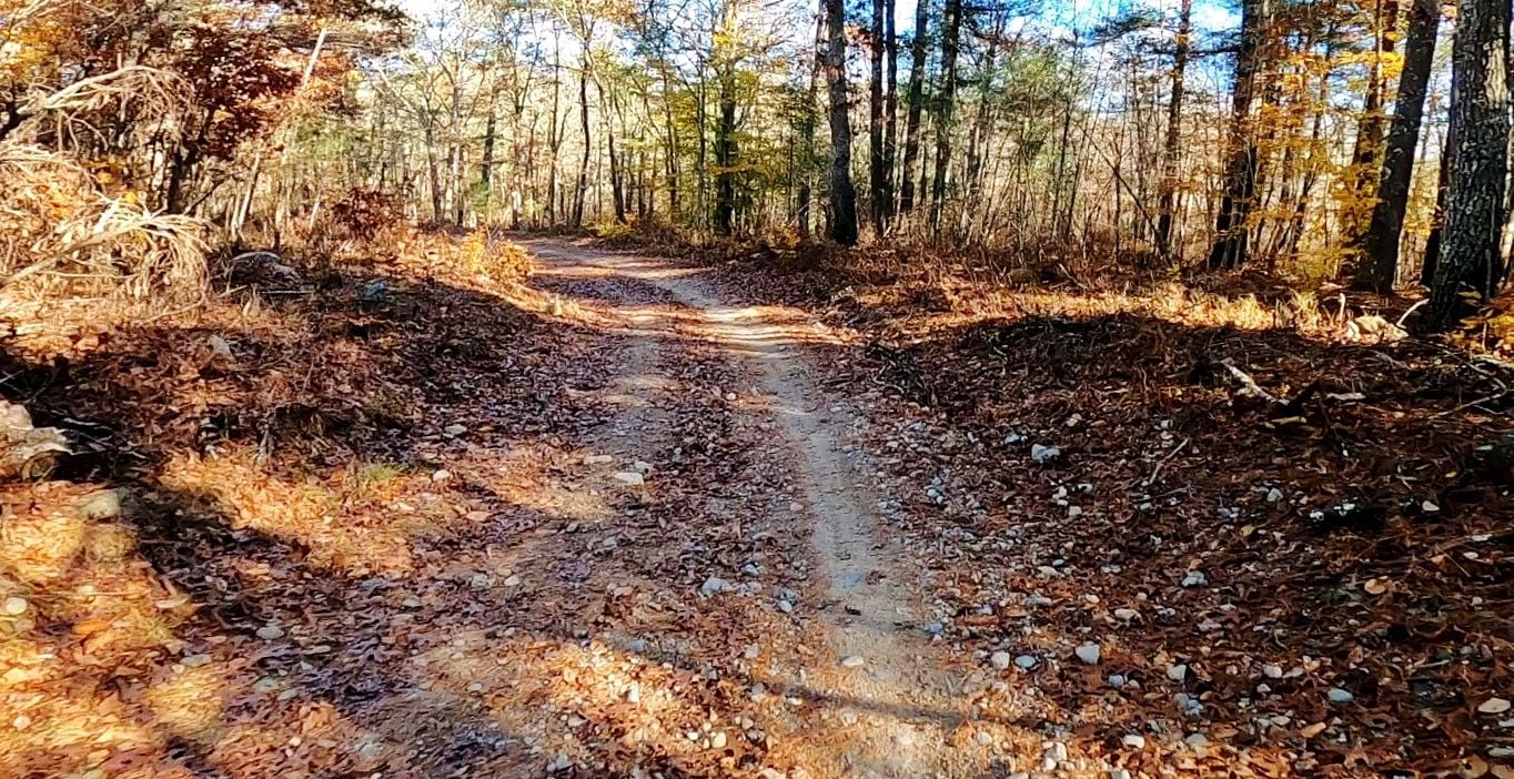
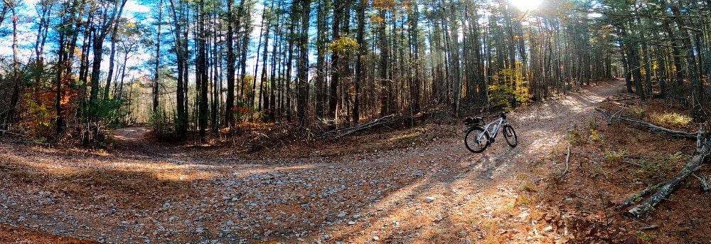
lots of intersecting roads & trails
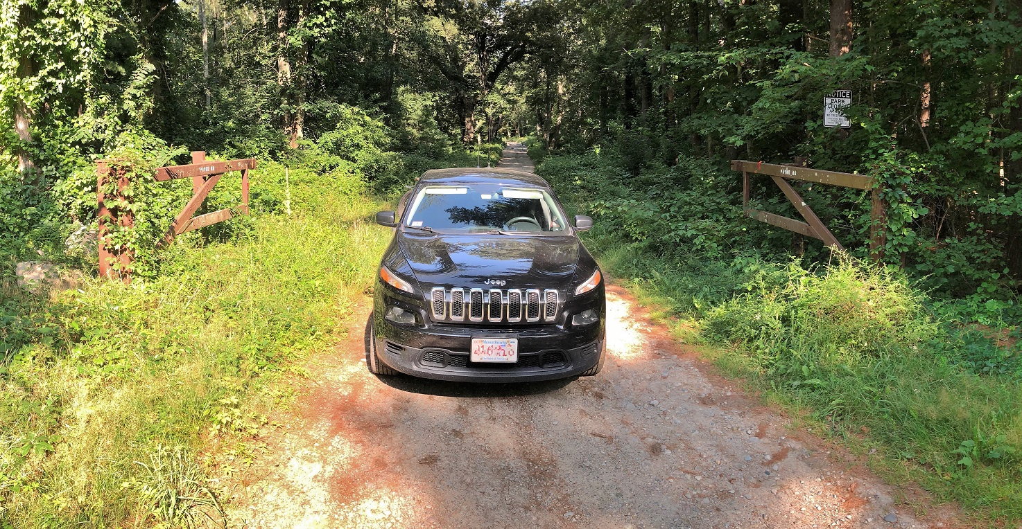
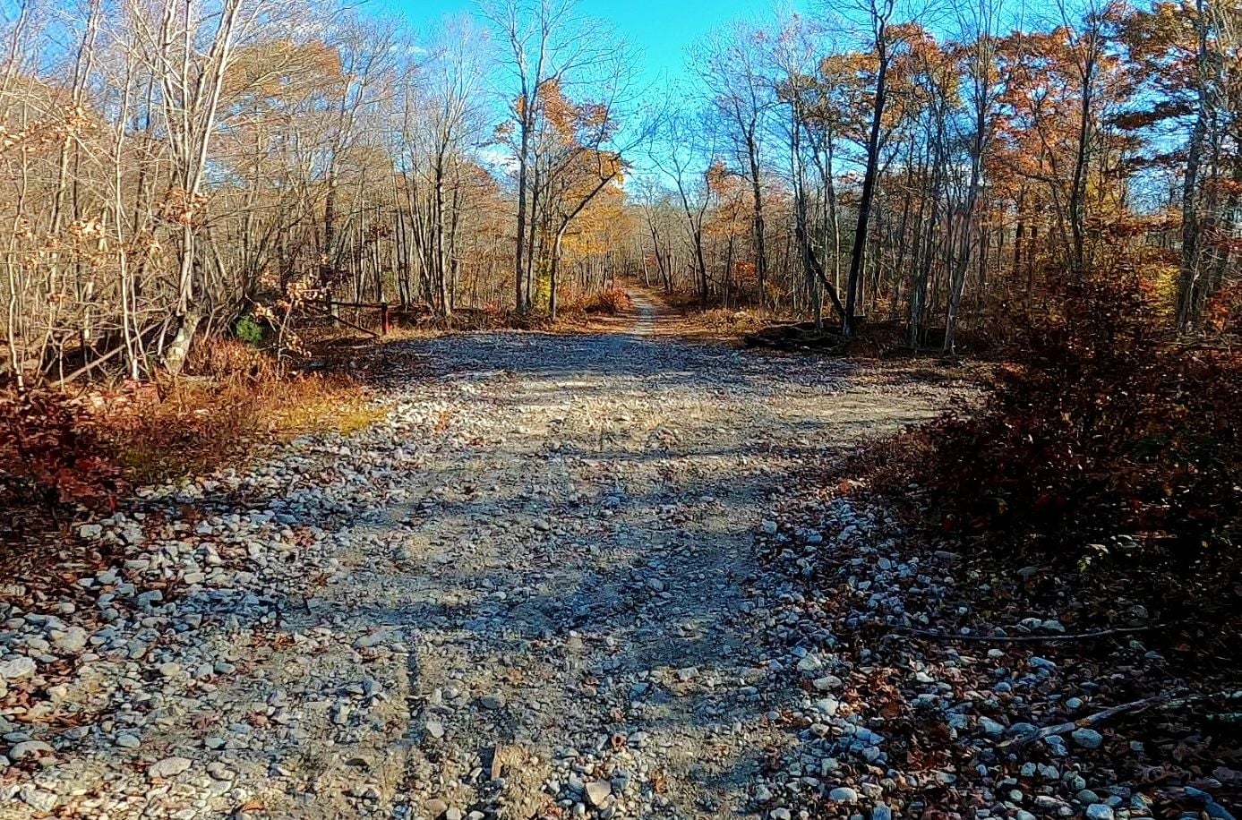
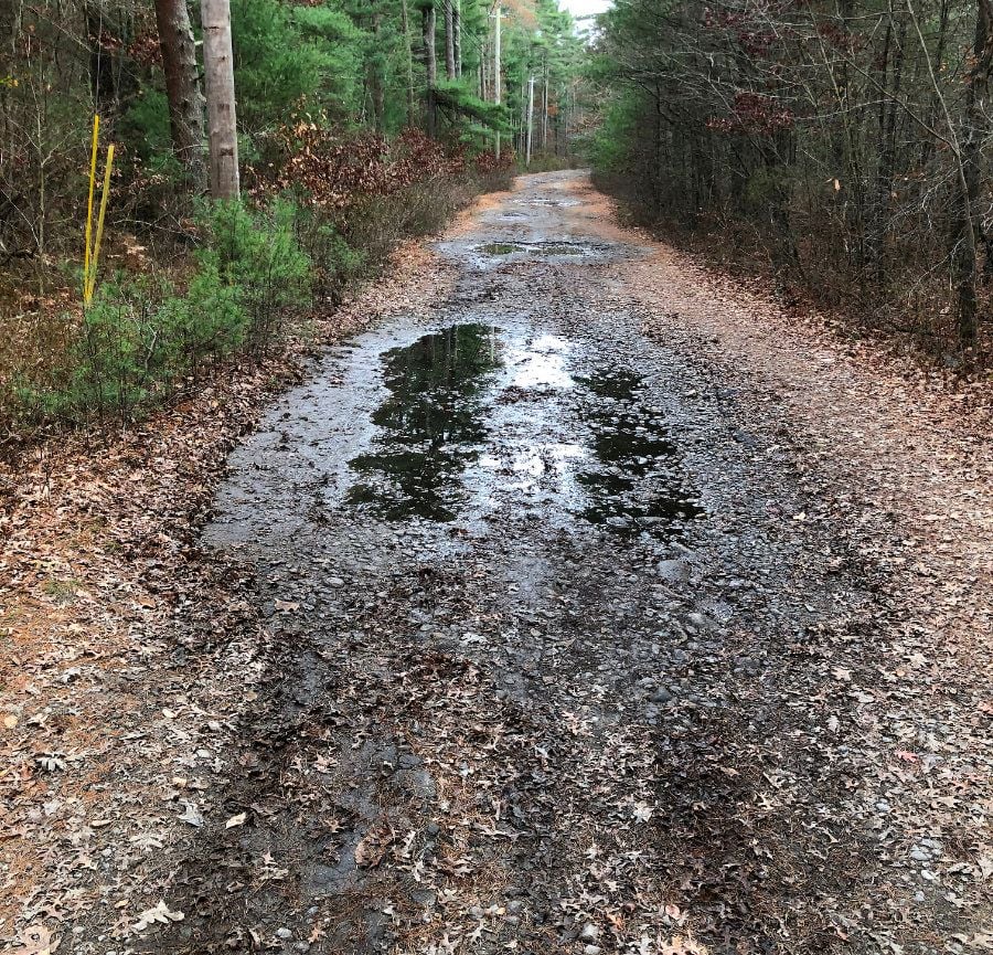
park roads are not paved such as Payne & Hathaway. when I was there 2 days ago the gates were open
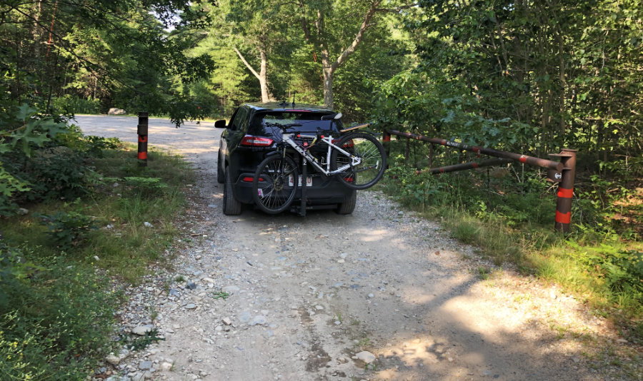
this is Payne Road
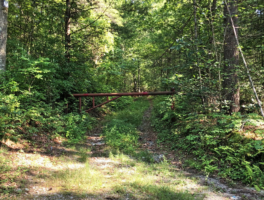
TB2 (whatever that stands for) was gate closed. by the looks of it, probably always closed
happened upon this place, by accident, after exploring the Copicut Wildlife Management Area. even tho it's a long drive for me I'll be going back. lots of trails over 5,000 acres. many roads open year round, many seasonal roads, motorized dirt bikes allowed seasonally. lots of dirt parking lots, but also several paved official parking areas. anyway, lots to explore!
https://www.mass.gov/locations/freet...r-state-forest
their map
https://www.mass.gov/doc/freetown-trail-map/download
from what I could tell the ground isn't like Myles Standish, which is sandy w/ pine needles. this area is more hard packed dirt with rocks
google street view by a dirt biker. this trail or road was gate closed when it was taken
some pics of mine from the Copicut area South of the Freetown forest
lots of intersecting roads & trails
park roads are not paved such as Payne & Hathaway. when I was there 2 days ago the gates were open
this is Payne Road
TB2 (whatever that stands for) was gate closed. by the looks of it, probably always closed
Last edited by rumrunn6; 08-03-23 at 07:11 AM.
 07-30-23 | 07:06 PM
#2
Senior Member


Joined: Oct 2008
Posts: 3,051
Likes: 810
From: in a house
Bikes: Specialized Aethos, Specialized Diverge Comp E5 and 2025 Spesh Tarmac SL8 Expert
Born in Fall River and rode my mt bike there a lot...baby heads rocks, roots, single track, etc.
It also has an interesting history of witch craft sites...ran across an area where some kind of rite was conducted.
Found a dead person once...not a fun day for anyone...poor sod.
Loved those trails.
It also has an interesting history of witch craft sites...ran across an area where some kind of rite was conducted.
Found a dead person once...not a fun day for anyone...poor sod.
Loved those trails.
11-11-23 | 09:06 PM
#3
Thread Starter
Senior Member
Joined: Jul 2008
Posts: 30,497
Likes: 4,570
From: 25 miles northwest of Boston
Bikes: Bottecchia Sprint, GT Timberline 29r, Marin Muirwoods 29er, Trek FX Alpha 7.0
4 months later, got back out there
parked near the OHV lot. no mountain bikers
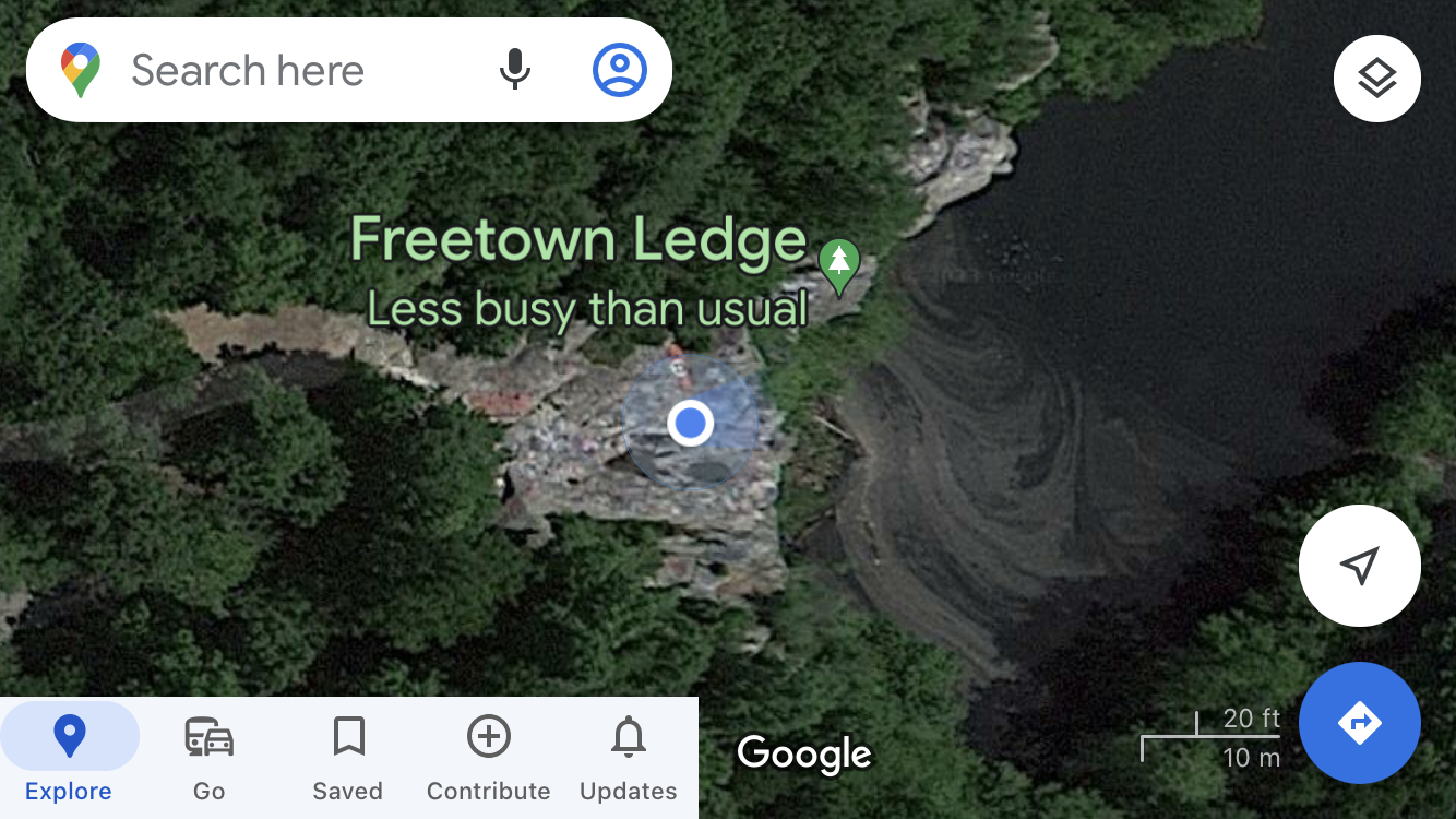
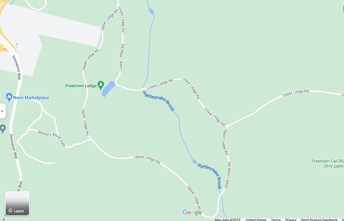
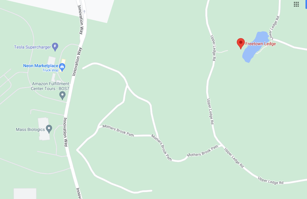
rode out to & around Freetown Ledge, which stand over an old quarry
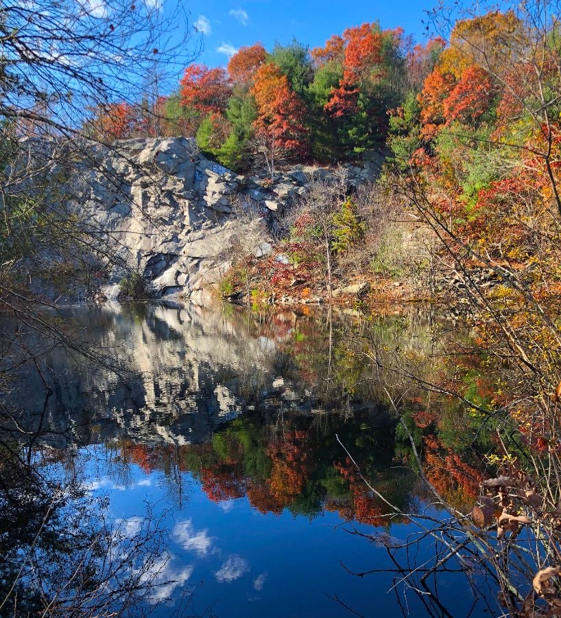
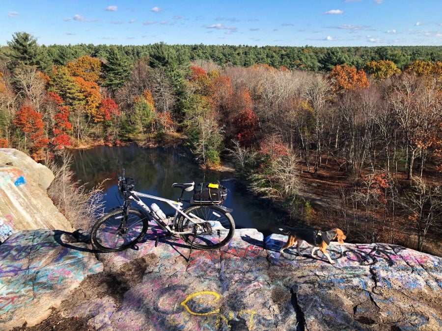
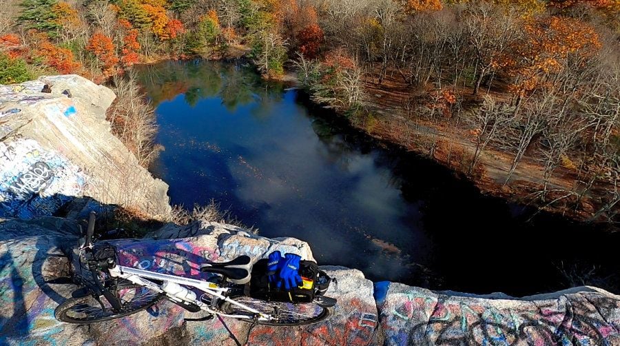
pretty darn high!
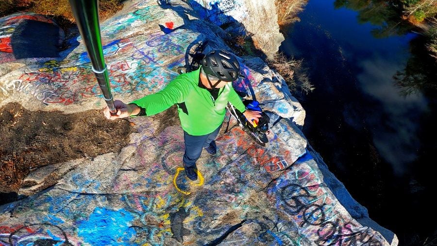
gravelly. large & loose
just a little water. should be interesting as winter comes in
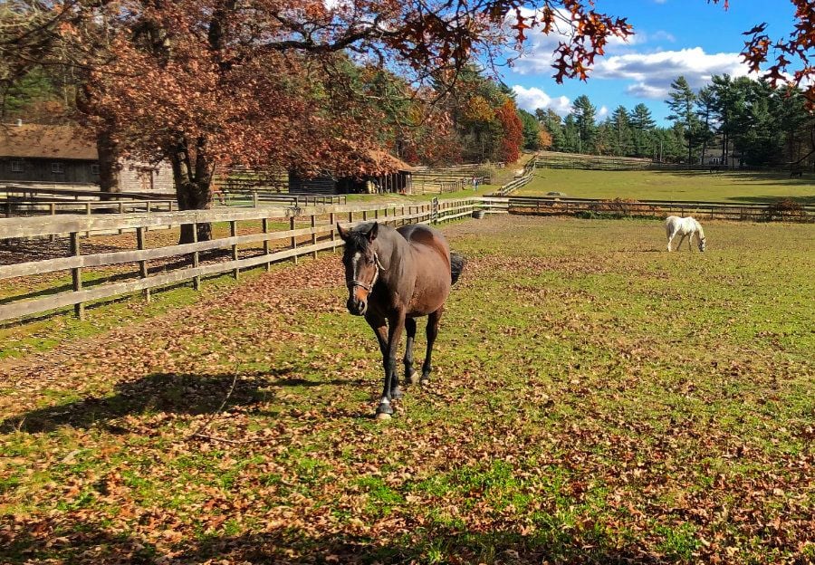
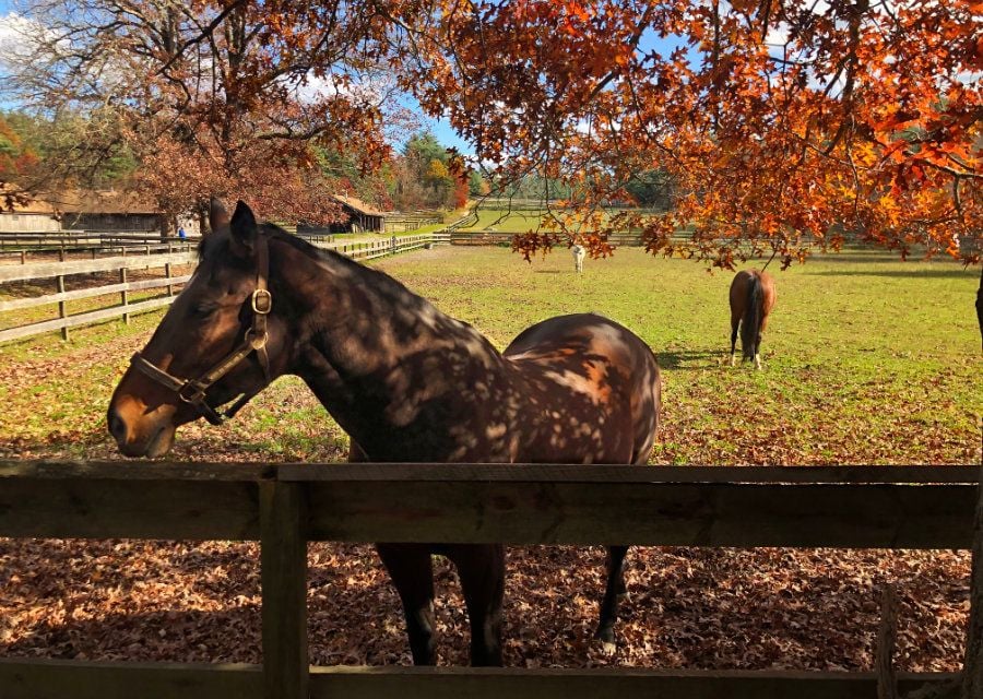
attractive horse farm across the street where I parked
parked near the OHV lot. no mountain bikers
rode out to & around Freetown Ledge, which stand over an old quarry
pretty darn high!
gravelly. large & loose
just a little water. should be interesting as winter comes in
attractive horse farm across the street where I parked
Last edited by rumrunn6; 11-12-23 at 06:38 PM.
11-12-23 | 05:52 AM
#4
Thread Starter
Senior Member
Joined: Jul 2008
Posts: 30,497
Likes: 4,570
From: 25 miles northwest of Boston
Bikes: Bottecchia Sprint, GT Timberline 29r, Marin Muirwoods 29er, Trek FX Alpha 7.0
apparently some spooky stuff goes on out there?
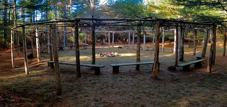
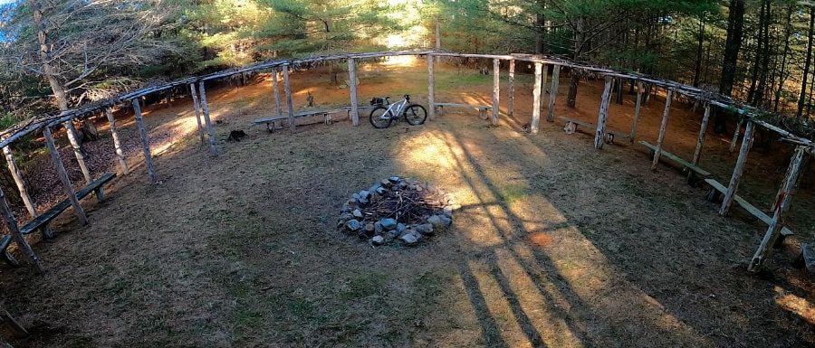
love this large fire circle w/ benches & pergola / arbour, covered w/ pine boughs?
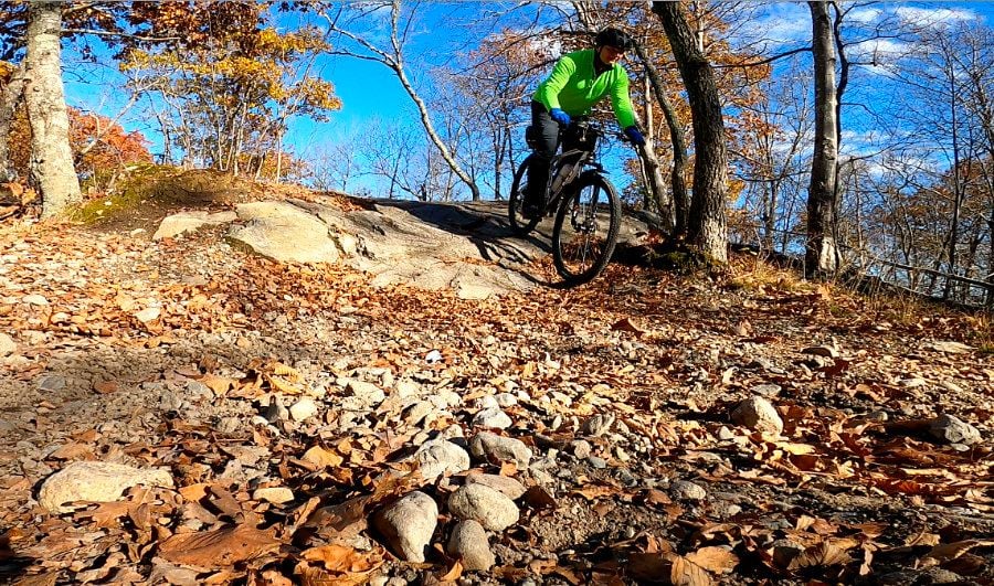
did not come across any sandy & soft trails. everything is hard packed dirt or gravel. so did not have to run at my lowest pressures. wicked bumpy though, so yes, to a front fork. even a cheap one helps
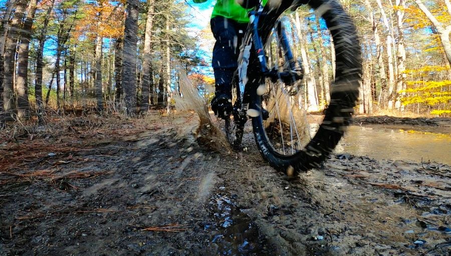
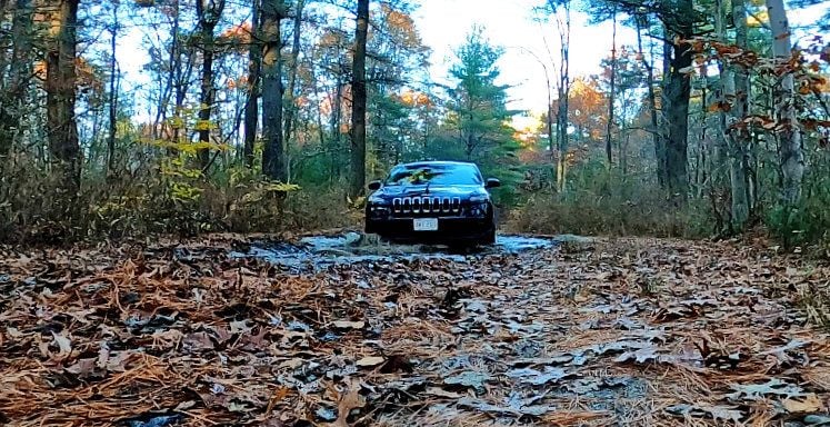
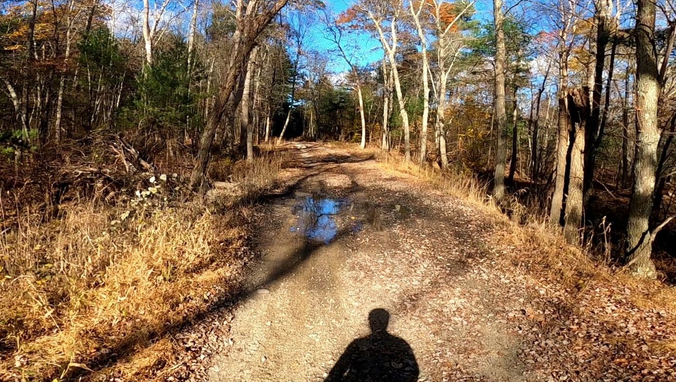
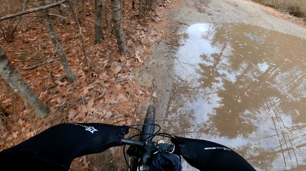
took a wrong turn w/ the Jeep & found a big puddle
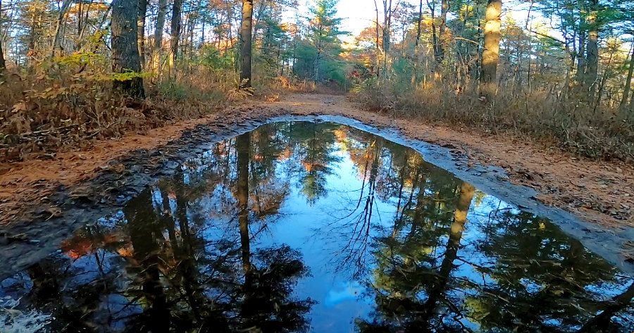
fortunately hard bottom & not too deep
how would google maps know if Freetown Ledge was less busy than usual?
love this large fire circle w/ benches & pergola / arbour, covered w/ pine boughs?
did not come across any sandy & soft trails. everything is hard packed dirt or gravel. so did not have to run at my lowest pressures. wicked bumpy though, so yes, to a front fork. even a cheap one helps
took a wrong turn w/ the Jeep & found a big puddle
fortunately hard bottom & not too deep
how would google maps know if Freetown Ledge was less busy than usual?
Last edited by rumrunn6; 11-12-23 at 06:34 PM.
11-12-23 | 06:18 AM
#5
Thread Starter
Senior Member
Joined: Jul 2008
Posts: 30,497
Likes: 4,570
From: 25 miles northwest of Boston
Bikes: Bottecchia Sprint, GT Timberline 29r, Marin Muirwoods 29er, Trek FX Alpha 7.0
some trip notes
found some way points on google maps w/ computer at home, then sent an email to myself that I can access with my phone, so in my car I was able to click on the links, launch google maps & navigate to an exact spot. then while riding, I was able to access my exact location, using google maps, which always knew where I was
10:45am left house, 45 degrees & windy
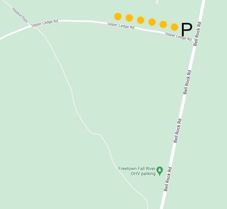
12:05 parked near the OHV (off highway vehicle) parking lot on Bell Rock Road. the lot is for gas power dirt bikes, etc. lots of other parking along the road, near other forest roads, closed to cars, such as "State Forest Rd" aka "Upper Ledge Rd"
after my ride, I drove Bell Rock Road to Wilson Road, crossed over the Watupa Pond which looks like a reservoir, to Route 24/Route 79 North
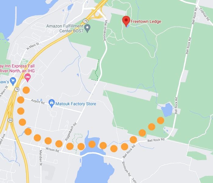
rode the loop around the quarry circa 1800. note other trails to explore & off on the left, is "Neon Marketplace", where I would later drive to for coffee & food
1:30pm back at the car, then rode back in, to explore near the road & found some structures which could accommodate large groups. looks like a great place to party w/ friends
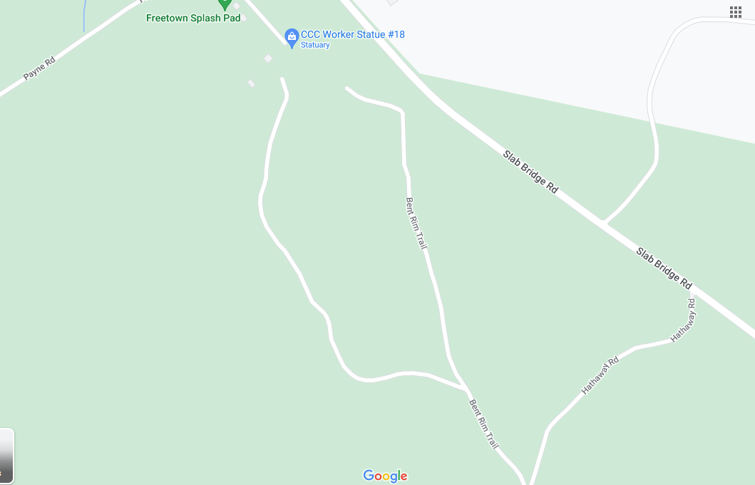
after the drive to Fall River & bike ride, needed coffee & food & wanted to explore some w/ the Jeep. navigated to the Splash Pad parking, near Forest HQ
took a circuitous route, clockwise, looping down & around, then up, stopping at the large truck stop, gas station, rest area (Neon Marketplace) near some industrial businesses such at an Amazon Fulfillment Center
2:30pm got coffee & food (Dunkins)
3pm restrooms at the Splash Pad (Slab Bridge Rd) are closed for the season
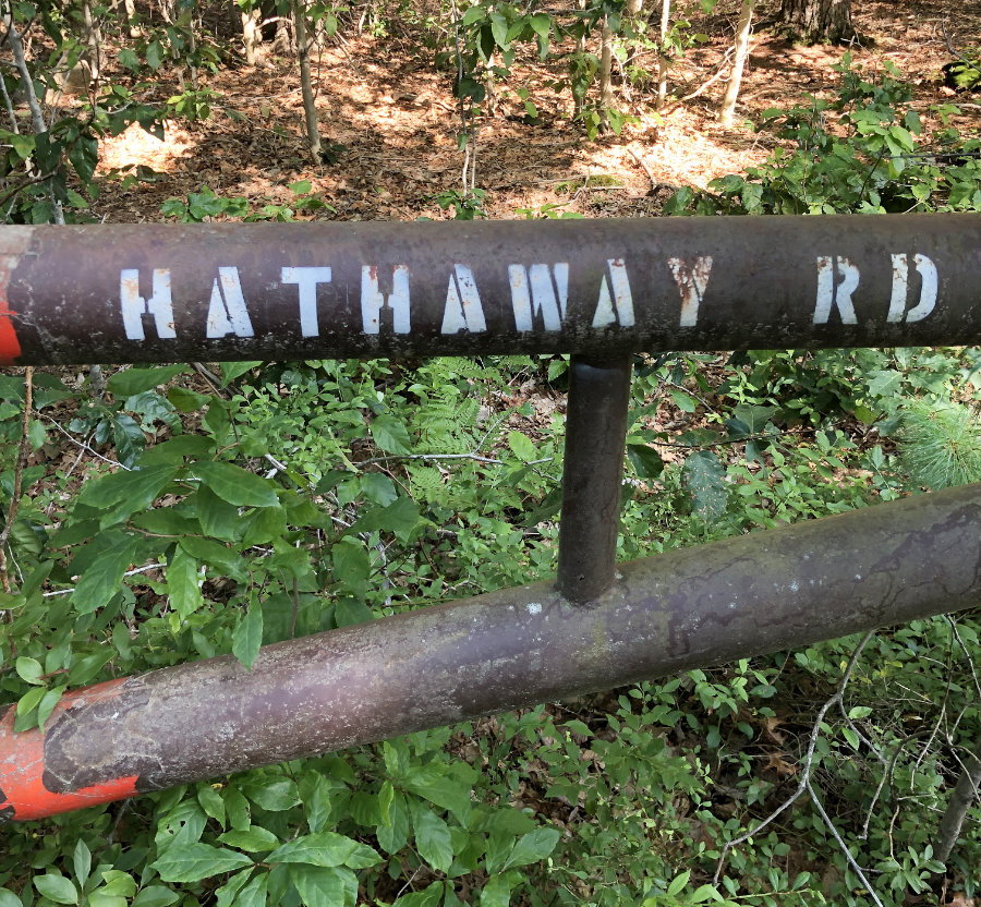
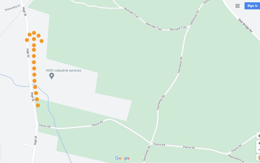
drove down Payne Rd which led me to Makepeace Rd & an intersection w/ Hathaway Rd
explored both directions of Hathaway Rd. one way (left) is not advisable, & leads back to the Splash Pad & the road is barricaded so couldn't get out & had to back track. met some ppl on bikes & on foot & it's nice in there w/o the car
Bent Rim Trail would be nice to bike on from the Splash Pad parking lot. the map doesn't show a connection but it's open & you can see the old road from the parking lot. it was dicey in an auto
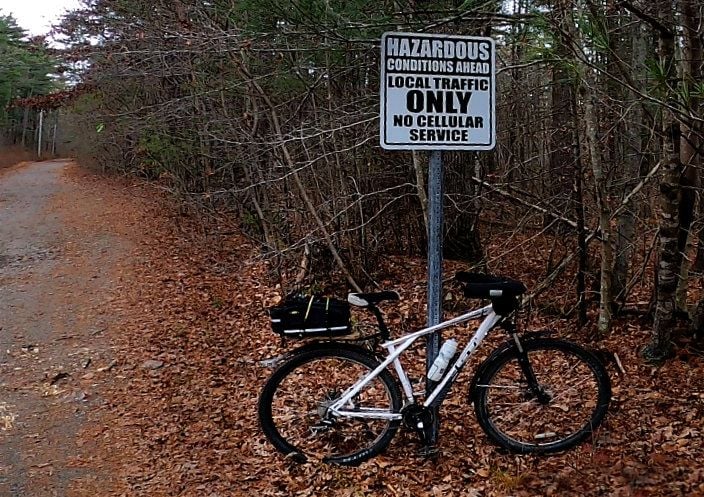
use caution driving on this little network of large unpaved roads. there are craters & rocks to avoid. all easily rideable on a bike & lots of side trails to explore. advisable to carry navigation, either map & compass or cell phone
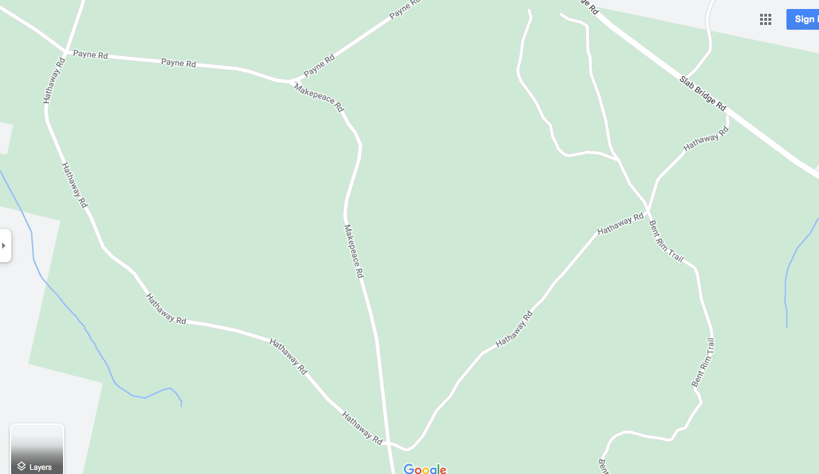
found my way out on High St
4pm no harm, no foul, back to pavement, & navigated home
5:15pm back home
found some way points on google maps w/ computer at home, then sent an email to myself that I can access with my phone, so in my car I was able to click on the links, launch google maps & navigate to an exact spot. then while riding, I was able to access my exact location, using google maps, which always knew where I was
10:45am left house, 45 degrees & windy
12:05 parked near the OHV (off highway vehicle) parking lot on Bell Rock Road. the lot is for gas power dirt bikes, etc. lots of other parking along the road, near other forest roads, closed to cars, such as "State Forest Rd" aka "Upper Ledge Rd"
after my ride, I drove Bell Rock Road to Wilson Road, crossed over the Watupa Pond which looks like a reservoir, to Route 24/Route 79 North
rode the loop around the quarry circa 1800. note other trails to explore & off on the left, is "Neon Marketplace", where I would later drive to for coffee & food
1:30pm back at the car, then rode back in, to explore near the road & found some structures which could accommodate large groups. looks like a great place to party w/ friends
after the drive to Fall River & bike ride, needed coffee & food & wanted to explore some w/ the Jeep. navigated to the Splash Pad parking, near Forest HQ
took a circuitous route, clockwise, looping down & around, then up, stopping at the large truck stop, gas station, rest area (Neon Marketplace) near some industrial businesses such at an Amazon Fulfillment Center
2:30pm got coffee & food (Dunkins)
3pm restrooms at the Splash Pad (Slab Bridge Rd) are closed for the season
drove down Payne Rd which led me to Makepeace Rd & an intersection w/ Hathaway Rd
explored both directions of Hathaway Rd. one way (left) is not advisable, & leads back to the Splash Pad & the road is barricaded so couldn't get out & had to back track. met some ppl on bikes & on foot & it's nice in there w/o the car
Bent Rim Trail would be nice to bike on from the Splash Pad parking lot. the map doesn't show a connection but it's open & you can see the old road from the parking lot. it was dicey in an auto
use caution driving on this little network of large unpaved roads. there are craters & rocks to avoid. all easily rideable on a bike & lots of side trails to explore. advisable to carry navigation, either map & compass or cell phone
found my way out on High St
4pm no harm, no foul, back to pavement, & navigated home
5:15pm back home
Last edited by rumrunn6; 11-12-23 at 06:28 PM.
11-12-23 | 06:54 AM
#6
Thread Starter
Senior Member
Joined: Jul 2008
Posts: 30,497
Likes: 4,570
From: 25 miles northwest of Boston
Bikes: Bottecchia Sprint, GT Timberline 29r, Marin Muirwoods 29er, Trek FX Alpha 7.0
will go back. reasonable to ride around the Ledge again & explore some of the side trails. maybe even try to navigate to the Neon Marketplace on Innovation Way, by bike?
Last edited by rumrunn6; 11-12-23 at 06:20 PM.
11-13-23 | 02:38 PM
#7
Thread Starter
Senior Member
Joined: Jul 2008
Posts: 30,497
Likes: 4,570
From: 25 miles northwest of Boston
Bikes: Bottecchia Sprint, GT Timberline 29r, Marin Muirwoods 29er, Trek FX Alpha 7.0
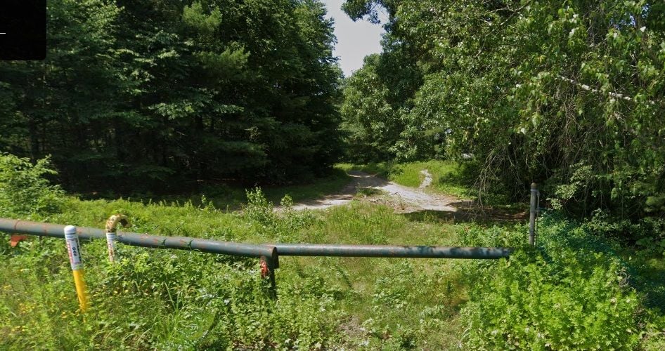
maybe check out the Gas Line Trail near the big giant pile of rocks on Copicut Rd. there's a dirt patch for parking, looks like. but there may be no way over Rattlesnake Brook. maybe in July when it's dry? or maybe approach it from the other end?
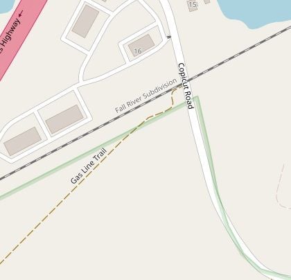
https://www.openstreetmap.org/way/85...7475/-71.08243
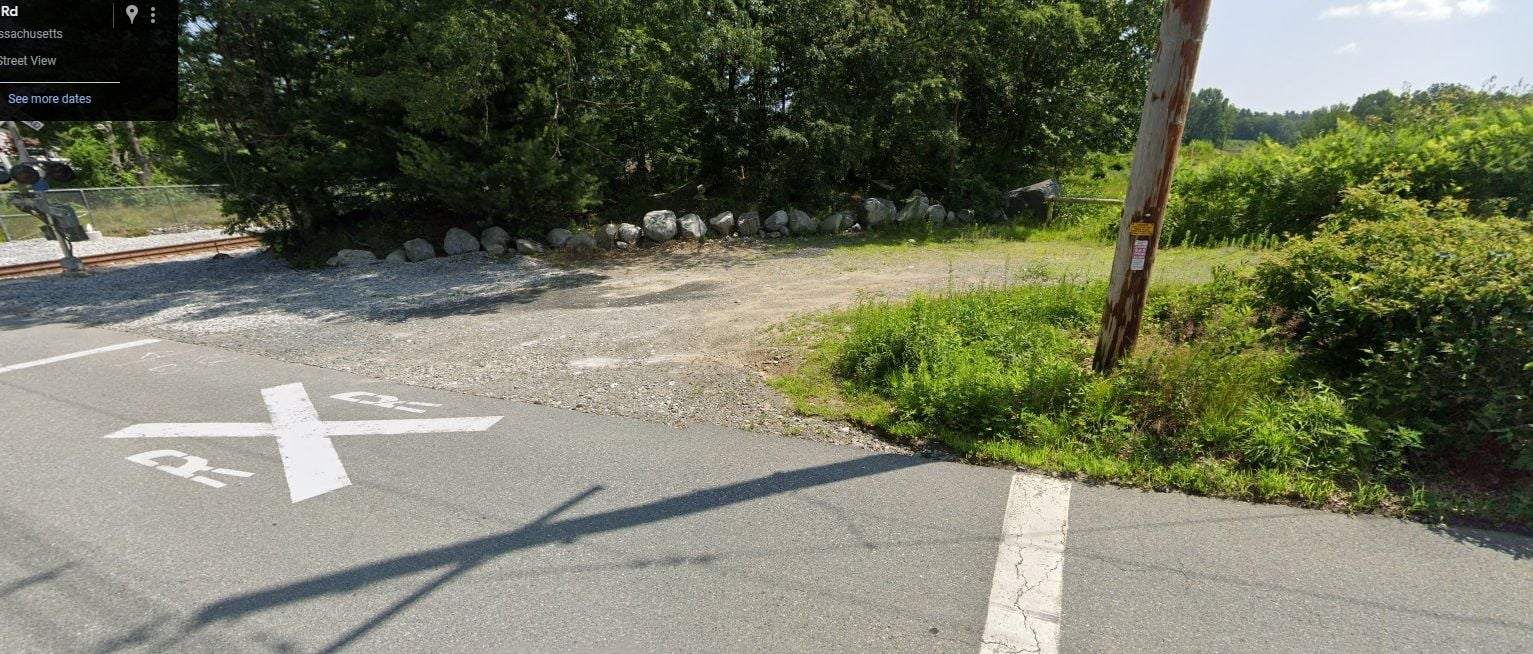
approx 20 Copicut Rd, near the train tracks
https://maps.app.goo.gl/2n7qo8J7JNqNc9JMA
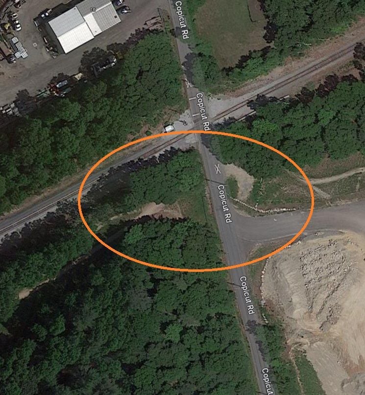
so maybe get it from the West end of Upper Ledge Rd?
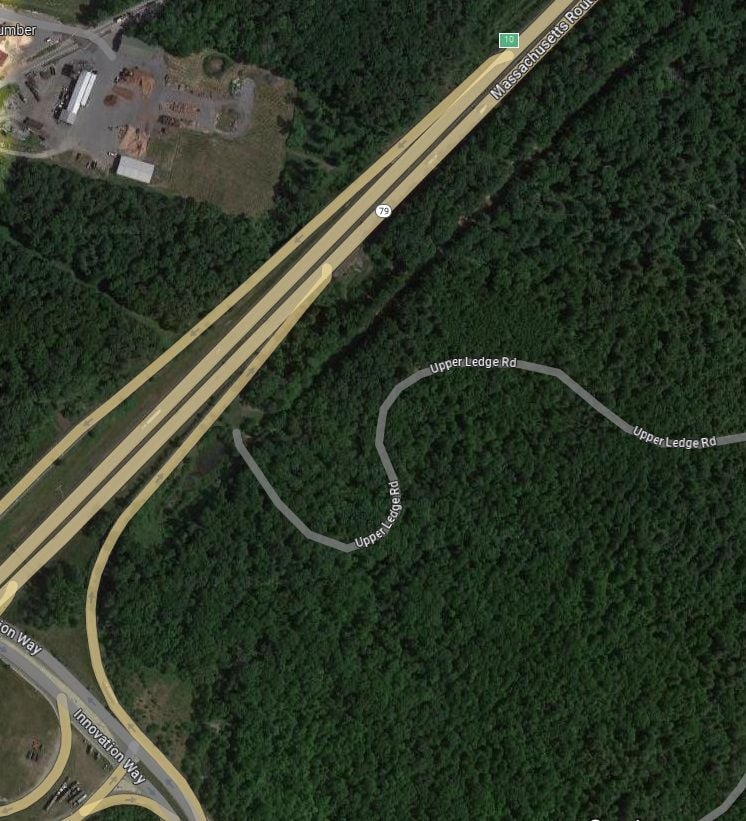
https://maps.app.goo.gl/MHcDfp3MgBTLAy7aA
https://www.openstreetmap.org/way/85...7475/-71.08243
approx 20 Copicut Rd, near the train tracks
https://maps.app.goo.gl/2n7qo8J7JNqNc9JMA
so maybe get it from the West end of Upper Ledge Rd?
https://maps.app.goo.gl/MHcDfp3MgBTLAy7aA
Last edited by rumrunn6; 11-13-23 at 02:42 PM.
11-15-23 | 04:10 PM
#8
Junior Member

Joined: Dec 2011
Posts: 132
Likes: 52
From: Fairhaven Ma.
Bikes: Trek Multitrac 750. Scott Addict . Motobacane La Champion Trek Crossrip, Scott Scale 925 mountain Bike Centry
Glad you had a good ride. I rode the Freetown Forest from the New Bedford side. I put in off of Bulluck road. I did 14 miles all single track full off rocks, way above my skill level.. Toughest ride ever. Riding on all rock trails was no fun for me. I told the guys I rode with they were trying to kill me .Good times. .
11-15-23 | 08:22 PM
#9
Thread Starter
Senior Member
Joined: Jul 2008
Posts: 30,497
Likes: 4,570
From: 25 miles northwest of Boston
Bikes: Bottecchia Sprint, GT Timberline 29r, Marin Muirwoods 29er, Trek FX Alpha 7.0
Glad you had a good ride. I rode the Freetown Forest from the New Bedford side. I put in off of Bulluck road. I did 14 miles all single track full off rocks, way above my skill level.. Toughest ride ever. Riding on all rock trails was no fun for me. I told the guys I rode with they were trying to kill me .Good times. .
11-16-23 | 08:19 AM
#10
Thread Starter
Senior Member
Joined: Jul 2008
Posts: 30,497
Likes: 4,570
From: 25 miles northwest of Boston
Bikes: Bottecchia Sprint, GT Timberline 29r, Marin Muirwoods 29er, Trek FX Alpha 7.0
regarding the riding conditions, on my ride, mostly on just the forest "roads", took a look at some video clips from riding there & grabbed a few frames for reference
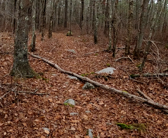
this frame shows a side trail. looks steep & narrow. does not look like it is used my motored dirt bikes. when I go back I'd like to try some of the side trails, but not the most rugged
for example, this looks like a doable side trail, for me, but also shows signs of dirt bikes
the trail / road that goes up around the right side of the Ledge
Last edited by rumrunn6; 11-16-23 at 07:50 PM.
11-17-23 | 04:32 PM
#11
Junior Member
Joined: Dec 2011
Posts: 132
Likes: 52
From: Fairhaven Ma.
Bikes: Trek Multitrac 750. Scott Addict . Motobacane La Champion Trek Crossrip, Scott Scale 925 mountain Bike Centry
That looks like the kind of ride I would enjoy. The times I rode in Freetown the guys I rode with always put in New Bedford, There were some fire roads but they always rode the single-track rock filled trails, I've rode with N,E M,B,A,, on the Cape. the trails were mostly single track. a lot easier than Freetown, I always enjoyed Cape Cod Mountain Bike riding,
11-19-23 | 07:10 PM
#12
Thread Starter
Senior Member
Joined: Jul 2008
Posts: 30,497
Likes: 4,570
From: 25 miles northwest of Boston
Bikes: Bottecchia Sprint, GT Timberline 29r, Marin Muirwoods 29er, Trek FX Alpha 7.0
That looks like the kind of ride I would enjoy. The times I rode in Freetown the guys I rode with always put in New Bedford, There were some fire roads but they always rode the single-track rock filled trails, I've rode with N,E M,B,A,, on the Cape. the trails were mostly single track. a lot easier than Freetown, I always enjoyed Cape Cod Mountain Bike riding,
11-26-23 | 04:51 PM
#13
Thread Starter
Senior Member
Joined: Jul 2008
Posts: 30,497
Likes: 4,570
From: 25 miles northwest of Boston
Bikes: Bottecchia Sprint, GT Timberline 29r, Marin Muirwoods 29er, Trek FX Alpha 7.0
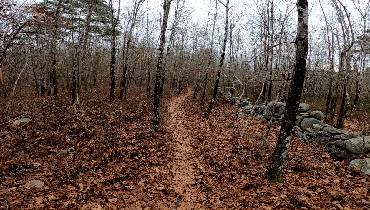
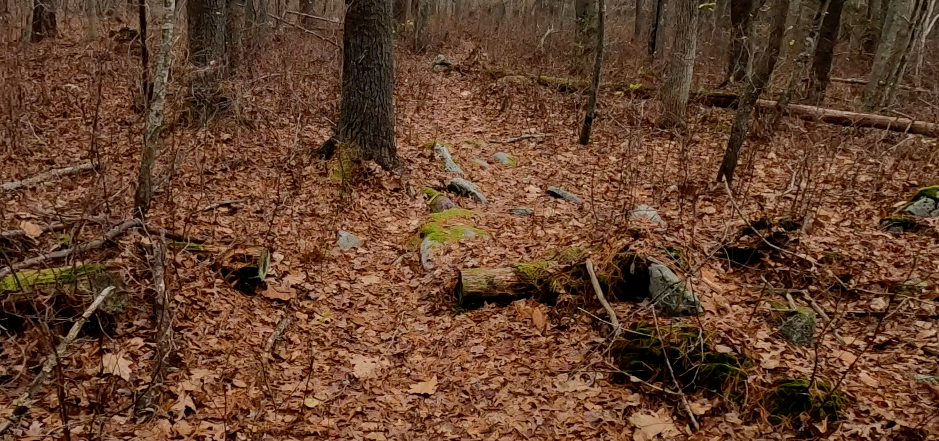
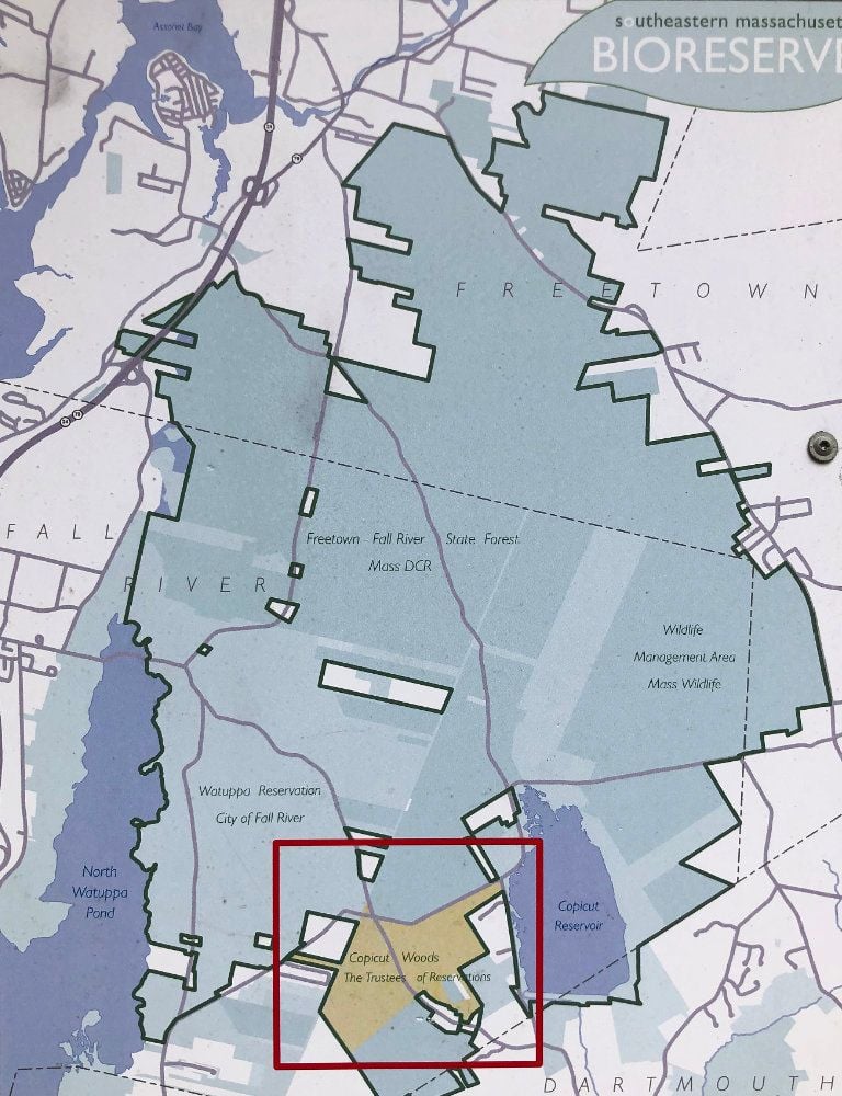
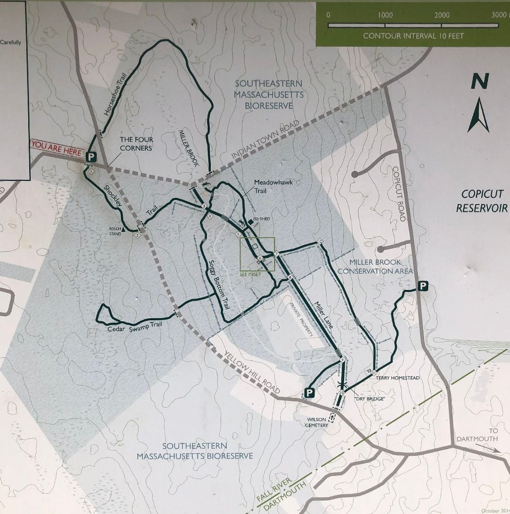
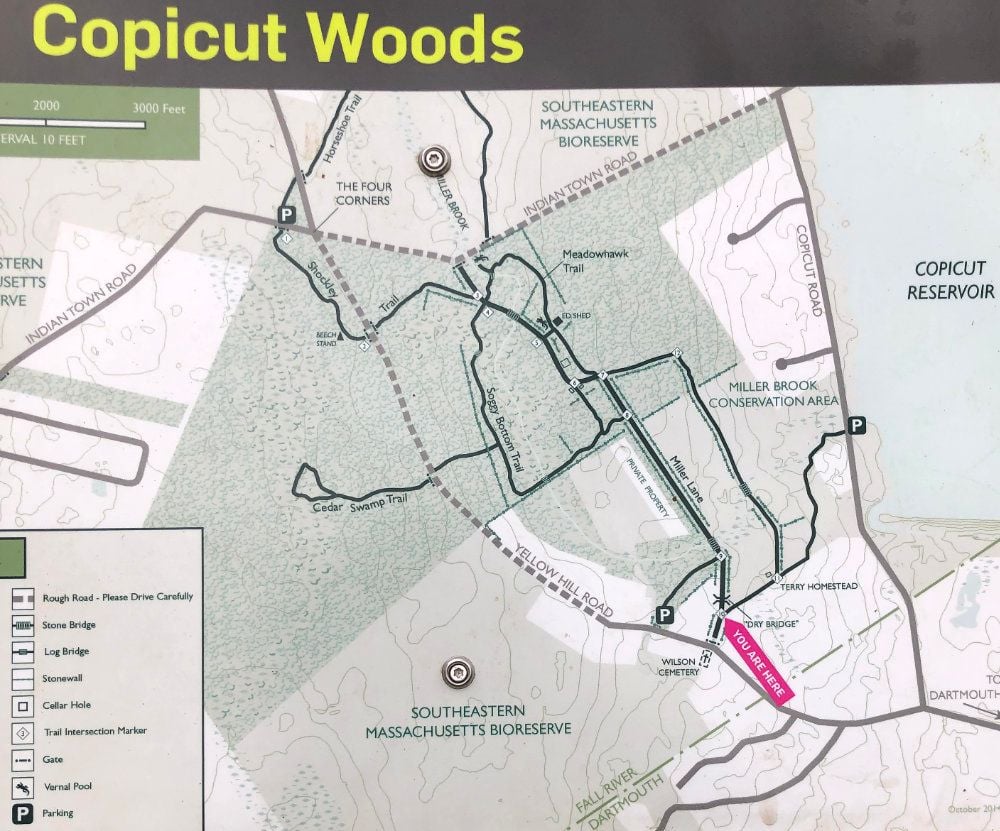
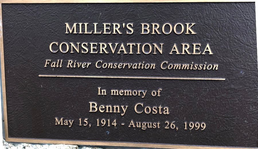
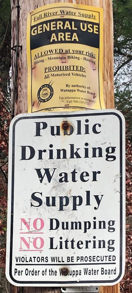
back to this area, but I was not in the Freetown State Forest. I was on Mass. Trustees Land. parked at the Copicut Woods parking lot in Indian Hilll Road. a slightly longer drive from home. tried the Shockley Trail, Soggy Bottom Trail, Meadowhawk Trail & other forest roads. got in about an hour & a half
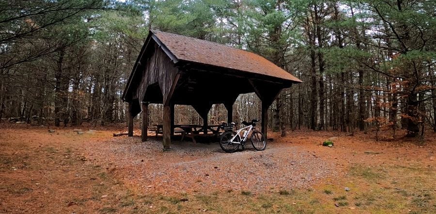
came across this picnic structure seemingly in the middle of nowhere
might have ridden this if I was coming the other way. but up hill? nope
never lost cell service & used google maps again to keep track of where I was. also used the compass app. recommended or a physical compass. nice that they have signs at trail intersections but you still need to know what direction to travel
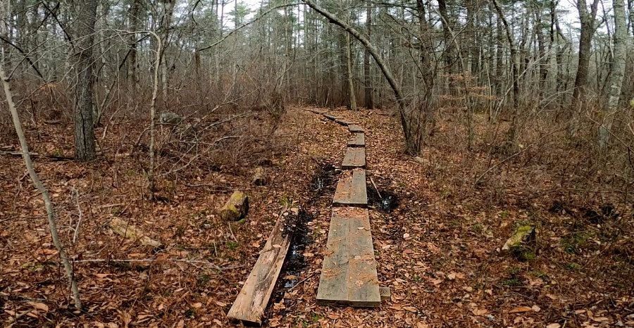
a cpl wet spots
would not call these trails fast & flowy. they are slow with lots of rocks & roots to navigate around or over, plus small downed trees. can't say I would come back to ride this area
did have lots of fun tho
not much to see & heard LOTS of gunfire. & it wasn't from hunters. no one hunting shoots off hundreds of rounds like that
came across this picnic structure seemingly in the middle of nowhere
might have ridden this if I was coming the other way. but up hill? nope
never lost cell service & used google maps again to keep track of where I was. also used the compass app. recommended or a physical compass. nice that they have signs at trail intersections but you still need to know what direction to travel
a cpl wet spots
would not call these trails fast & flowy. they are slow with lots of rocks & roots to navigate around or over, plus small downed trees. can't say I would come back to ride this area
did have lots of fun tho
not much to see & heard LOTS of gunfire. & it wasn't from hunters. no one hunting shoots off hundreds of rounds like that
Last edited by rumrunn6; 11-27-23 at 08:53 AM.
11-26-23 | 06:25 PM
#14
Thread Starter
Senior Member
Joined: Jul 2008
Posts: 30,497
Likes: 4,570
From: 25 miles northwest of Boston
Bikes: Bottecchia Sprint, GT Timberline 29r, Marin Muirwoods 29er, Trek FX Alpha 7.0
easy to find parking. 3 cars when I got there. empty when I left
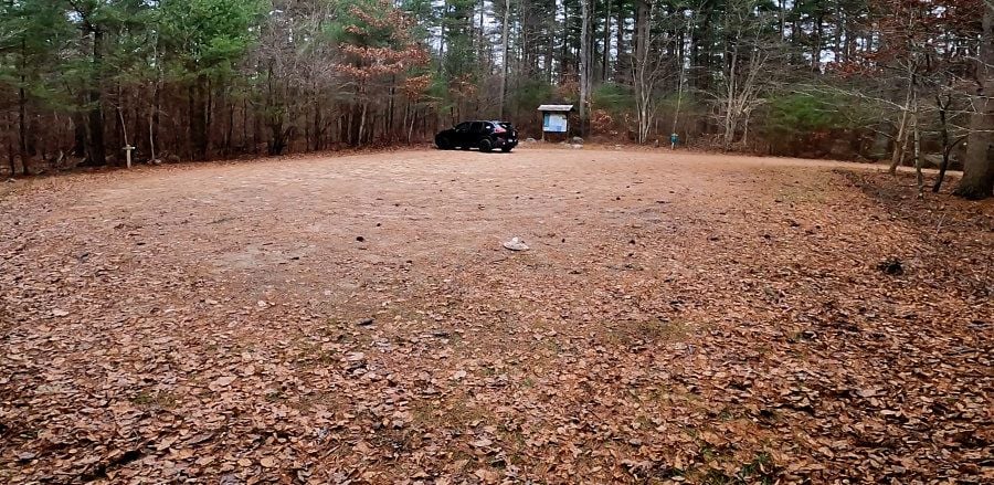
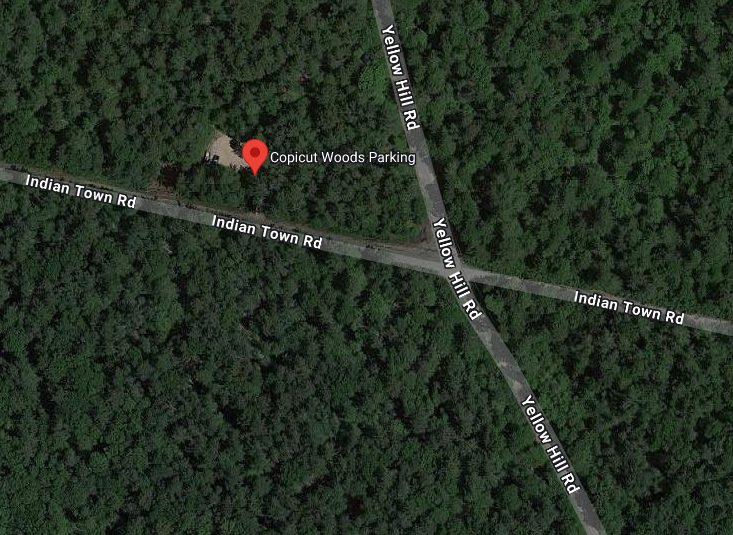
search for: Copicut Woods Parking, Indian Town Rd, Westport, MA 02790
https://maps.app.goo.gl/osL6vX2K427Cm9wT6
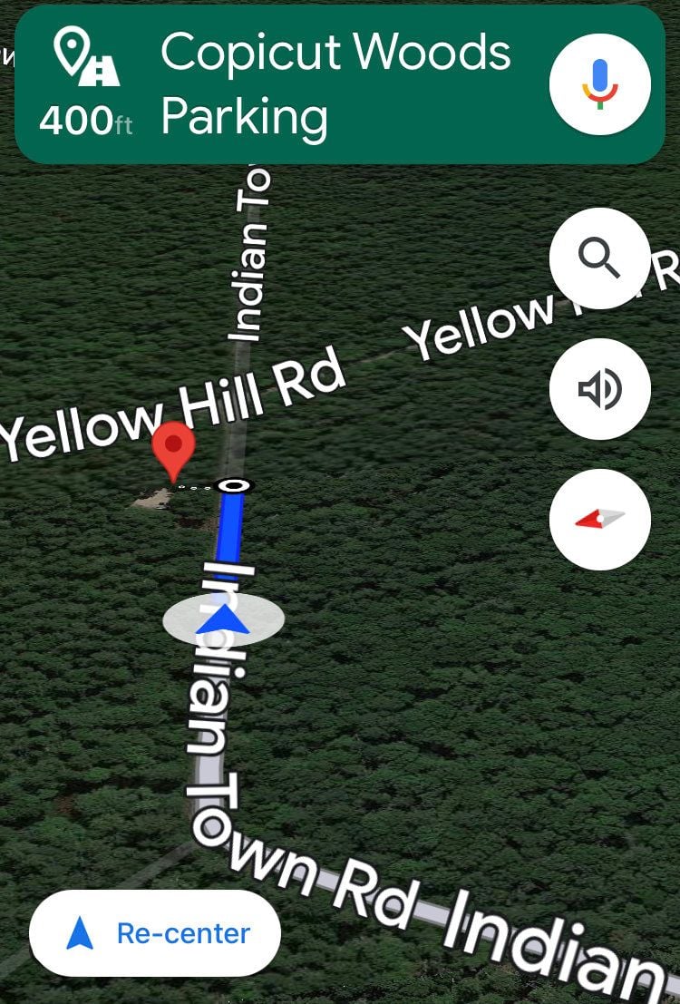
South of the State Forest
worked the trails between here
& here
a very manageable, finite set of trails
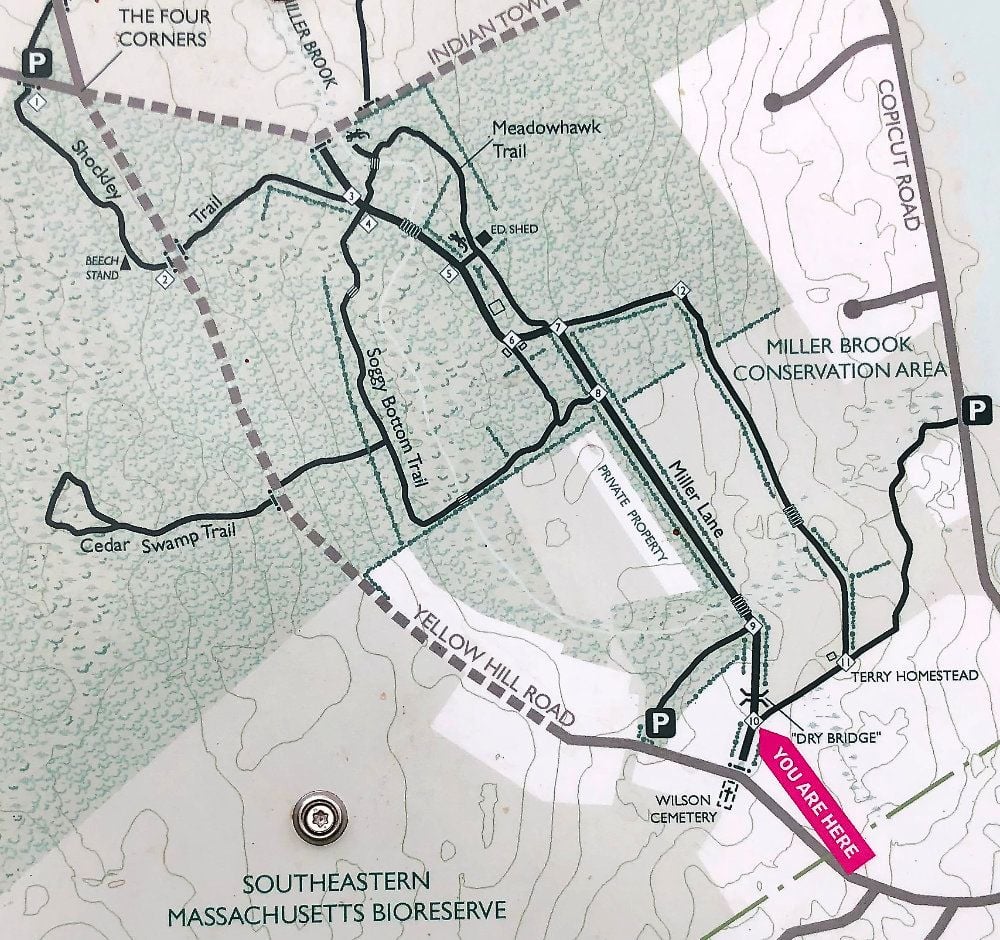
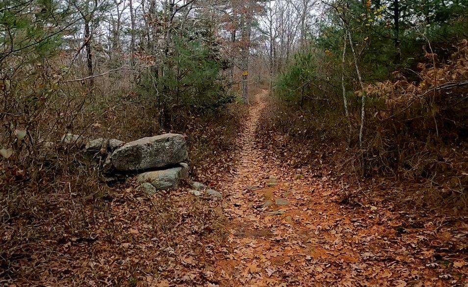
a cpl signs along the way
search for: Copicut Woods Parking, Indian Town Rd, Westport, MA 02790
https://maps.app.goo.gl/osL6vX2K427Cm9wT6
South of the State Forest
worked the trails between here
& here
a very manageable, finite set of trails
a cpl signs along the way
Last edited by rumrunn6; 11-26-23 at 06:45 PM.
11-27-23 | 04:03 PM
#15
Junior Member
Joined: Dec 2011
Posts: 132
Likes: 52
From: Fairhaven Ma.
Bikes: Trek Multitrac 750. Scott Addict . Motobacane La Champion Trek Crossrip, Scott Scale 925 mountain Bike Centry
Pictures 7 and 8 on today's post look like some of the trails I've rode in Freetown except a little rockier. With the downed trees in 2 of the picture's The guys I rode with, they would just jump over. Thanks for sharing the pictures. Next time you ride down here PM me. Also, be careful out there it's a big forest very easy to get lost. This time of year, there's a lot of hunters.
